Ontario: Close call as stateside system will brush the southwest with wet snow

The second half of April will trend below seasonal for the province, in a reversal from the relative warmth of the first half.
Temperatures in southern Ontario are looking at a modest recovery for the weekend, but first, people in the southwest are looking at a dash of snow, courtesy of a U.S. system that will brush the province as it passes on Friday -- though any accumulations will be short-lived. Details and timing, below.
WEATHER HIGHLIGHTS:
Light, wet snow on Friday in southwestern regions, remaining cool
Slight warmup on Saturday
Below-seasonal second half to the month
Keep on top of the latest weather ALERTS in your area
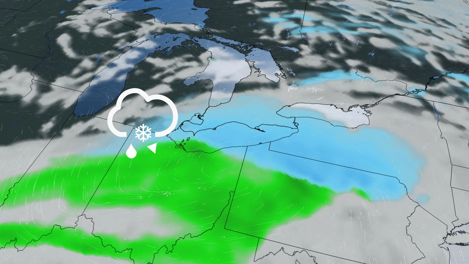
FRIDAY: CLOSE CALL, AS WET SNOW WILL GRAZE THE SOUTHWEST
People across the province have been seeing brief bursts of flurries or light snow from the lake effect, but the snow we are anticipating Friday will be from a more organized system trekking through the northern United States.
Beginning Friday morning in the extreme southwest, spreading east into the afternoon, areas from Windsor to Niagara will mainly see the wet snow, but because daytime highs will sit above the freezing mark, accumulations will rapidly melt. Surfaces will be slushy, however.
Light, wet flurries may extend to the western and southern edges of the Golden Horseshoe, but again, no accumulations are expected before it all comes to a close by day's end.
WATCH BELOW: 3,000 KM BAND OF SNOW WILL STRETCH ACROSS THE U.S. AND CANADA THIS WEEK
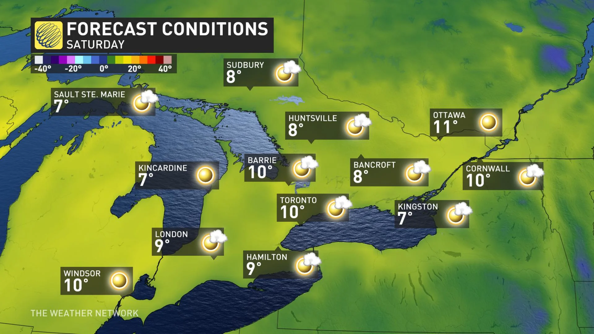
WEEKEND: TEMPERATURES TO WARM UP BRIEFLY, UNSETTLED WEATHER RETURNS
Temperatures will attempt to climb back towards seasonal values this weekend, with double-digit daytime highs returning to much of the south Saturday, along with sunshine.
However, some unsettled weather is expected Sunday across southern Ontario with a few showers, but most of the day will be rain-free. Temperatures will be near seasonal.
Check back for updates as we continue to keep an eye on the forecast.