Ontario: Multi-day rainstorm could cause flooding, pooling water

This month has been abnormally dry in southern Ontario and the region has only seen roughly half the amount of rainfall that is normally expected in April. The dry conditions will soon come to an end since a strong low pressure system will bring half of the month's average rainfall total starting Wednesday. Between 30-50 mm of rain will be widespread and even higher amounts are possible along eastern areas of Lake Ontario. This could cause flooding and pooling water in low-lying areas. Details and timing, below.
WEATHER HIGHLIGHTS:
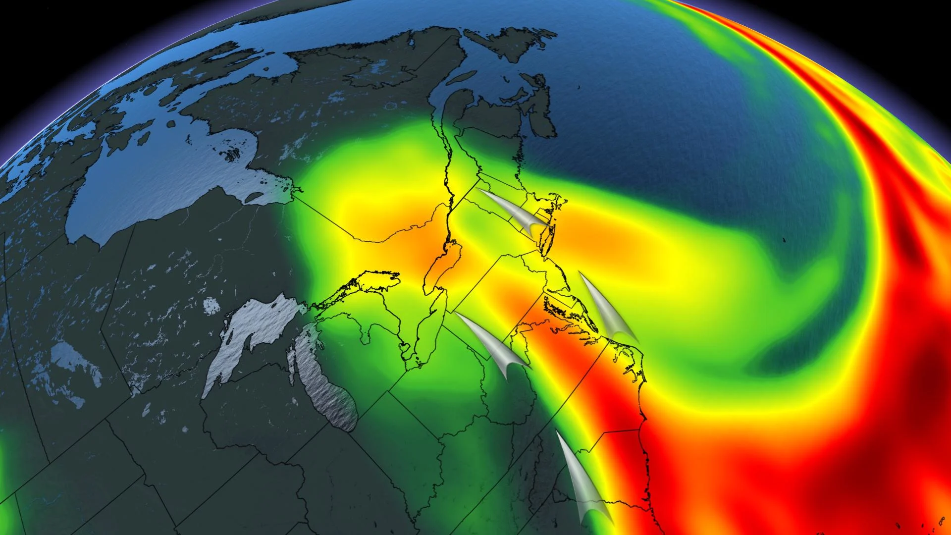
Incoming low-pressure system will track in late Tuesday
Widespread rainfall totals of 30-50 mm expected across the south, up to 60 mm near east end of Lake Ontario
Stayed informed of the weather ALERTS in your area
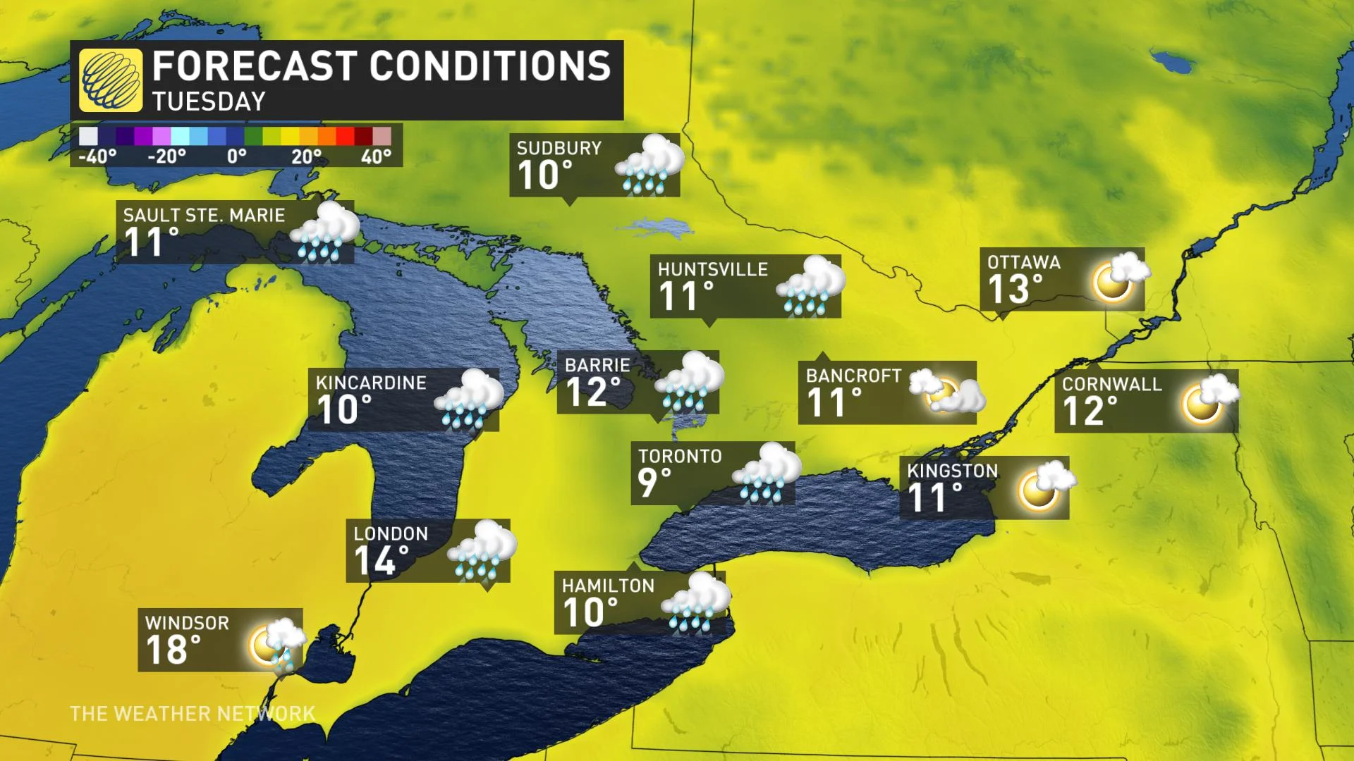
TUESDAY: BELOW SEASONAL TEMPERATURES, LIGHT RAIN
Temperatures on Tuesday will drop a couple degrees for most areas, except in the southwest, where there will be more sunshine available to bring daytime highs near 20°C.
The next round of rain will track in on Tuesday evening and will bring several days of soggy conditions that will linger into Friday.
COVID-19: Here's what's happened so far this month
WEDNESDAY: SOAKING RAINS COURTESY OF MOISTURE-LADEN SYSTEM
Rain will become widespread Wednesday morning as the strong system tracks through southern Ontario, drawing in moisture from the southern United States.
Rain will become heavier Wednesday afternoon and most areas in the south can expect to see between 30 to 50 mm from this system. Areas on the eastern end of Lake Ontario may see upwards of 60 mm, while Sudbury and surrounding regions could get as much as 75 mm through Friday morning. Central and much of eastern Ontario will see a little less, with 20-30 mm expected.
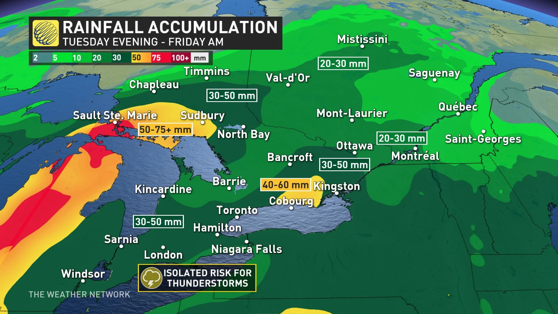
The heavy rain has the potential to cause flooding and pooling water in low-lying areas. There will also be some embedded thunderstorms, which may increase localized rainfall amounts.
A ridge of high pressure situated in Atlantic Canada can be attributed to the low pressure system stalling in southern Ontario on Wednesday, which is why there will be soggy conditions for several days.
Weather Network meteorologist Tyler Hamilton says that the rainfall from this system could exceed the amount of rain that has fallen during the first three weeks of April.
“We’ve already seen 30-40 mm across parts of southern Ontario and we are forecasting 30-40 mm, so we’ll finish the month roughly around normal in the precipitation department,” Hamilton says.
In addition to the below seasonal temperatures, strong winds will hit 60 km/h Wednesday, creating a wind chill and blustery conditions. More scattered showers are expected Thursday for all of Ontario.
LOOK AHEAD: A QUICK SHOT OF WARMER TEMPERATURES BEFORE COLDER PATTERN LOCKS IN
There will be a brief shot of warmer temperatures for the weekend, with widespread mid to upper teens and a few spots could reach 20°C. The timing of a cold front on Sunday will be key to how warm we get on that day.
"Slower timing would allow for more widespread upper teens and a few spots could reach 20°C, but faster timing would keep temperatures several degrees cooler," says Weather Network meteorologist Dr. Doug Gillham.
A widespread colder pattern will return for the first week of May and continue through to at least Mother’s Day. Temperatures won’t be as cold as it has been in recent weeks, but still well below seasonal for early May.
Check back for updates as we continue to monitor this system.


