Ontario: Tracking cold soaking rain potential this weekend

Southern Ontario will enjoy a break from the unsettled weather to start the weekend, but conditions will change Saturday night
Warmer, but still below-seasonal, temperatures continue into Saturday, which will stay dry through Saturday afternoon, with the next system bringing rain across the south in the evening. The unsettled weather will continue through Sunday. Temperatures will remain cool through the weekend. Details, timing, below.
WEATHER HIGHLIGHTS:
Chance for double-digit highs Saturday
System brings rain Saturday night into Sunday
Little sustained warmth for the rest of the month
Stayed informed of the weather ALERTS in your area
SATURDAY AND SUNDAY: WEEKEND STARTS OUT DRY, BUT RAIN EN ROUTE
Saturday looks to stay dry through to the afternoon across most of the province. Double-digit warmth makes a return, too, but it's still a few degrees shy of seasonal for late April.
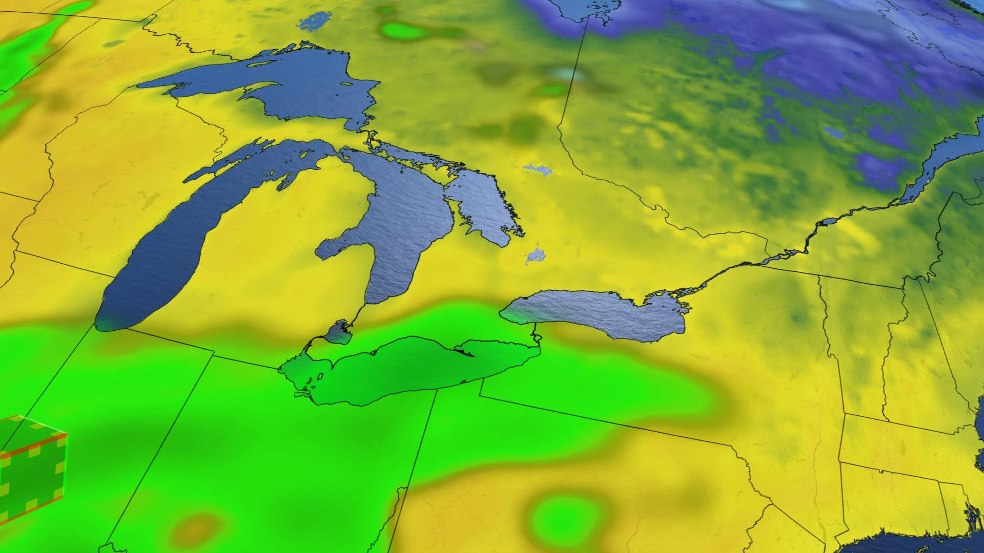
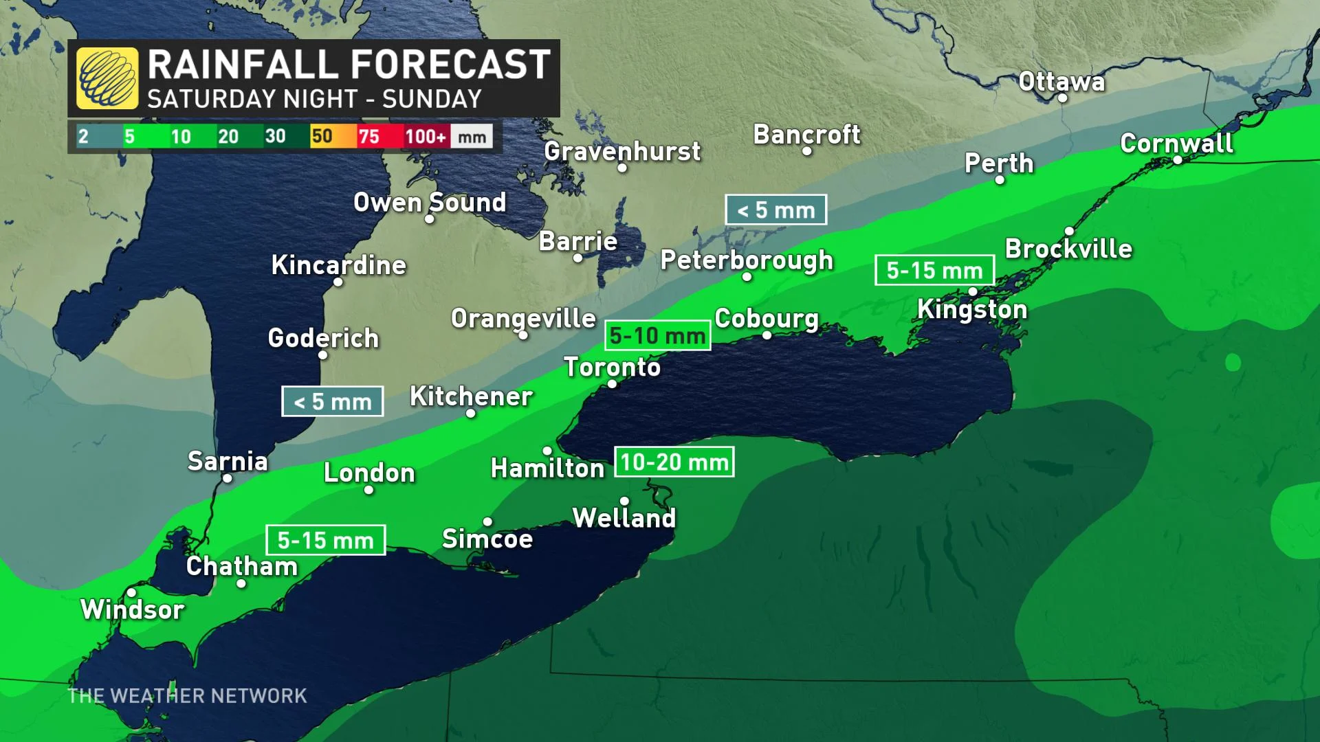
The next system will track south of the Great Lakes Saturday, but close enough to the south to bring rain starting Saturday evening and continue into Sunday morning, drying out in the afternoon for the southwest and Monday morning for the east. Cottage country can expect a chilly, but clear day.
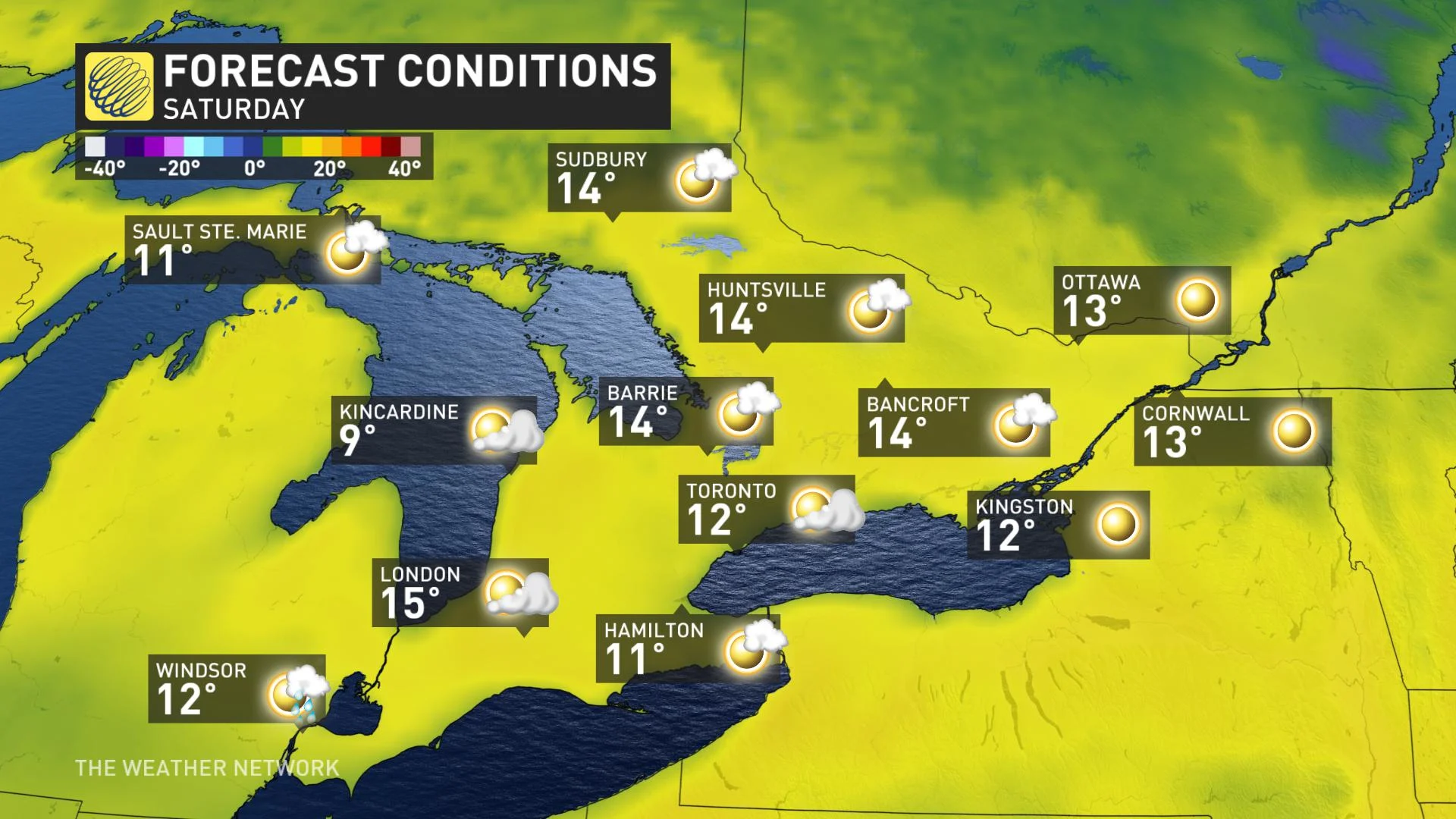
Temperatures remain cool Saturday and will be the warmest day this weekend. Temperatures will just graze the double digits southern Ontario with the warmest temperatures inland away from lakes reaching into the mid-teens.
Areas north of Orangeville will escape the rain, while areas adjacent to the lakes will get some more substantial showers, heaviest in the Niagara region, where 10-20 mm is expected through Sunday. The GTA down to Windsor can expect amounts in the 5-15 mm range.
LOOK AHEAD: REMAINING BELOW SEASONAL, AS NO SUSTAINED WARMTH IN SIGHT
Fair and cool conditions are expected for early next week, but a system will move in by Wednesday or Thursday. It will bring a wet and chilly end to April. Below seasonal temperatures will continue to dominate through the first week of May, as there is no sustained warmth in sight.
"A brief warmup is possible at the end of next week and into the start of next weekend, but at this point we are rather skeptical of the warm temperatures on a few models," said Weather Network meteorologist Dr. Doug Gillham.
Cooler than seasonal temperatures are expected to dominate the first 7-10 days of May, but it won't be as cold as it has been in recent weeks.
Check back for updates as we continue to monitor the forecast.