Ontario: Snow squalls stream in as temperatures drop below seasonal

Snow squalls could create rapidly-changing road conditions on Sunday
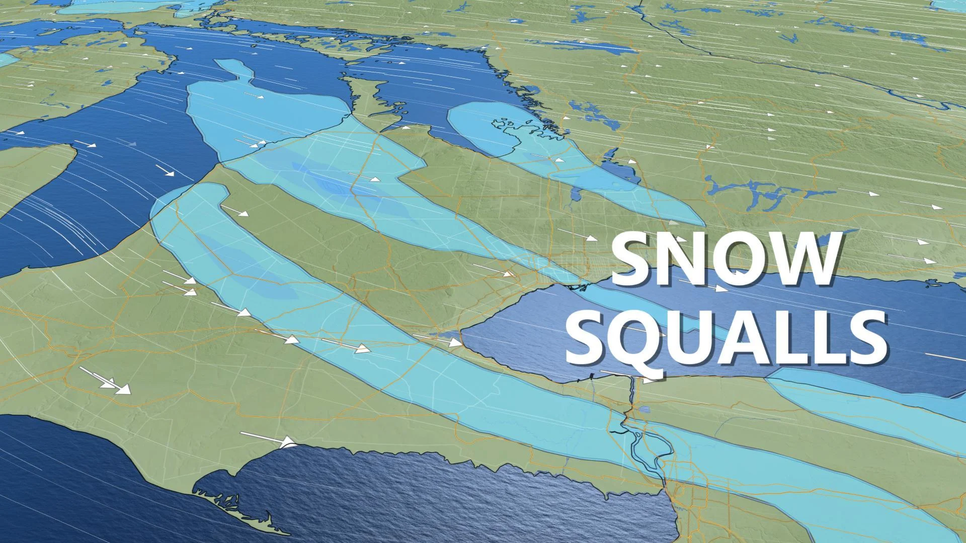
After a soggy Saturday, snow squalls have resumed for southern Ontario, thanks to cold, northwest winds -- winds that are also bringing falling temperatures and a biting wind chill. The lake-effect streamers will see the snow pile for some through Sunday, with regions southwest of Georgian Bay and Lake Huron seeing the potential for up to 15 cm. See below for details and timing.
Visit our Complete Guide to Winter 2019/2020 for an in depth look at the Winter Forecast, tips to plan for it and a sneak peek at the spring season next year
WEATHER HIGHLIGHTS:
Lake-effect snow squalls through Sunday
Cold northwest winds, minus double-digit wind chills
Stay up-to-date on the ALERTS in your area
SUNDAY -- COLDER AIR LOCKS IN, LAKE-EFFECT SNOW RETURNS
Northwest winds will spur lake-effect snow streamers on Sunday for most of southern Ontario's traditional snowbelts, boosting weekend snowfall totals southwest of Georgian Bay and Lake Huron -- including Barrie, Orangeville, and Stratford -- to the 10 to 15 cm range.
WATCH BELOW: SNOW SQUALL TIMING
While shifting winds will limit overall snow totals for any one place, those with travel plans for anywhere between Peterborough and London are likely to encounter at least one bout of rapidly-changing conditions. Squalls will taper off through Sunday night.
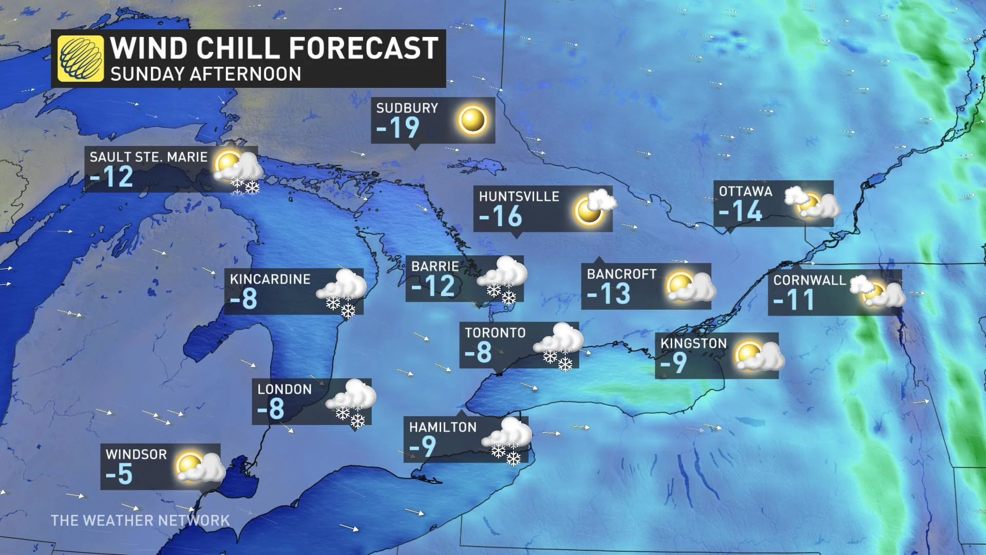
Those gusty northwest winds will also spur a biting wind chill for parts of southern Ontario, with afternoon temperatures feeling close to -10 -- or lower -- across the board.
LOOK AHEAD -- EYES ON SIGNIFICANT WINTER STORM POTENTIAL
Forecasters are keeping an eye on another extensive and moisture-laden system that is expected to track south of the border late Monday night and into Tuesday. While the exact track and impacts are still uncertain, it has the potential to bring significant snow or an icy mix during the day on Tuesday.
"Some computer models keep this system too far to our south to have any impact on our region. However, a more northerly track looks more likely, bringing the potential for 5-10 cm to most of our region late Monday night and into Tuesday," says Weather Network meteorologist Dr. Doug Gillham.
WATCH BELOW: TRACKING THE NEXT CHANCE OF SNOW
Later on in the month, the weather pattern leading up to Christmas looks to remain changeable, with no sustained cold weather in sight. But there will still be the potential for wintry weather at times, though it is still too early to make the call on a white versus green Christmas.