
October disguise? This month looks suspiciously like September

October is looking suspiciously like September with an overall warmer than normal outlook expected for the new month ahead.
Fall 2021 is off to a rather mild start across most of Canada.
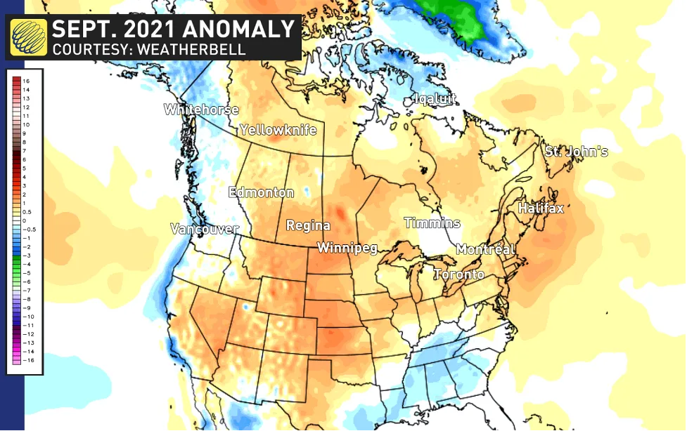
Take a look at the September temperature anomalies shown on the map below. The various shades of orange highlight the warmer than normal temperatures that many have enjoyed during the past month across most of Canada east of the Rockies.
Visit our Complete Guide to Fall 2021 for an in-depth look at the Fall Forecast, tips to plan for it and much more!
Only parts of B.C., Yukon and Nunavut were colder than normal during September.
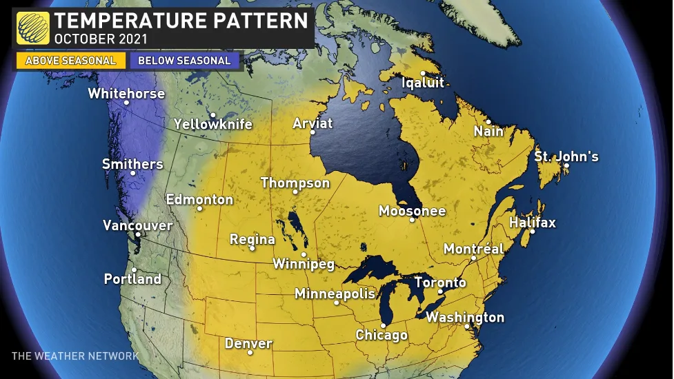
We expect that a similar pattern will dominate across Canada during October. Here is look at what we expect for the month of October.
However, it is important to keep in mind that “normal” drops off very quickly this time of year. Across much of Canada, “normal” temperatures fall by 1-2 degrees per week during October, but for parts of the Prairies and northern Canada, we lose 2-3 degrees per week. So, what we consider to be a chilly day during early October can feel like a relatively warm day by the end of the month.
Also, keep in mind that a pattern map for a month can never capture the all-important daily details. We expect that most of Canada will be warmer than normal for the month as a whole, but everyone should expect some interruptions to the milder pattern. However, the periods of warmer weather should outweigh the shots of colder weather.
Here are more details on what you can expect from the month of October across Canada.
BRITISH COLUMBIA AND YUKON
This is the one part of Canada where we do not expect above normal temperatures during October.
While we will still have some mild and pleasant days at times, we expect that near normal or colder than normal temperatures will dominate the month. We also expect that we will continue to have an active Pacific jet stream into the region, bringing above normal precipitation, including an abundance of snow for alpine regions.
THE PRAIRIES, NORTHWEST TERRITORIES AND NUNAVUT
Above-normal temperatures will dominate across most of the region through the month of October, especially during the first week of the month, which will include some late summer-like warmth across the southern Prairies.
However, as we get deeper into the month, we will see more shots of colder weather, especially across western parts of the region. Also, long-time residents of the region know that it is normal for October to bring some winter weather to the region. Even a warm October is capable of bringing quick shots of cold and snow.
ONTARIO AND QUEBEC
Warmer than normal temperatures are expected to dominate during the month of October, but of course there will be some chilly days mixed in as well. October will include some extended stretched of mild and dry weather, which will be ideal for enjoying the fall foliage which is running later than normal this year after a warm September. Fewer than our typical number of fall storms are expected, but a couple of soggy systems could still bring the final rain-fall totals to near normal for parts of the region.
ATLANTIC CANADA
We will continue to keep a close eye on the tropics through October as an active conclusion to the hurricane season is expected, but it is too early to know if any of those storms will have a direct impact on the region.
Warmer than normal temperatures are expected to dominate through the month of October. A few shots of chilly weather will interrupt the mild weather at times, but there will be stretches of pleasant weather to enjoy the fall foliage.