
Significant storm could drop 30 cm of snow on parts of Quebec

A chilly but mostly calm weekend will go out with a strong winter-like blast, as the effects of an incoming low begin to impact the province later Sunday in the form of strong winds and at-times heavy snow. By Monday, some 25-30 cm of snow is possible in the Laurentians, with noticeable amounts along the St. Lawrence, including in Montreal, though a later infusion of warm air will also bring mixing and rain. More details, below.
WEATHER HIGHLIGHTS:
Snow reaches southern Quebec Sunday evening, intensifying overnight
Gradual changeover to rain Monday morning for areas along St. Lawrence River and south
Potential for 25-30 cm of snow over areas of central, eastern Quebec
SUNDAY NIGHT/MONDAY: POTENTIALLY SIGNIFICANT SNOWSTORM
The potent low will already have been affecting southern Ontario early Sunday, but will not reach Quebec until the evening hours. It will begin as snow almost everywhere, though the heaviest snowfall rates look to be overnight.
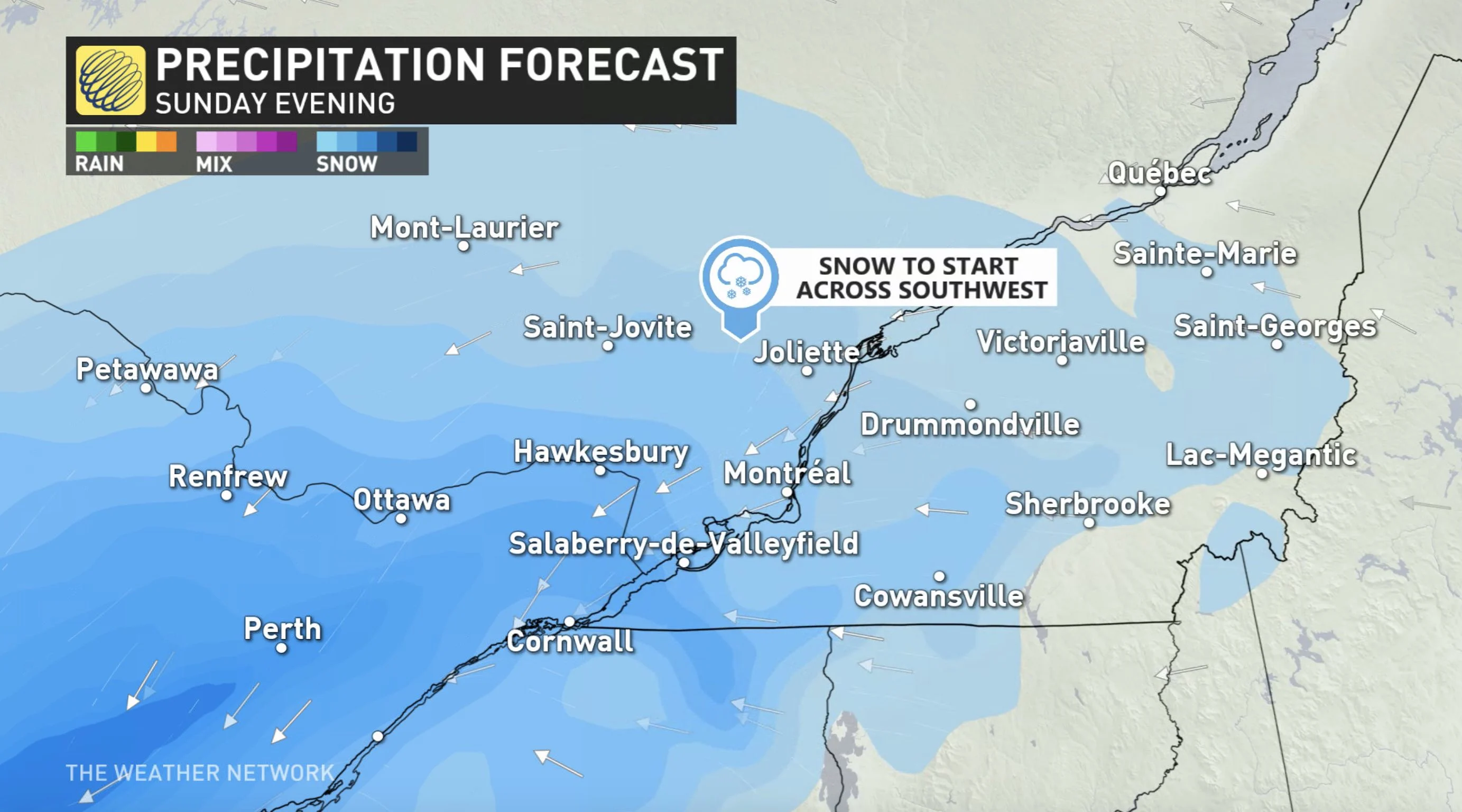
This will be a moisture-laden system, but with a track keeping the heaviest snows north of the St. Lawrence, and some southerly flow to more southerly areas, meaning temperatures warm enough to rise above freezing in later stages of this system. That will mean those areas will experience a rain-snow mix into Monday morning before snow switches to rain for the region including Montreal, keeping amounts somewhat limited, but still shovellable.
Though a quick shot of afternoon snow is possible in some areas, most precipitation will be clearing out by Monday afternoon, but rising winds will be peaking by then as the low pushes through. Gusts of 40-60+ km/h are expected, likely to create hazardous travel on the roads due to blowing and drifting snow.
WEEKEND SNOW TOTALS:
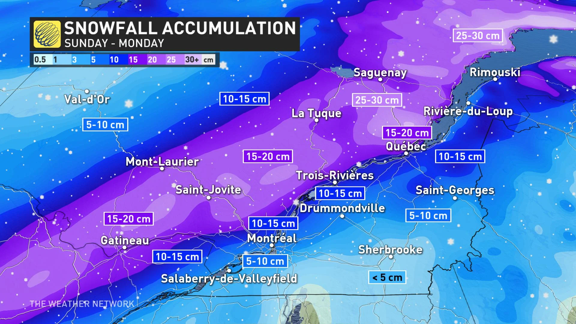
The heaviest snow totals will be through the Laurentians, where there will be 25-30 cm through Monday. The Montreal area can expect 5-10 cm, but will rapidly melt due to the 5-15 mm of rain and warmer temperatures. Accumulations will rise sharply north of Laval.
Beyond, a somewhat disorganized system will track across the region by mid-week with snow to the north and rain-snow mix in the south or all rain for southernmost areas. It is still early to have confidence in snow totals, but this could bring 5-10 cm for Montreal.
Be sure to check back we continue to monitor this system.


