We're officially under La Niña Watch - what does that mean?
National Oceanic and Atmospheric Administration (NOAA) just officially issued a La Niña Watch. But was is La Niña and how does it impact the world, North America and Canada.
As of July 9th, we're officially under a La Niña Watch. National Oceanic and Atmospheric Administration (NOAA) declared that conditions are favourable to develop La Niña over the next six months and onward.
Right now the chances are only around 50-55 per cent of one developing, as the water is cooler than normal around some of the areas that are being monitored. Though the chances are the same for your reliable coin toss, what do these chances actually mean?
With a coin toss, there is a 50/50 chance of getting heads or tails. Whether selecting which team gets to go first, choosing a place to go eat, or deciding who should get the last piece of pie, the coin toss provides a fair decision-making tool. La Niña does exactly that, gives us a heads up of what we can expect six months down the road.
La Niña and its more popular opposite, El Niño, give us guidance during the summer as what to expect for the winter. “The point of a La Niña Watch is to give planners for energy, agriculture, disaster management, and other sectors a heads-up that the chance of La Niña developing is greater than the combined chance of neutral and El Niño,” NOAA states.
WHAT DOES LA NIÑA MEAN?
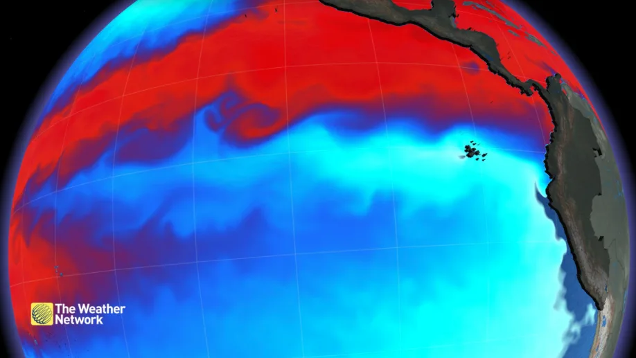
La Niña, neutral and El Niño are the three states of El Niño Southern Oscillation (ENSO). Is a science a science if it doesn't include confusing acronymic jargon? ENSO says NO! The ENSO cycle describes the fluctuations in temperature between the ocean and atmosphere in the east-central Equatorial Pacific, which can be seen below:
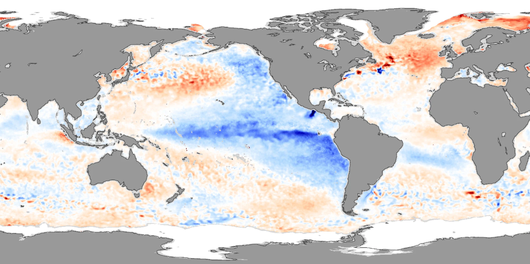
In La Niña, the surface temperatures of the equatorial water trend cooler, which is the opposite of El Niño, where temperatures are warmer than normal.
Right now, the water surface temperatures are less than one degree Celsius cooler than normal. Though it doesn't seem like a lot, it's enough to set off a chain of reactions (learn more here) that can influence extreme weather, supply chain, and even the global economy.
THE POSSIBLE IMPACTS OF A LA NIÑA
Firstly, La Niña impacts the weather. For Canada, this could mean a cooler winter for the west coast. In the past, it can be advantageous to spring for a season pass for alpine skiing, as there’s a correlation to more snow at higher elevations. It could also mean more extreme precipitation for areas around the northern Rockies.
The east coast also gets more extreme weather and it was a La Niña that caused eastern Canada's 2007/2008 almost record-breaking snowfall. As the planet is composed of 70 per cent water, these changes in sea surface temperatures can alter the rising and sinking air patterns near the equator; consequently, this can influence the global jetstream pattern.
So secondly, there are the economic impacts that extreme weather has on certain areas of the world. Areas near the Indian and Pacific oceans could face increased hurricanes, floods, and cyclones. This leads to unstable farming conditions, which impacts the supply of goods.
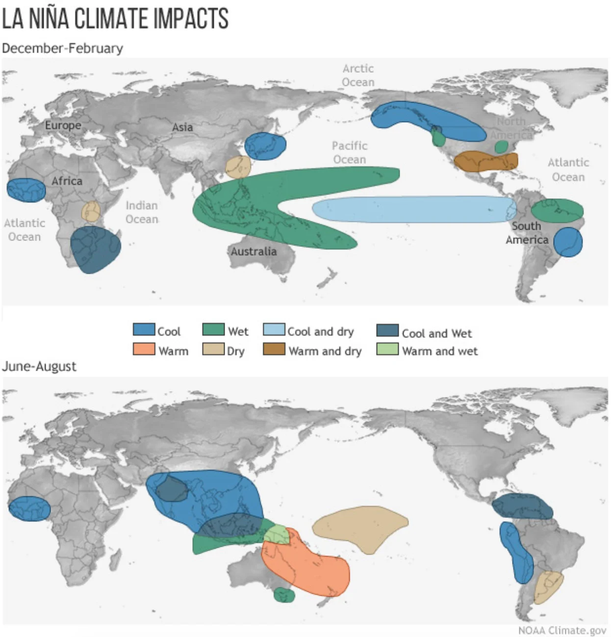
Typical impacts of La Niña on the world during Northern Hemisphere winter and summer. Credit: Climate.gov
WHAT'S HAPPENING RIGHT NOW
As of now, we remain in a neutral state, but the atmosphere is acting like we're in a La Niña. This can impact hurricane season, which peaks in September for the Atlantic basin. As for the Eastern Pacific, it looks like a slowdown of named storms this year.
Just because we're not in La Niña, doesn't mean the atmosphere isn’t already mimicking one. There's a variable jetstream going through the North Pacific. This is why British Columbia and Alberta have had an extremely slow start to summer.
As of now, there are some La Niña traits occurring throughout western Canada, but NOAA is still calling it a conservative 50-55 per cent of actually developing one. NOAA’s main concern that could hinder the development of a La Niña is a limited supply of cooler water at depth. We will continue to monitor the potential for a developing La Niña as we head towards the fall season.