Bill becomes post-tropical as remnants stay south of Newfoundland

Bill has lost steam in the Atlantic, and is no longer a tropical storm as it heads across cooler waters. The system's remnants will send tropical moisture to Newfoundland on Wednesday.
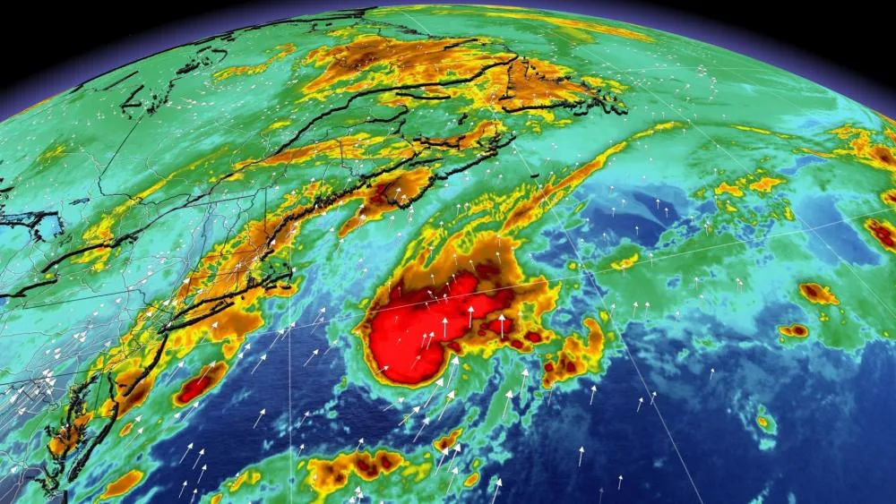
Bill is nearing the end of its life and is now a post-tropical cyclone. It has hit colder waters, with further weakening from a cold front expected. What's left of the storm may boost rainfall totals and bring gusty winds in eastern Newfoundland on Wednesday.

The U.S. National Hurricane Center's final update found that Post-Tropical Cyclone Bill has slowed down slightly to near 46 km/h and the motion is expected to continue through Wednesday.
Maximum sustained winds are near 85 km/h with higher gusts. Weakening is expected, and the post-tropical low is expected to dissipate on Wednesday.
SOME RAIN AND WIND IN NEWFOUNDLAND
While the remnants of Bill could pass near or over the Avalon Peninsula, the system will prove little more than a nuisance in Newfoundland.
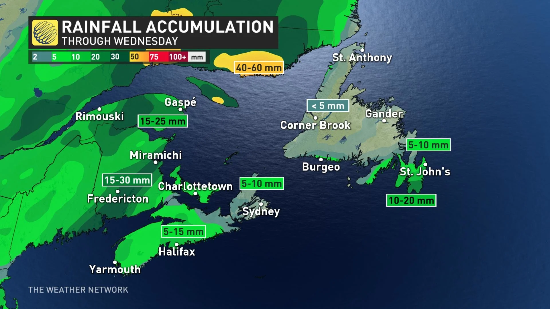
The addition of tropical moisture will enhance precipitation totals over southern Newfoundland and the Avalon Peninsula, but overall, the amounts will be on the low end. There is the potential for 10-20 mm of rain through Thursday for southern portions of the island.
Environment Canada still has a tropical cyclone information statement for southern Nova Scotia and Newfoundland in place, with the final planned statement issued Tuesday afternoon.
"Forecast guidance is indicating possible slow weakening during the next 12 hours as it travels over warm waters before reaching the southeastern Scotian Slope or the southwestern Grand Banks tonight. The system is then expected to continue weakening over offshore Canadian waters before becoming absorbed by a larger non-tropical low pressure system originating from the West. It is expected to become fully absorbed south of Newfoundland during the day on Wednesday, before moving over southeastern Newfoundland," the statement read.
Gusty winds of 60-70 km/h are possible as the storm’s remnants pass through the area.

It’s common for tropical cyclones in June to form in the Gulf of Mexico or off the coast of the southeastern United States. These early-season systems often get their start from non-tropical sources like cold fronts and complexes of thunderstorms that started over land.
Tyler Hamilton, a meteorologist at The Weather Network, noted there has been 144 June storms in data base records since 1951 and very few of them form off the Africa coast.
However, there is the small chance of a tropical wave developing off Africa in the next several days, which is "extremely rare" in this part of the Atlantic basin in June.