NASA's Ingenuity helicopter broke records during high-speed 'nail-biter' flight

The Mars helicopter broke records as it flew at high speed over 'unfriendly terrain' this week.
Although it was only intended as a simple technology demonstration, after nine successful flights, NASA's Mars Ingenuity helicopter continues to prove to be a valuable member of the mission science team.
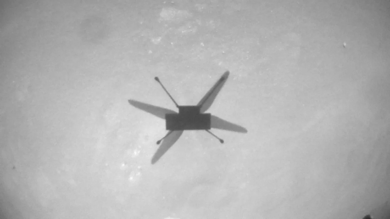
Around midday on July 5, on Mars, that is, the Mars helicopter lifted off on its 9th successful flight over Jezero Crater. It was a 'nail-biter' according to the mission team. The drone flew farther, faster, and spent more time in the air than it ever had on any of its flights before.
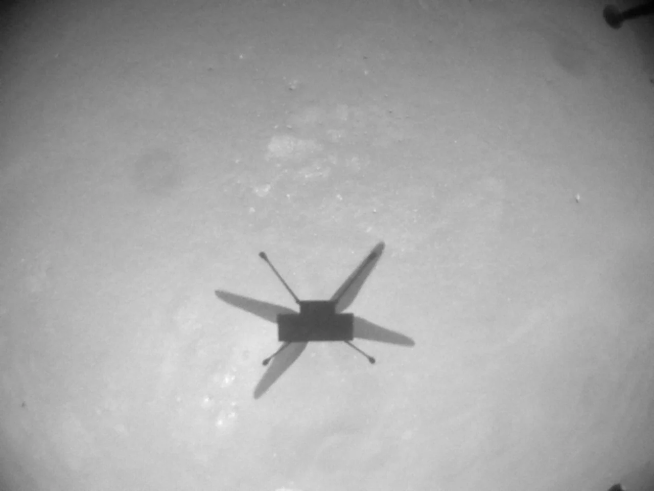
Ingenuity's shadow is clearly visible in this mid-flight Navcam image taken during Flight 9, on July 5, 2021. Credit: NASA/JPL-Caltech
"Flight 9 was not like the flights that came before it," the team wrote in a blog post on Wednesday. "It broke our records for flight duration and cruise speed, and it nearly quadrupled the distance flown between two airfields. But what really set the flight apart was the terrain that Ingenuity had to negotiate during its 2 minutes and 46 seconds in the air — an area called 'Séítah' that would be difficult to traverse with a ground vehicle like the Perseverance rover. This flight was also explicitly designed to have science value by providing the first close view of major science targets that the rover will not reach for quite some time."
Séítah (which means "amidst the sand" in Navajo) is one of Perseverance's first major science targets in Jezero Crater. It is a low-lying area, littered with rocks and striped with numerous rippled sand dunes. Unfortunately, the terrain of Séítah might be too treacherous to risk driving Perseverance into the middle of it. On the other hand, Ingenuity was able to fly over the most interesting targets, snapping colour images to send back to the team.
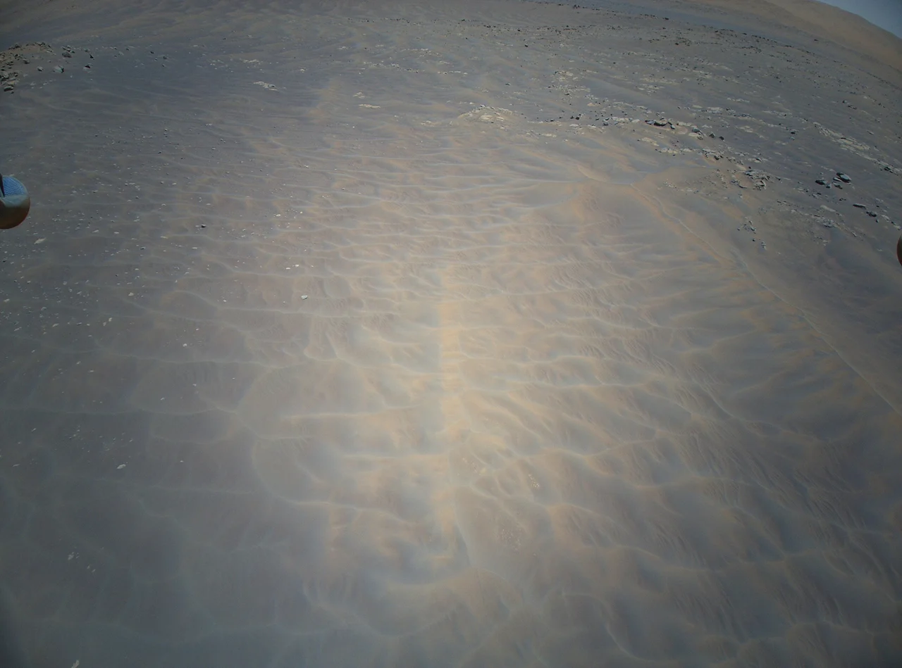
This raw image was snapped by Ingenuity's Color Camera, at 12:35 p.m. local time on Mars, on July 5, 2021. While the black and white Navcam photos show the view directly below the drone, the Color Camera is pointed off to the side, at approximately 22 degrees below the horizon. The small silver ball at the top left (and the tiny fraction of one visible top right) are the helicopter's landing feet. Credit: NASA/JPL-Caltech
One of the reasons this flight was a 'nail-biter' is that, so far, Ingenuity has flown over mostly level ground. Séítah represented a patch of 'unfriendly terrain' as the team called it in a blog post leading up to the flight. The ground sloped down into the feature, and Ingenuity flew over numerous sand dunes before the terrain rose again and levelled out at the helicopter's next flat airfield. The problem with flying over this kind of terrain is that Ingenuity's navigation software wasn't designed to interpret changes in the distance between it and the ground.
"When we as human beings look at moving images of the ground, such as those taken by Ingenuity's navigation camera, we instantly have a pretty good understanding of what we're looking at," the team wrote. "We see rocks and ripples, shadows and texture, and the ups and downs of the terrain are relatively obvious. Ingenuity, however, doesn't have human perception and understanding of what it's looking at. It sees the world in terms of individual, anonymous features — essentially dots that move around with time — and it tries to interpret the movement of those dots."
Their solution to this was relatively simple.
"We told it that those features are all located on flat ground."
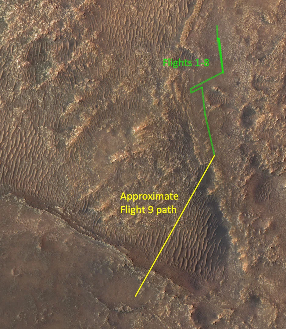
This map shows the approximate flight path of Ingenuity during its July 5th flight. Credit: NASA/JPL-Caltech.
There is a risk to this solution, though. If Ingenuity's navigational computer makes a wrong interpretation of something it sees in the images during flight, it can cause the helicopter to veer off course. Careful planning and anticipating potential problems based on other imagery the obtain of the flight path ahead of time can help reduce the risk.
Now, with Ingenuity resting at its new airfield, southwest of Séítah, the team is waiting for all the high-resolution colour imagery to arrive here on Earth. Of particular interest is a feature known as "Pilot Pinnacle," which could be leftover from the deepest water environments in the lake that once filled Jezero Crater.


