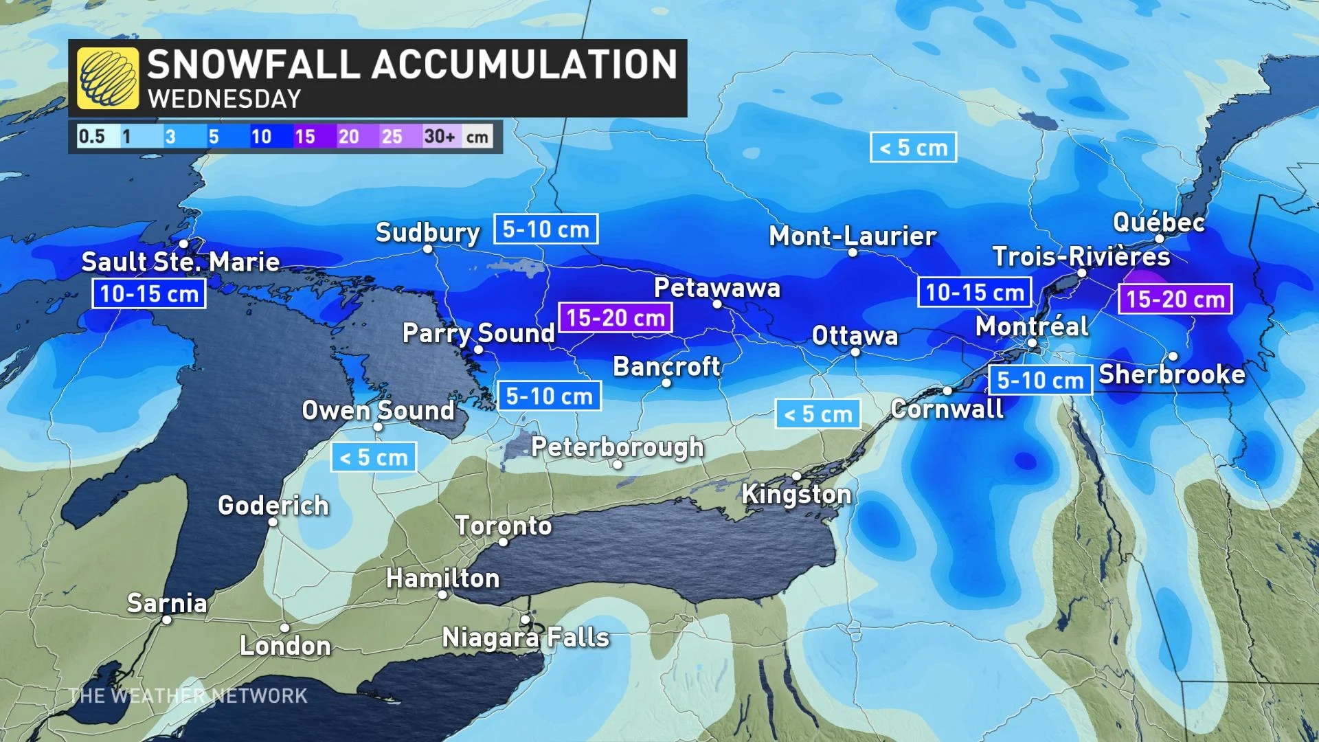
Current system could drop 10-20 cm of snow over parts of Ontario

Rounds of unsettled weather will see out the month of February across Ontario, with the next system anticipated to bring ample amounts of snowfall for central, eastern areas on Wednesday, while the south soaks up some of the mildest conditions in months.
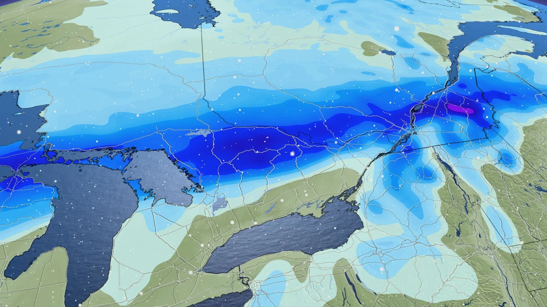
Stuck in an unsettled pattern this week, the third round of snow for Ontario will spread across parts of the region Wednesday, though mostly impacting parts of central and eastern Ontario this time. Difficult travel is likely across cottage country, with weather advisories in place warning of the accumulating snow and reduced visibilities. Parts of the region could see 10-15 cm of snow by the time it tapers later Wednesday evening. Southern Ontario will be much quieter in comparison, with warmer temperatures and perhaps mixing and/or rain. Wednesday may also feature the warmest daytime highs felt since December in the south. More on the mid-week storm timing, and a look at the messy weekend system up next in southern Ontario, below.
WEATHER HIGHLIGHTS:
Snow spreads across central, eastern Ontario on Wednesday, difficult travel expected
Mild temperatures in the south Wednesday, scattered precipitation remains as mixing and/or rain along lake shores
Fair conditions Thursday and Friday before a messy weekend system
WEDNESDAY: HEFTY SNOWFALL ACROSS CENTRAL ONTARIO, MILDER AIR IN THE SOUTH
The third in a series of systems this week will track across the central Great Lakes Wednesday, with 10-15 cm of snow expected across cottage country and parts of the Ottawa Valley. Snow will intensify during the day, prompting winter weather advisories for areas east of Georgian Bay, extending into portions of eastern Ontario as well.
Motorists should allow extra time to reach their destination as poor visibility is expected. Sections of Highways 69, 400, 11 and 17 will be impacted in cottage country and eastern Ontario.
Meanwhile, across the southern sections and the GTA, Wednesday will feature very mild conditions -- possibly the warmest temperatures felt since December for the region.
With the warmer air in place, the GTA will likely just see light mixing or rain with this clipper system in the afternoon, especially along the shorelines of Lake Ontario. Snow should remain primarily north of the GTA.
Travellers in the region can expect ponding on the roads, however, due to the melting snowpack from the recent mild temperatures.
Snow should wind down in the central, eastern areas in the evening hours.
LOOK AHEAD: UNSETTLED WEATHER RETURNS FOR THE WEEKEND WITH MESSY SYSTEM
Fair conditions return for Thursday and Friday, with the latter featuring abundant sunshine. As high pressure builds in over the area, we'll see more sun, but with daytime temperatures back near the freezing mark.
Forecasters are also keeping an eye on the next potential weather system for Friday night, which could bring a widespread messy mix of precipitation to the region.
At this point it looks like this system will bring a period of snow and ice changing to rain. However, more rain than snow is expected for southern Ontario.
Sunday will dry out with milder temperatures returning once again, and some areas possibly even flirting with double digit daytime highs.
Be sure to check back for the latest updates on the active set-up across Ontario Ontario.