Snow continues for parts of Prairies, big drop in temperatures

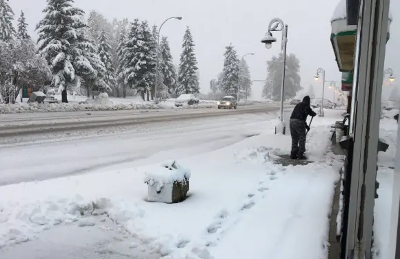
Another round of snow left many in southern Alberta reaching for the shovels on Tuesday. While this event wasn't as dramatic as the first significant snowstorm of the season, it has left another hefty helping of snow along the southern foothills, and will spread light accumulations into Saskatchewan and Manitoba through Wednesday. This early-week storm isn't the main event when it comes to significant snow in the days ahead, however. More on what's left of this system, and the storm that looms for late-week, below.
Visit our Complete Guide to Fall 2019 for an in-depth look at the Fall Forecast, tips to plan for it and a sneak peek at the winter ahead
WATCH BELOW: TRACKING THE SNOW THROUGH WEDNESDAY
A passing cold front supplying Pacific moisture for the southern Prairies -- combined with upsloping winds -- fueled another helping of snow across southern Alberta and into the foothills on Tuesday. While the worst of the snow has already fallen, some flakes will linger through early Wednesday as the system pulls away from southern Alberta.
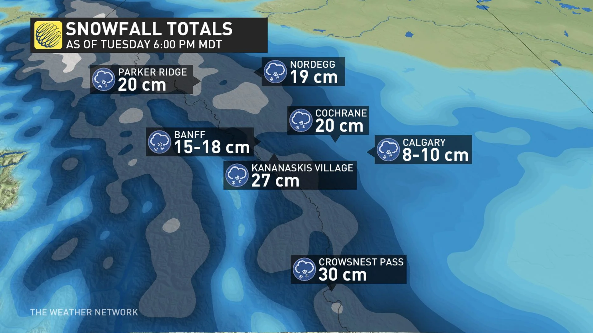
Snow spreads into southern Saskatchewan through the overnight and into Wednesday, with light accumulations expected on Wednesday as far east as Regina and the Manitoba border.
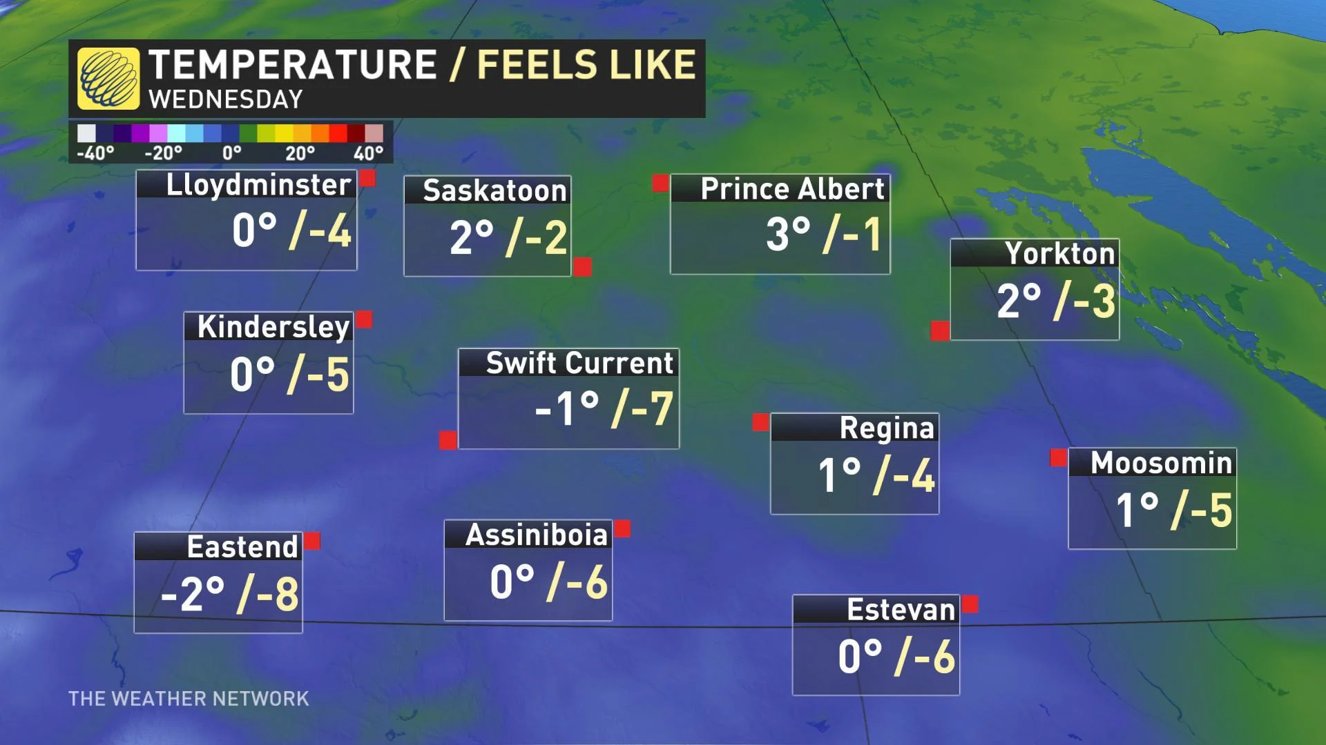
This system comes along with a major drop in temperature across the region as cold, Arctic air floods down from the north. While temperatures Monday afternoon climbed to near the 20ºC mark across much of southern Alberta, Tuesday's highs struggled to make it above freezing. The same is true for Saskatchewan, and more of the same is on the way for Wednesday.
MAJOR LATE WEEK SNOWSTORM FOR SOUTHERN MANITOBA
Later this week, a "high impact snowstorm" is set to blast southern Manitoba with heavy snow through Saturday.
"As the Colorado low develops late week and tracks along the boundary between the Arctic air versus warmer air, a major snowstorm with the potential for blizzard conditions is expected for parts of the U.S. Upper Midwest and across southern Manitoba on Friday through Saturday," says Weather Network meteorologist Dr. Doug Gillham. "Substantial snowfall totals between 25-50+ cm are likely, making travel disruptions very likely."
The chilly and below seasonal pattern is set to last through the Thanksgiving long weekend.