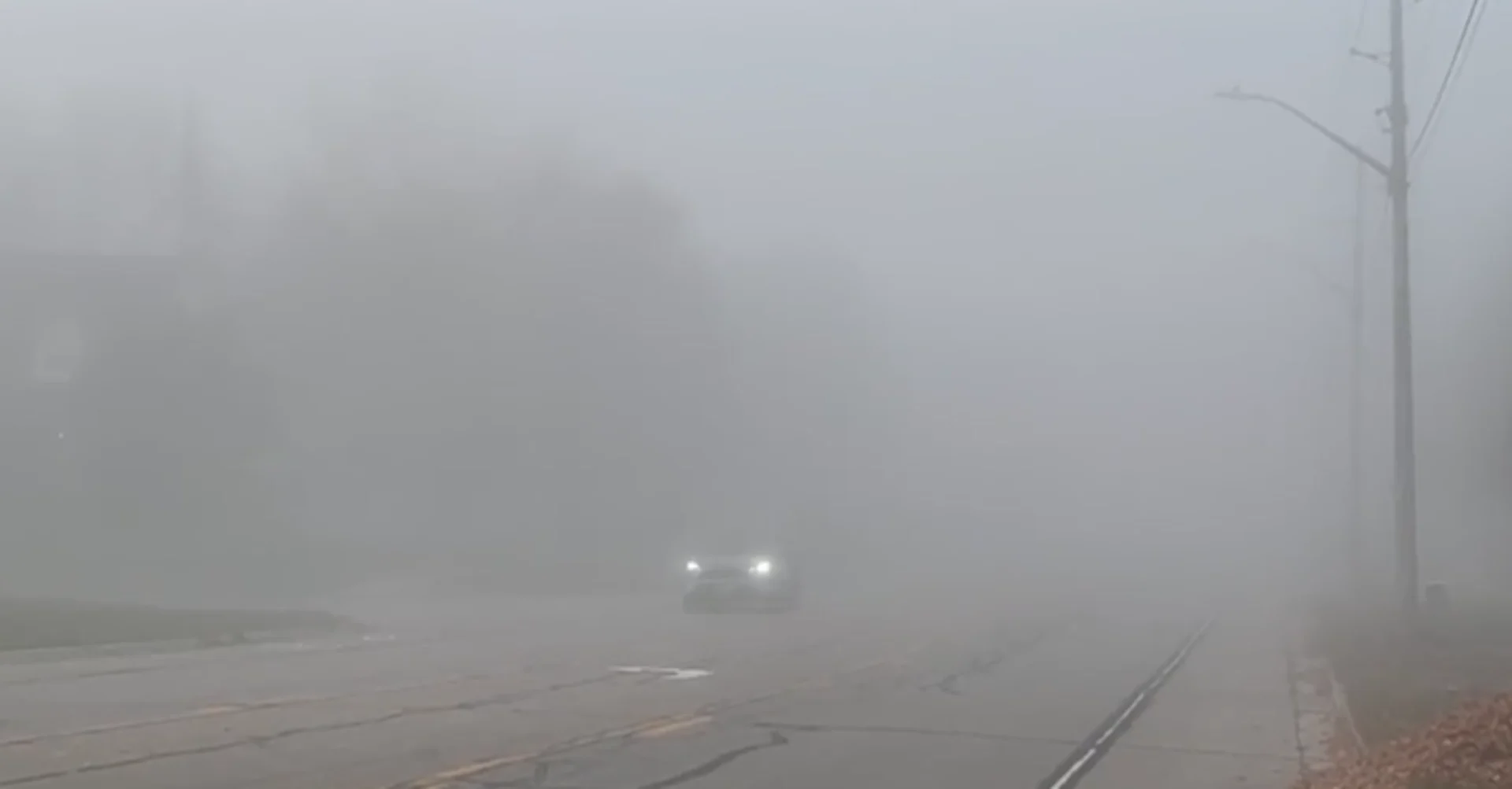
More dense fog on Friday impacts travel in southern Ontario

This first week of November has brought days of fog advisories across much of southern Ontario, with dense fog blanketing the region through the evening, overnight and early morning hours.
The advisories continue for Friday, warning drivers that visibility may be significantly and suddenly reduced to near zero.
"Travel is expected to be hazardous due to reduced visibility. If visibility is reduced while driving, slow down, watch for tail lights ahead and be prepared to stop," says Environment and Climate Change Canada (ECCC) in the advisory.
RELATED: It’s not your imagination—here’s why fall is the foggiest season
Fall really is the foggiest season of the year. We endure huge swings in daily conditions as summer fades to winter. These constant lurches from sultry to brisk make fog a fixture around this time of year.
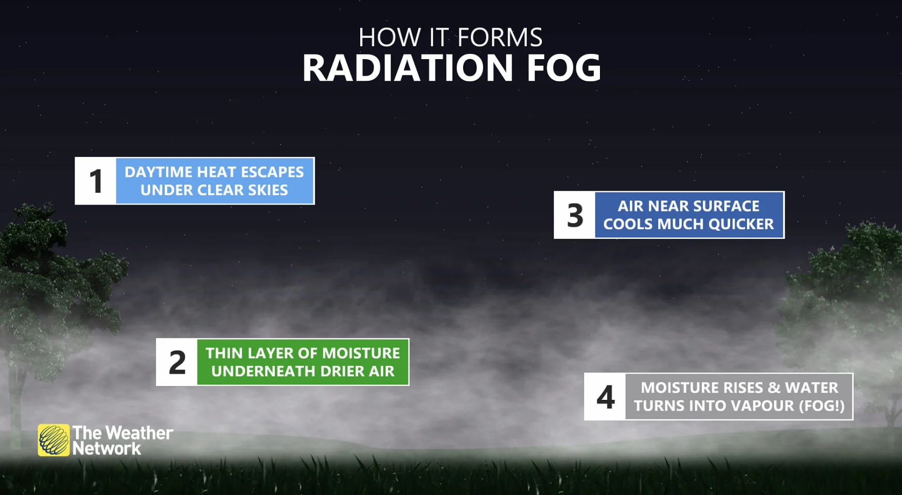
With the temperatures cooling through the overnight period this week in southern Ontario, combined with the relatively warm lakes, a lot of fog has developed in communities in close proximity to the lakeshores. This type of fog is known as radiation fog.
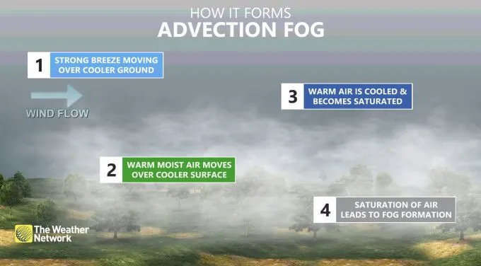
We also see advection fog all the time around the Greater Toronto Area (GTA) as warm air flows over the cooler waters of Lake Ontario.
The chilly waters cool the air immediately above the surface of the lake, bringing the air temperature down to its dew point, allowing a thick layer of fog to form near the lakeshore and roll inland.
Friday's dense fog is expected to last through the morning hours before dissipating by the afternoon.


