How Hurricane Delta may impact outdoor Thanksgiving in Ontario

Hurricane Delta's moisture looks to approach southern Ontario for the end of the long weekend, but though some showers are still possible, a more widespread Thanksgiving soaking looks less likely.
The Thanksgiving weekend will start out pleasantly mild, but it won't stay rosy throughout. An incoming cold front looks to bring a few showers Saturday and drop temperatures down somewhat into Sunday, while beyond, the remnants of Hurricane Delta, though not espected to be as impactful as some models were suggesting, will still make for a wetter holiday Monday than many would prefer. A closer look, below.
WEATHER HIGHLIGHTS
Daytime highs in the low 20s for many Saturday
Cold front may bring showers later Saturday, cooler temperatures Monday
Still uncertain forecast on Hurricane Delta's effects on the holiday Monday, but washout looks less likely
SATURDAY INTO SUNDAY: WARM AND SUNNY, COLD FRONT TO BRING SHOWERS
One thing that doesn't look to be in much dispute is the start to the long weekend. Province-wide, most of the province is looking at clear, or mostly-clear skies, for Saturday, with daytime highs around or even a bit above 20. Consider this the curtain call for any late summer weather.
A passing cold front may bring some showers behind it through the afternoon and evening -- along with a sharp temperature drop back down into the low-to-mid teens by Sunday, though offset somewhat by mostly sunny conditions.

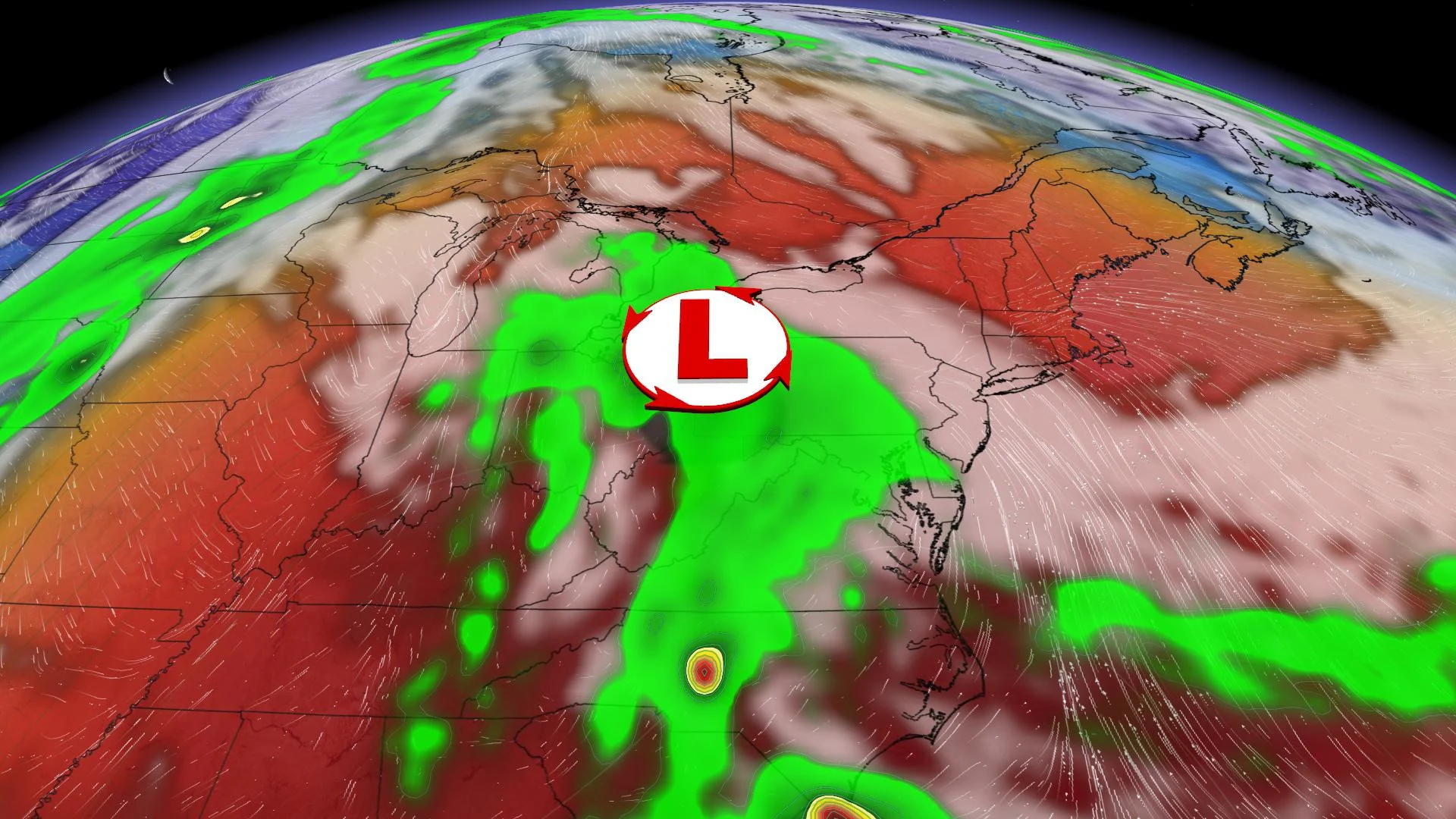
MONDAY: CLOSELY WATCHING THE REMNANTS OF DELTA
That's what we know about Saturday and Sunday -- Monday's forecast is slightly trickier, but it's now looking a little rosier, forecasters say.
Hurricane Delta, a powerful Category 2 storm that slammed Mexico and is now en route, to the U.S. Gulf Coast, looks set to take a track deep into the heart of North America later this week, or at least, its remnants will.
Though it will rapidly lose strength after its Gulf landfall, that's still a lot of moisture involved, and its path will take it north through the eastern U.S. and in the general direction of southern Ontario.
For a time, the forecast was uncertain, with some models having that moisture bringing showers for the southwest, while others kept it mostly south of the province -- a view which now looks more likely, though it will still be a gloomy day for many, and there's still a chance of some showers later in the day, though by no means a washout.
"We will have an increasing threat for showers during the afternoon and evening but it is still possible that the rain holds off until Monday night," Weather Network meteorologist Dr. Doug Gillham says.
More impactful will be a deepening trough that looks to bring more widespread rain to the province late Monday night into Tuesday to kick off the shortened work week.
Check back for updates as we continue to monitor the effects of Delta.