30+ cm of snow, heavy rain in parts of Ontario with intense system

Ontario is in for a stormy start to the week due to a potent Texas low tracking into the region. The first round of precipitation will come Monday morning as mostly rain before transitioning to snow across the southwest, areas north of the GTA, and cottage country. Winds also will be strong, with 70 km/h gusts for regions near Georgian Bay and Lake Huron. Another round of rain and snow moves in Tuesday morning. Some areas could see over 30 cm of snow and 30-50 mm of rain by the time the low pushes out Wednesday. Details and timing, below.
WEATHER HIGHLIGHTS:
Storm system moves in Monday morning bringing heavy rain, strong winds and snow for some
Cooler pattern beckons for early days of December
MONDAY: WIDESPREAD RAIN BEFORE TRANSITIONING TO SNOW
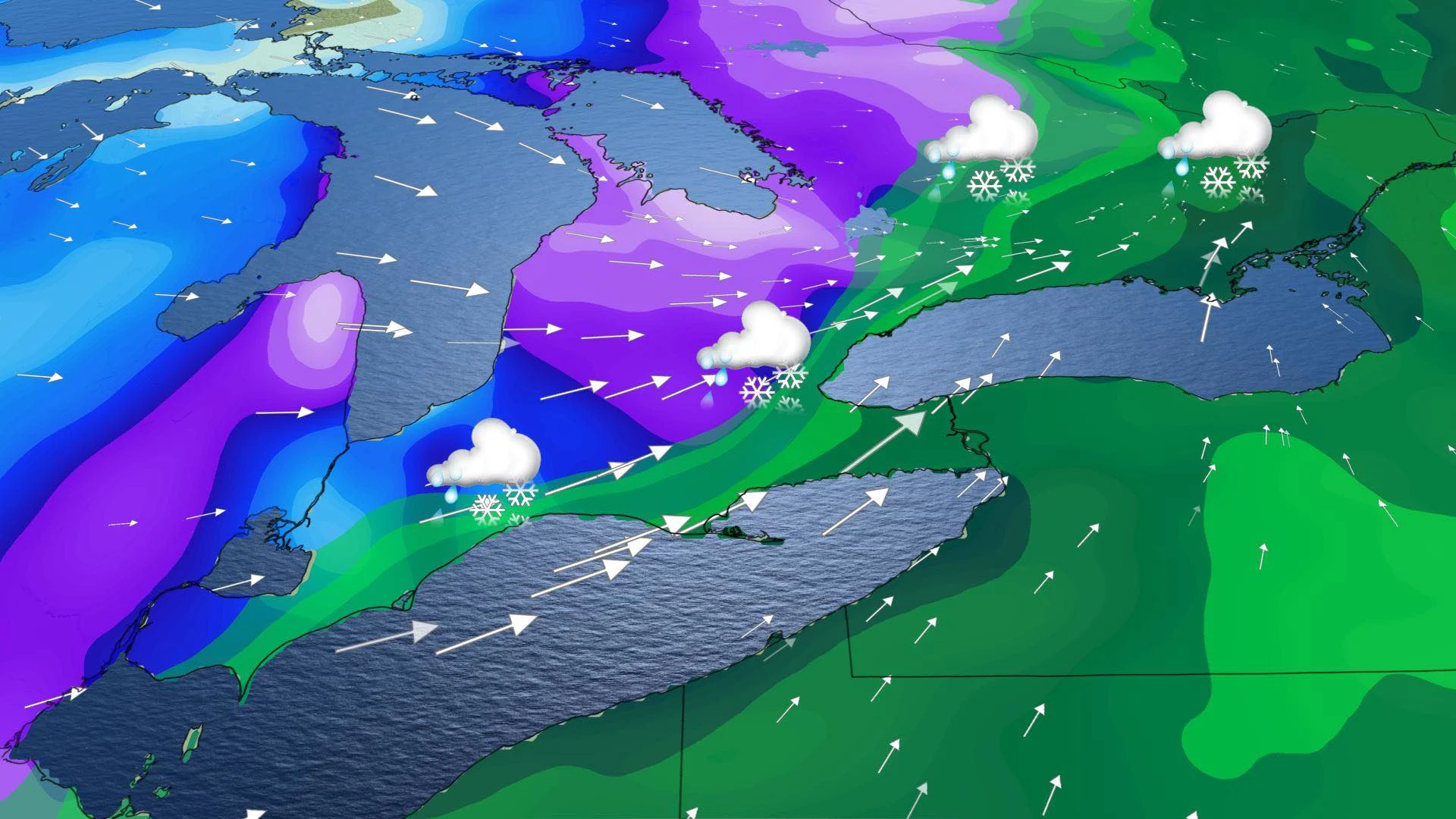
The first shot of stormy weather arrives on Monday morning courtesy of an intensifying low that developed in Texas, tapping into Gulf moisture as it strengthens. Environment Canada warns that “difficult travel conditions are expected as snow covered and icy roads are possible, particularly Monday night into Tuesday.”
WINTER FORECAST: On Monday, November 30 The Weather Network releases the official 2020/21 Winter Forecast. Tune in!
Most areas in the south will see precipitation start as rain, though there could be some mixing in some areas in the southwest, with moderate temperatures in place.
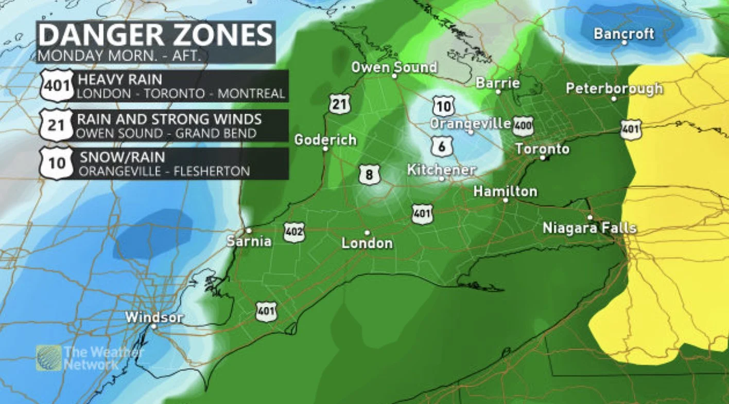
By the afternoon areas northwest of the GTA, southwestern Ontario, and cottage country will see a transition to snow. Precipitation will continue through the overnight hours.
Winds will also be blustery, with northwesterly winds gusting near 70 km/h Monday evening and Tuesday, particularly near Georgian Bay and Lake Huron.
TUESDAY: SECOND ROUND OF MESSY PRECIPITATION
Come Tuesday morning, the second push of energy from the storm will bring the dividing rain-snow line into the GTA, while eastern Ontario and Quebec remain as rain.
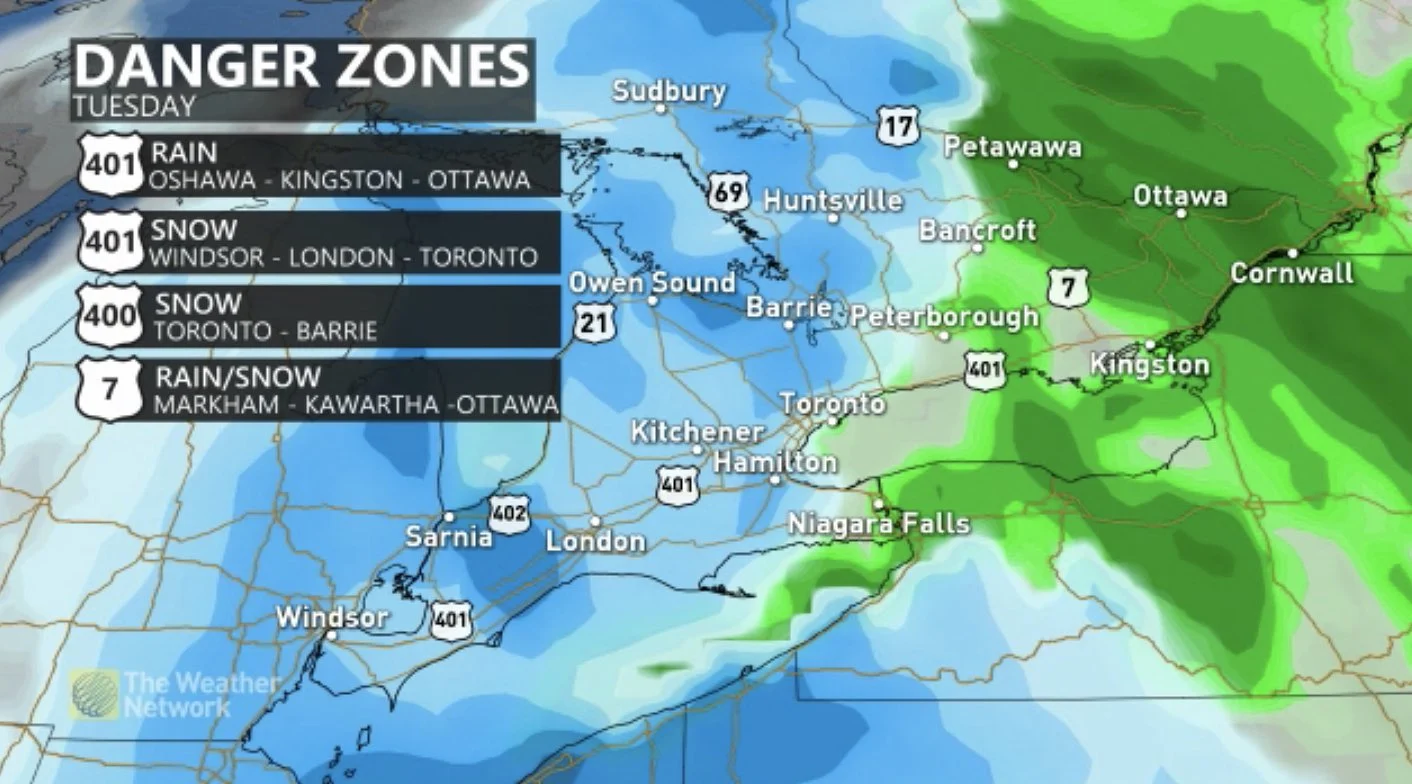
"Difficult travel conditions are expected as snow covered and icy roads are possible, particularly Monday night into Tuesday. Several transitions between rain and snow are possible throughout this event," Environment Canada warns in the special weather statement.
Snowfall and rainfall totals will vary across the province, depending on where you are on the dividing line of the precipitation.
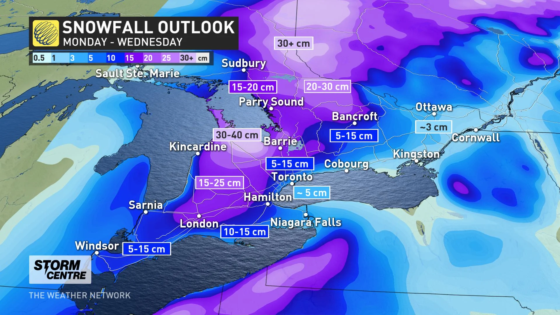
Areas near the southern tip of Georgian Bay could see over 30 cm of snow, the Algonquin Highlands could see 20-30 cm, and 15-25 cm of snowfall is expected for areas atop the escarpment and north of Highway 9.
Meanwhile, 5-10 cm is forecast in extreme southwestern Ontario, 10-15 cm between London and Hamilton, and 5-10 cm for most of the GTA. Less than 5 cm is expected for downtown Toronto.
As for rainfall, 20-30 mm is expected for the GTA, along the eastern shores of lakes Erie and Ontario, and up to 30-50 mm for eastern sections where precipitation over the duration of the multi-day event will stay as rain.
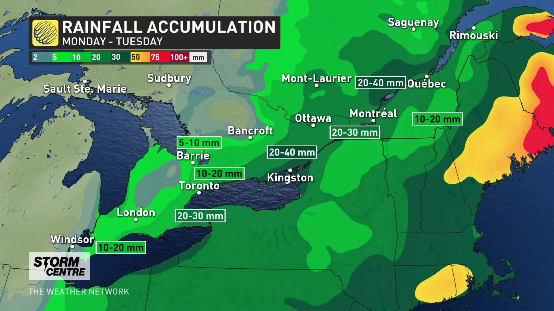
Precipitation associated with the low-pressure system is expected to move east of the province on Wednesday.
Beyond, as we move into the month of December, forecasters are also watching some preliminary signs that show a transition into a more "consistent" and "typical" early winter pattern by the second week of the month.
Be sure to check back as we continue to fine-tune this forecast and potential impactful systems that start out the month of December.


