Storm brings heavy snow for mountains, first measurable amounts for Calgary

Snowfall likely to impact travel across major roadways in southern Alberta on Friday.
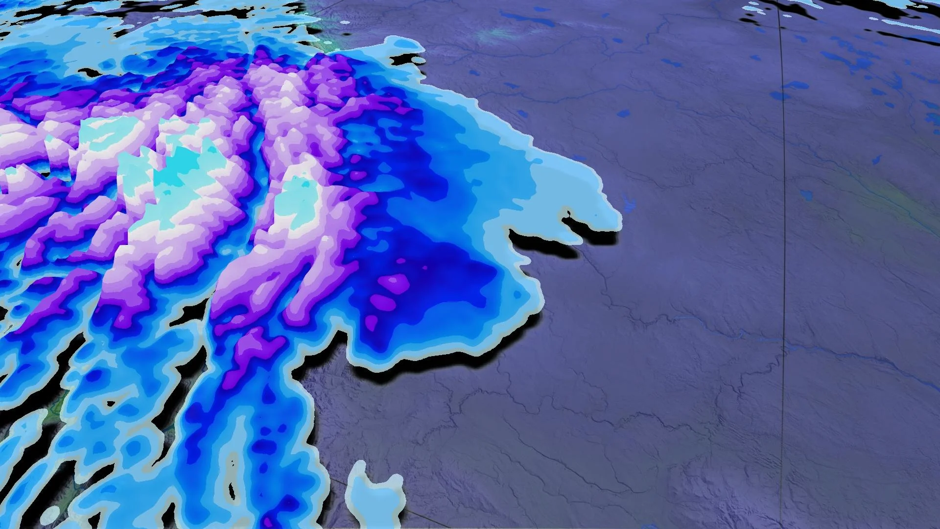
People across much of southern Alberta will be waking to ongoing snow Friday to see out the week – including Calgary. While the city may see a few centimetres, the real accumulations are in the foothills and mountains, where as much as 40 cm is possible by the time the snow finally exits the region Saturday morning. By the weekend, widespread cooler temperatures will span the Prairies, with daytime highs struggling to climb over the freezing mark. While not unusual for this time of year, this will be by far, the coldest weather of the season to date. More on the significant chill, plus a look at the tricky snow set-up through Friday, below.
INTO FRIDAY: SOME FIRST SNOWFALL ACCUMULATIONS OF THE SEASON FOR SOUTHERN ALBERTA
A stream of Pacific moisture is once again pointed at B.C., and while it manifested there as very heavy downpours, and snow at that province's higher elevations, there was plenty left over to spill across the Rockies into Alberta.
The first flakes already began at the highest elevations Thursday, and areas along and a little lower than the foothills, including Calgary, were set to see the snow fall through the night.
"Be prepared to adjust your driving with changing road conditions," says Environment and Climate Change Canada in a snowfall warning for high-elevation areas. "Visibility may be suddenly reduced at times in heavy snow. If visibility is reduced while driving, turn on your lights and maintain a safe following distance."

By early Friday morning, light snow will move further east, impacting areas along the QE2. While Calgary and parts of the QE2 have already reported some flakes this October, for some it may be the first measurable accumulations of the season, with around 5 cm expected with this system.
Widespread snow will be continuing for much southern Alberta as the system sinks south and a cooler northerly flow takes a firm grip on the province. There's a non-zero chance of rain showers for the most southerly areas, but those will soon transition to light snow by the evening.
WEEKEND: SIGNIFICANT COOL DOWN FOLLOWS THIS SNOW
The snow finally eases during the pre-dawn hours on Saturday, as high pressure moves back into the region and sweeps the skies clear.
Temperatures will fall significantly as we head into the weekend, with cities like Calgary and Edmonton even struggling to crack the freezing mark.
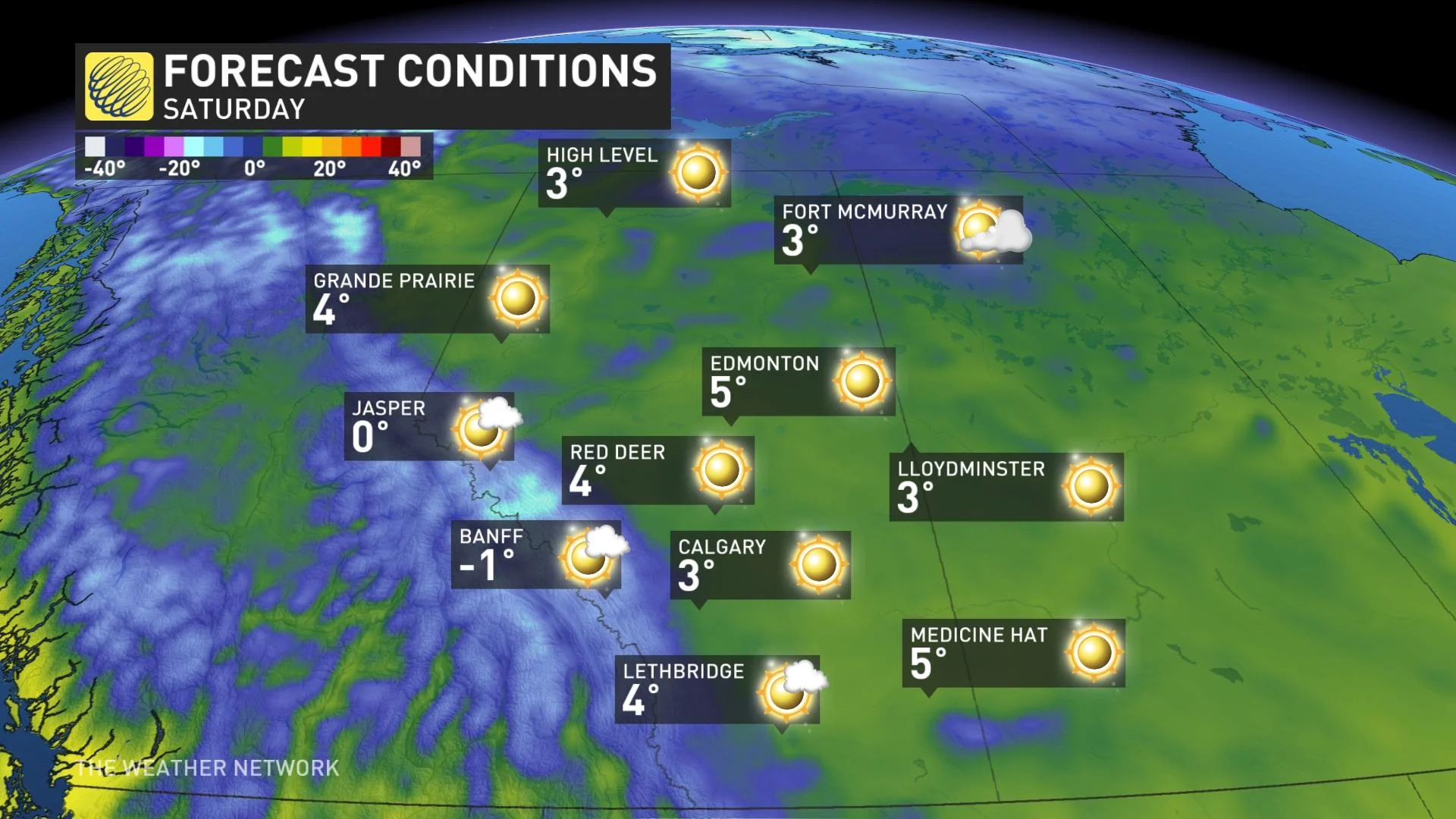
While not all that unusual for this time of year, this will definitely be the coldest weather of the season so far.
Be sure to check back for the latest updates on this snowy system for Alberta.