
Pattern change ahead, but there's a catch in Canada's warmth

Much of Canada is waiting for a big pattern change this month. We check in with Dr. Doug Gillham on how March is shaping up.
The March forecast featured a highly anticipated pattern change, and now, as the first few days of the month tick by, many Canadians are asking how much longer we have to wait for the warmth. The Weather Network's Dr. Doug Gillham takes us through a quick update, below.
Visit our Complete Guide to Spring 2019 for an in depth look at the Spring Forecast, tips to plan for it and much more
HOW IS THE 'FURIOUS FINISH TO WINTER' PLAYING OUT?
"The early March forecast is working out very well," says Gillham. "The map below shows temperature anomalies for March so far with colder than normal temperatures from coast to coast, and most places colder than seasonal even for January."
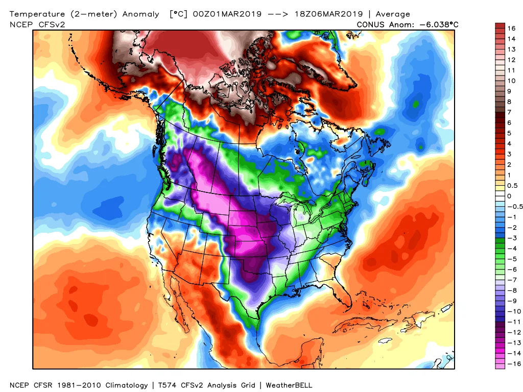
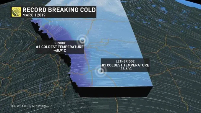
Numerous record cold temperatures were broken through the Prairies early this week, with all-time cold records for March falling in parts of southern Alberta.
There's good news if you're ready for milder weather -- but don't put away the warmer clothing just yet.
"This pattern starts to relax over the next 5 days," says Gillham, "but temperatures remain colder than normal for much of Canada. The map below is a model forecast of the temperature anomaly for the next 5 days."
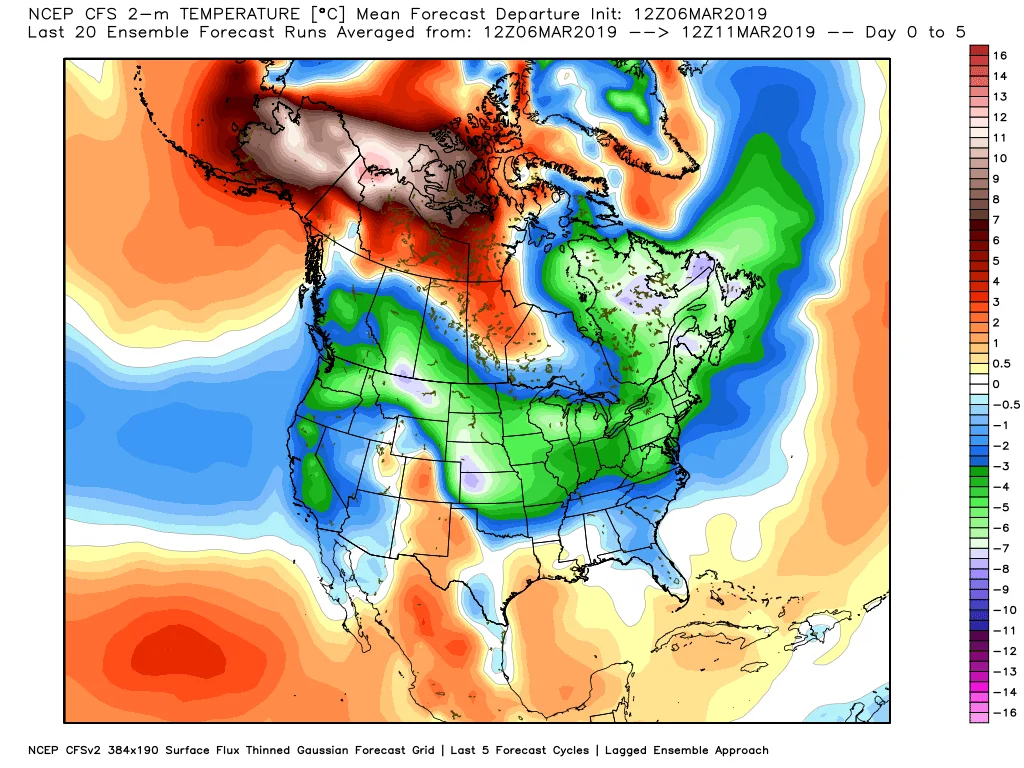
That said, the deep purples and pinks -- indicating temperatures well below average for the time of year -- that appear on the previous map are absent here. A step in the right direction!
PATTERN CHANGE AHEAD -- WITH A CATCH
Here's the moment we've all be waiting for, however: the long-anticipated pattern change. Gillham says it's on the way, and will bring milder temperatures to most of Canada after March 10th.
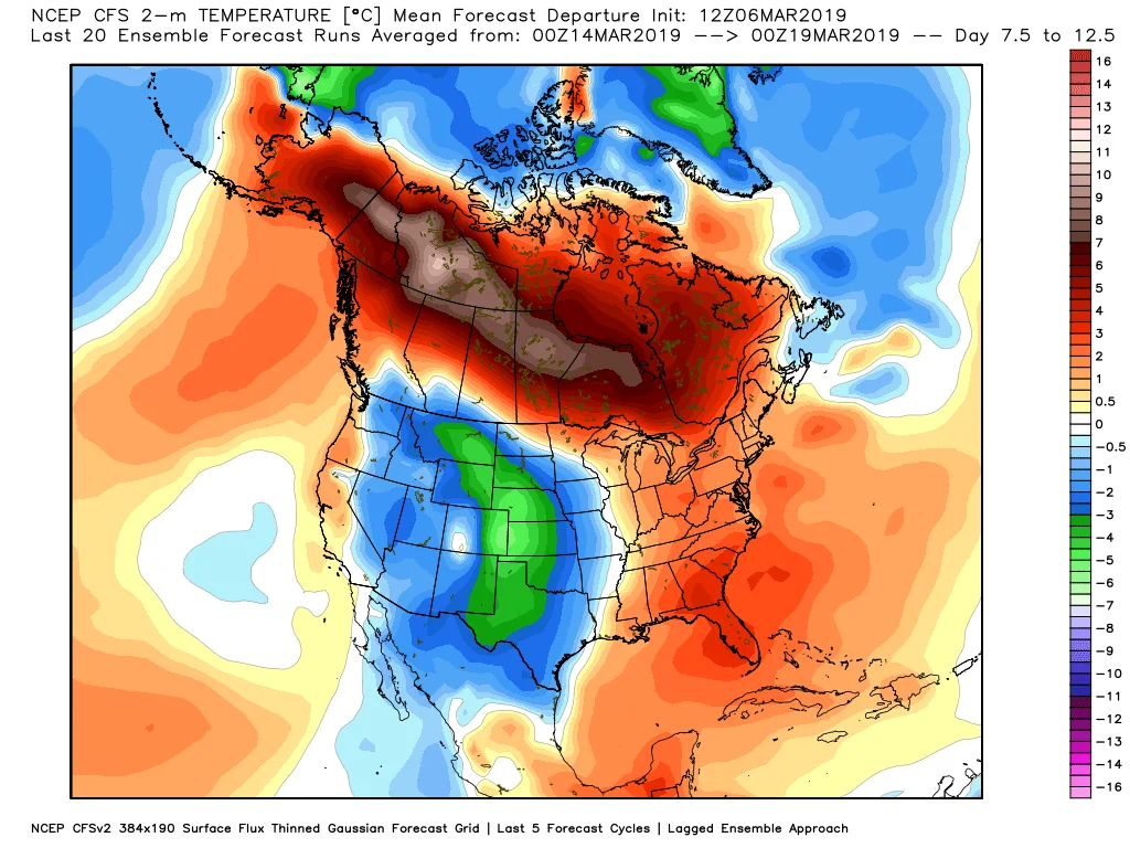
"The warmest 5-day period for Canada as a whole looks to be March 13 to 18th -- shown below with almost a coast to coast mild pattern," says Gillham.
But it's not all smooth sailing into spring from there, unfortunately, as something of a snag has appeared on the long range maps.
"We expect a substantial interruption to the milder pattern for the eastern half of Canada," Gillham explains, citing the anticipated behaviour of one of the main drivers for large-scale weather patterns around the workd -- the Madden-Julian Oscillation (MJO). This cyclical pattern moves through the atmosphere over the Indian and Pacific oceans, and has an impact on our weather here in North America by interacting with features like ENSO. Its behaviour is a key factor in deciphering the very long range and seasonal patterns expected around the world.
Unfortunately for those in eastern Canada, the MJO isn't cooperating this time. Instead of progressing through its typical cycle, it is going to put on the brakes and actually go into reverse. This will bring the dip in the jet stream back into the Great Lakes region and bring a significant interruption to the milder pattern from the Great Lakes to the Maritimes.
"The map below is a temperature anomaly forecast for the first 5 official days of spring. Note, this will still be much milder than how we started the month, but much colder than what we expected for this time period."
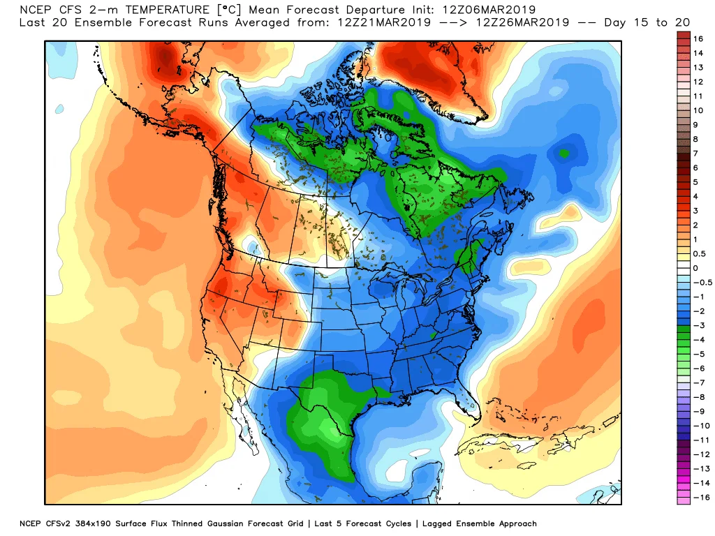
"While colder than seasonal temperatures could hold on beyond this time period, the signals for warmth in April are stronger," says Gillham.
There is a bit of a silver lining, even if the temperatures may not be as warm as some have hoped.
"While most residents of southern Ontario and southern Quebec will not be thrilled with this colder pattern, there may be some positive news here for reducing flood concerns," says Gillham, adding that the pattern is favourable for a slower spring melt in areas that currently have a very deep snowpack. "Temperatures that are above freezing during the day but below freezing at night would alleviate concerns of a sudden melt -- unless the melt is so slow that there is still a lot of snow left as we head into April."
Images courtesy WeatherBell.