Storm eyes Newfoundland next as wintry impacts linger in the Maritimes

A powerful storm that left its mark on the Maritimes will leave lingering impacts on the region into Wednesday as it prepares to march through Newfoundland.
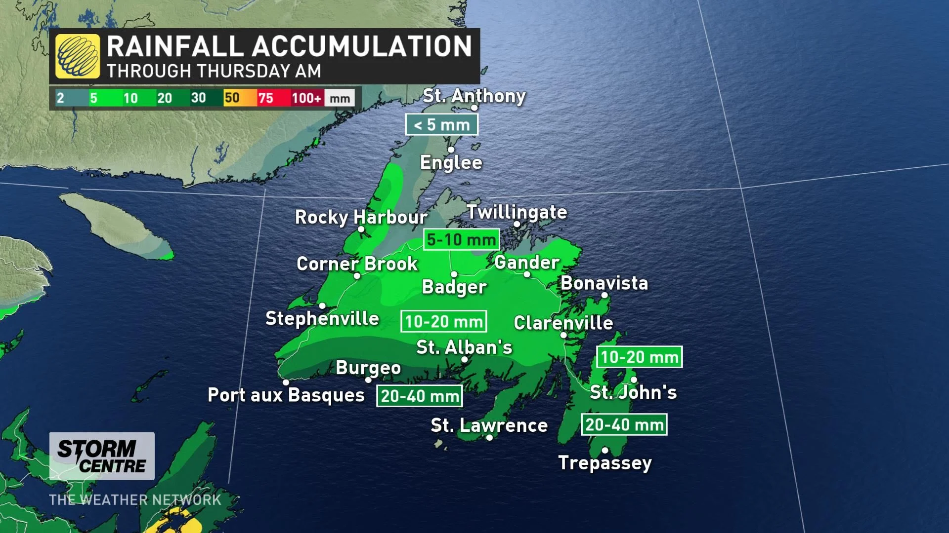
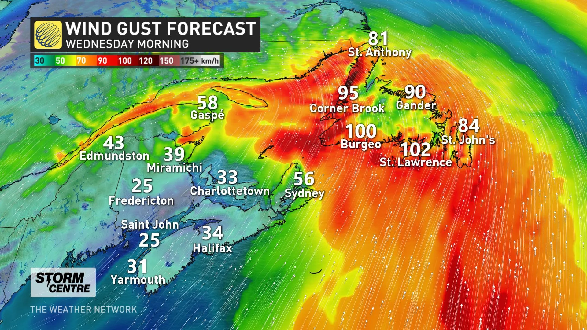
A wintry mix of precipitation made quite the mess Tuesday across the Maritimes, thanks to a potent East Coast storm that powered through. Schools were closed in the Maritimes, power was knocked out to thousands in Nova Scotia and roads were in poor shape across all the provinces. Wintry effects from the storm will continue to impact the Maritimes into Wednesday morning before winding down in the afternoon, as Newfoundland will bear the brunt of the system through the day. Snowfall amounts may hit 20-30 cm in parts of Newfoundland, while some could see 20-40 mm of rainfall through Thursday. Winds will also be blustery, with western coastal sections expected to see gusts of 120-140 km/h. Les Suêtes region will also see powerful winds, with gusts up to 170 km/h before diminishing Wednesday morning. More details on what is left of the storm in the Maritimes and what's ahead in Newfoundland, below.
WEATHER HIGHLIGHTS:
Rain, snow, freezing rain, ice pellets linger in Maritimes into Wednesday morning
Winter storm moves into Newfoundland Wednesday
Threat for localized flooding with heavy rain expected along the Atlantic coast of Nova Scotia
THROUGH WEDNESDAY: WINTRY MIX LINGERS IN THE MARITIMES
Winter storm, snowfall, rainfall, and wind warnings, as well as special weather statements, remain in place across Atlantic Canada. They are expected to drop in the Maritimes Wednesday as the system continues moving into Newfoundland.
Heavy rain will continue in Nova Scotia through the morning hours before easing off and departing Wednesday afternoon. When all is said and done, up to 75 mm of rain could accumulate along the Atlantic coast, which keeps localized flooding and water pooling on the roads a concern even after the rain ends.

Meanwhile, snow will have moved out of northern New Brunswick by Wednesday morning, but ice pellets, showers and possible freezing rain will persist and will tapering off in the afternoon.
20-40 cm of snow could accumulate in parts of the far northern region before it diminishes, and in Cape Breton. The bulk of the Maritimes may have seen 10-20+ cm of snow before the switch to rain, but any accruing snowpack will melt as a result.
MUST SEE: Winter will attempt to make up for lost time during February across Canada
Temperatures will then jump to nearly 10°C for the southern shores of Nova Scotia by the pre-dawn hours Wednesday morning.
Winds will also remain intense for parts of the coastal sections of Nova Scotia. The Les Suêtes region will see gusts increasing to 170 km/h in the overnight hours, subsiding early Wednesday morning.
POTENT STORM MOVES INTO NEWFOUNDLAND
The storm will continue to push snow into Newfoundland through the overnight hours, with some ice pellets and freezing rain for southwestern coastal sections. By Wednesday morning, the ice pellets and freezing rain will reach the Avalon.
Temperatures will rise in the afternoon, resulting in a changeover to rain across Newfoundland for the remainder of the storm’s duration. Rain will begin to taper in the evening hours Wednesday.
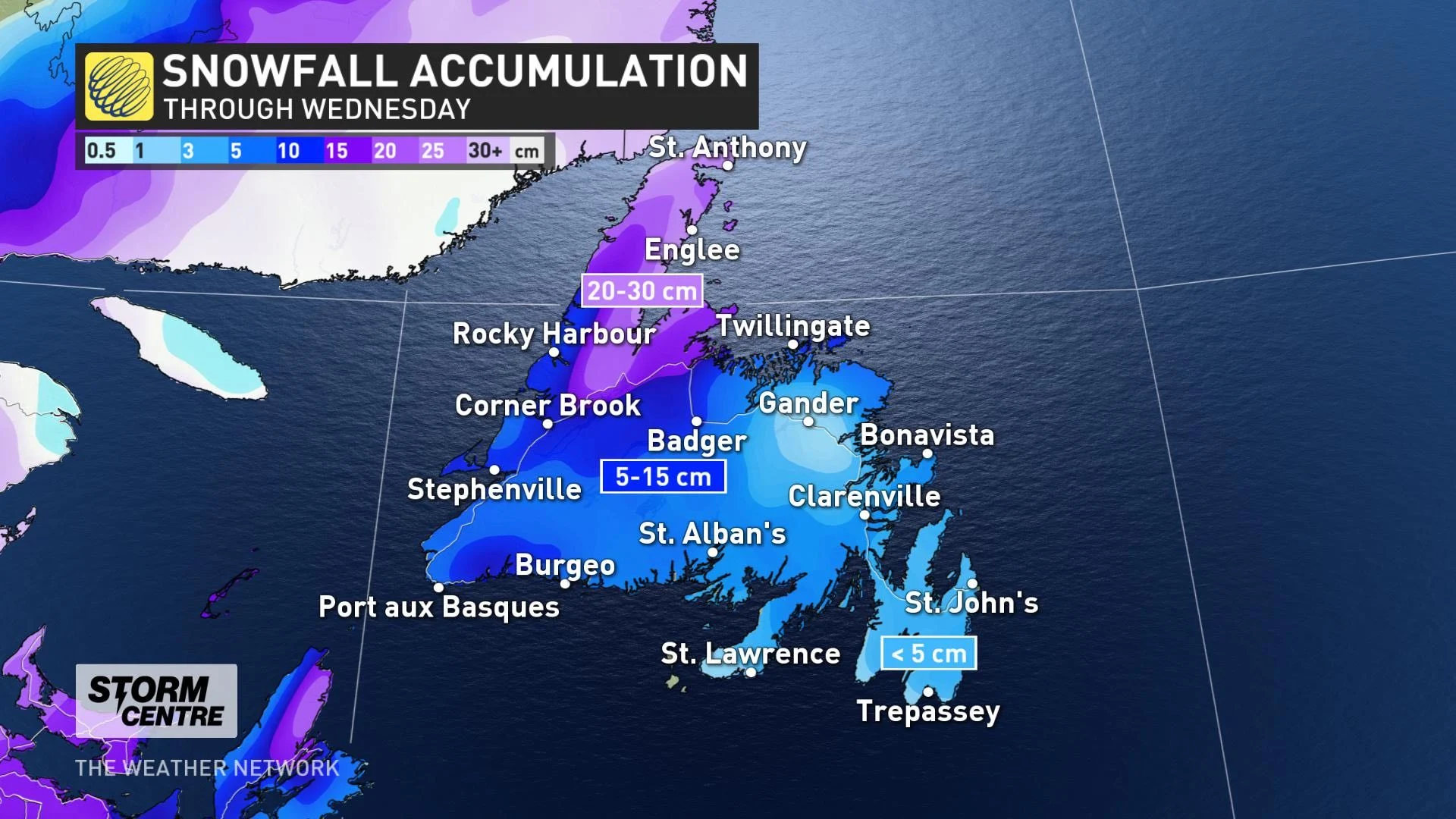
Snowfall amounts for Newfoundland will vary, with 20-30 cm expected for the northern coast, 5-15 cm for the southwestern coast and central inland areas, and less than 5 cm is anticipated for the Avalon.
Rainfall totals through Thursday will be heaviest along the southern coastal areas of the island, with 20-40 mm expected. Amounts decrease as you head further inland, with 10-20 mm expected for St. John's.
Winds will also be intense for Newfoundland, picking up through the overnight hours and continuing into Wednesday, especially in areas prone to enhanced easterly winds. Southeasterly gusts of 80-100+ km/h will develop, but western coastal sections are expected to see easterly gusts of 120-140 km/h. Winds will diminish Wednesday evening.
WATCH: RAIN ADDING WEIGHT TO SNOW, MAKING FOR TREACHEROUS DRIVING CONDITIONS
Beyond the storm, temperatures will turn briefly colder but still seasonal, before they become much milder ahead of the next system that will push through for the weekend.
Be sure to check back as we continue to monitor the track of this strong winter storm for Atlantic Canada.
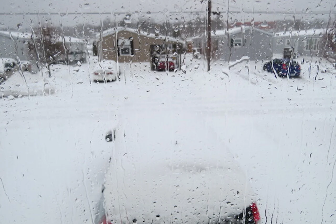
Thumbnail image courtesy: Frank Bailey, taken in Bridgewater, N.S.