
Winter storm will bring 20-40 cm of snow to parts of Ontario on Monday

A substantial and impactful winter storm will bring widespread heavy snow to southern and eastern Ontario on Monday, with hefty totals also creeping into the Greater Toronto Area (GTA).
Snowfall that began on Sunday evening will continue into Monday morning, threatening the morning rush-hour commute with rapid and heavy accumulations. Travel will likely remain hazardous, if not impossible, through the afternoon with disruptions to major roadways. Avoid non-essential travel if possible. The hardest-hit areas, including Niagara and Hamilton regions, as well as southeastern Ontario, could see 20-40+ cm of snow. Details and timing, below.
MONDAY: EXPECT MAJOR TRAVEL IMPACTS
A low-pressure system that is tracking south of the Great Lakes will bring significant snowfall to Ontario on Monday. Winter storm and snowfall warnings, as well as special weather statements, are in effect.
DON’T MISS: Why those wild weather maps you see on social media are probably bogus
Heavy snow will fall through Monday morning over parts of southern and eastern Ontario. Blowing snow and reduced visibility on the roads is expected on Monday morning, likely persisting into the afternoon.

The snow will quickly cover the freezing roadways, making for treacherous travel conditions throughout the Golden Horseshoe in time for the morning commute. Motorists should prepare for significant disruptions on the QEW, Highway 427 and 401, and the Don Valley Parkway, in particular.
TIMING THE SNOWFALL ACROSS SOUTHERN ONTARIO:
Environment and Climate Change Canada (ECCC) says there may be a significant impact on rush-hour traffic in urban areas.
"Consider postponing non-essential travel until conditions improve. Surfaces such as highways, roads, walkways and parking lots may become difficult to navigate due to accumulating snow. Visibility may be suddenly reduced at times in heavy snow," says ECCC in the winter storm warning.

The hardest-hit areas include the Niagara and Hamilton regions, as well as southeastern Ontario, where 20-40+ cm is possible. Accumulations will drop off in areas northwest of the GTA, with 15-25 cm anticipated for the GTA.
Ottawa, where over 30 cm could fall, is also seeing the potential for significant snow and Monday could be in the top five snowiest days for the Ottawa airport. To have the snowiest January day on record, 39 cm would have to fall, beating the record set on January 30th, 1966 (38.6 cm).

The good news is that this will be a quick-moving system, easing by Monday evening from west to east. However, impressive snowfall rates (peaking at 2-5 cm per hour) will afford the storm the potential to drop significant amounts of snow in a short period of time, meaning snow removal will struggle to keep up.
Behind the system, weak lake-effect snow will set up across the traditional snowbelt regions Monday overnight into Tuesday morning.
TUESDAY AND BEYOND: THE WINTRY PATTERN CONTINUES
The rest of next week looks rather wintry with temperatures near seasonal or on the cold side of seasonal.
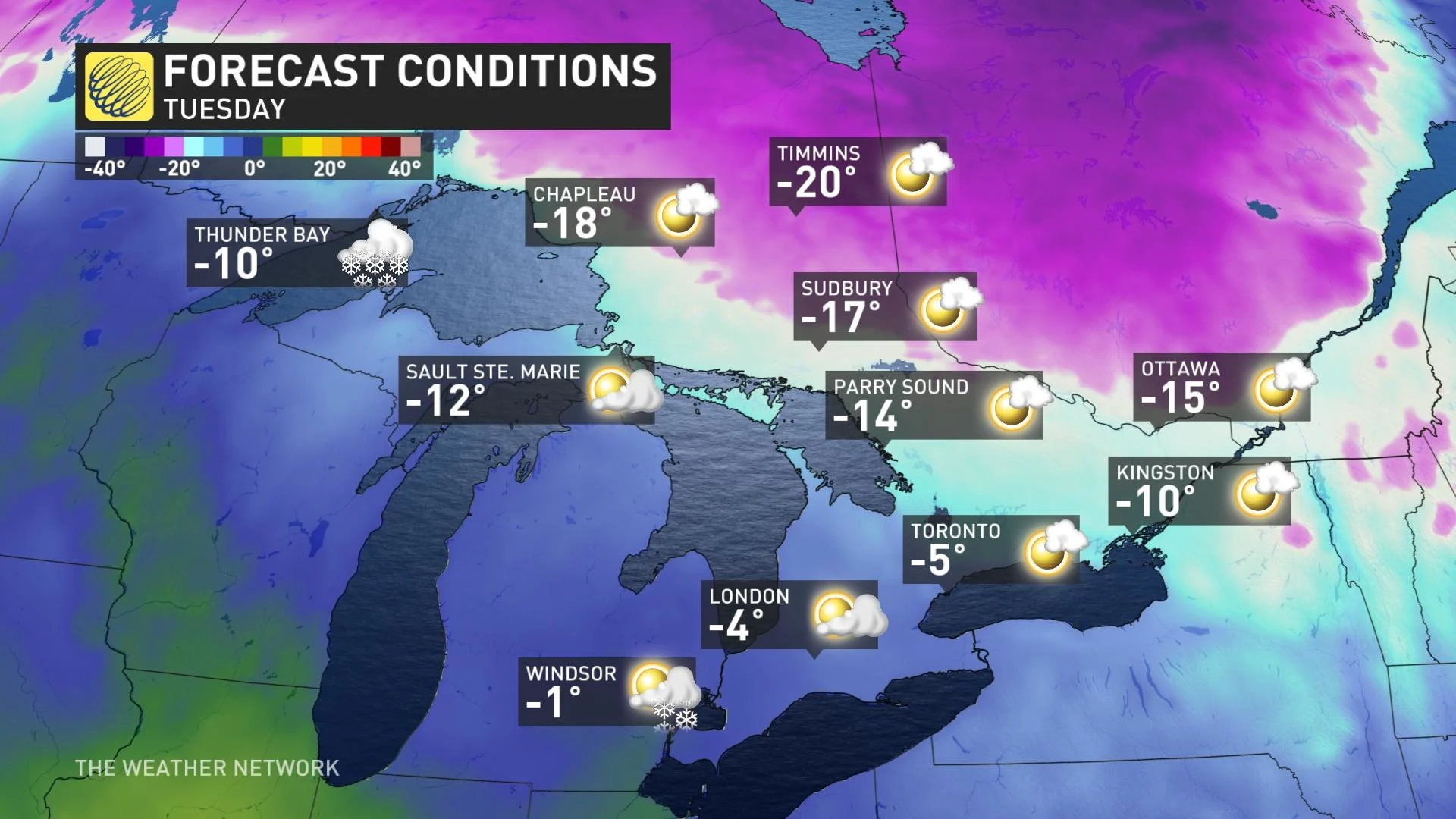
A clipper is expected Tuesday night and into Wednesday, followed by another shot of Arctic air for Thursday and Friday. This wintry pattern is expected to continue through the final week of January with a couple more blasts of frigid weather.
Stay tuned to The Weather Network for the latest forecast for Ontario.