
Messy start to the week in Ontario with wet snow, up to 10 cm with squalls

A Colorado low will bring widespread snowy impacts to southern Ontario throughout Monday morning and could complicate travel in some areas. Relatively mild air is tracking into the region, which means that a mix of snow and rain is possible at times along the Great Lakes. Snowfall amounts will range from 5-10 cm for inland regions, but pockets of totals exceeding 10 cm are certainly not out of the question. More on what we expect from this system, and what's beyond, below.
WEATHER HIGHLIGHTS:
Snow reaches GTA pre-dawn hours Monday morning, up to 10 cm of snow expected for some
Milder temperatures forecast Monday, rising above freezing across the region, could lead to rain-snow mix along lake shores
Unsettled weather continues beyond Monday
MONDAY: COLORADO LOW BRINGS LATEST ROUND OF SNOW
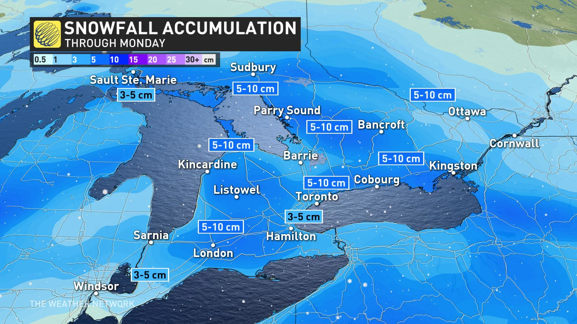
The latest round of snow starts in southwestern regions and then reaches the GTA during the pre-dawn hours on Monday morning. Snowfall will continue across much of the south through the morning hours.
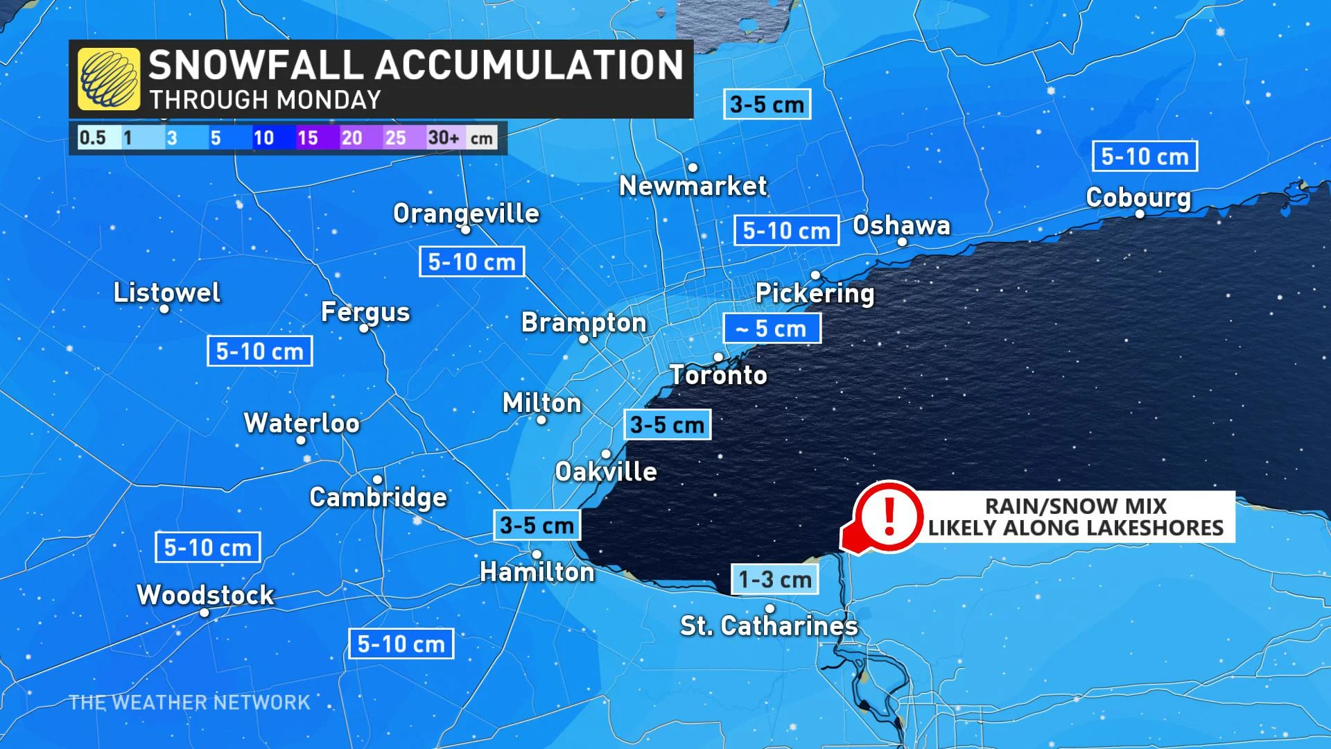
Approximately 3-5 cm is expected for areas along the lakes, but not all of the snow is expected to stick. Between 5-10 cm is expected for inland areas across a swath of southern, central and eastern Ontario, but pockets of 10 cm are possible—especially over high terrain and along the escarpment.
This particular Colorado low is expected to take a slightly more northerly track, which means there will be more milder air to play with, certainly heading into Monday afternoon. The track will allow for southerly flow to enter portions of southern Ontario and will send daytime highs a few degrees above the freezing mark.
The warmer temperatures Monday afternoon, with south-southwesterly winds developing, could yield a rain/snow mix at times for areas along the lake shores, where daytime highs will be mildest.
Snow will subside from west to east early Monday evening. It will continue for the Ottawa region into early Tuesday morning.
LOOK AHEAD: REMAINING UNSETTLED WITH MULTIPLE SYSTEMS, MILDER TEMPERATURES
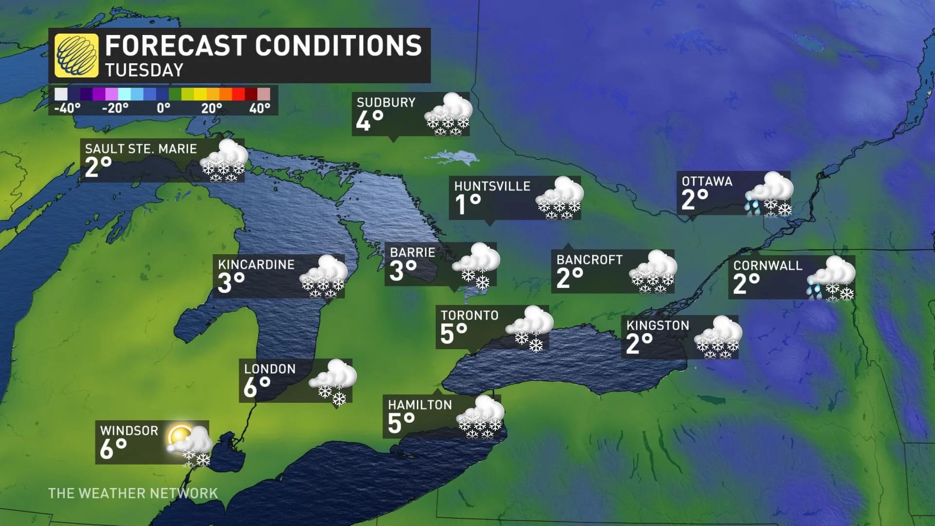
Conditions are expected to remain unsettled beyond Monday, with a clipper tracking across the region on Tuesday with several centimetres of snow and a rain/snow mix for parts of southern Ontario. Another weak system is possible on Wednesday.
Much milder weather will dominate, but temperatures will be a few degrees cooler, or near or a couple degrees below seasonal, late in the week. Milder again for next weekend but there is a potential for a significant system later in the weekend or early the following week.
Be sure to check back for the latest updates on the weekend system that threatens Ontario.


