Remnants of Hurricane Laura fuel East Coast deluges

A direct impact from Laura's remnants isn't in the cards, but it still is having an indirect effect on the Atlantic region.
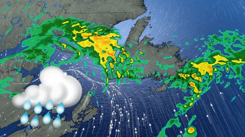
The remnants of Hurricane Laura won't impact the East Coast directly, but their abundant moisture is fuelling downpours there, particularly in Newfoundland Sunday through Monday. As well, strong winds may reach damaging levels, and have already brought elevated storm surge to parts of Nova Scotia, with Newfoundland next. A more detailed look, below.
WEATHER HIGHLIGHTS
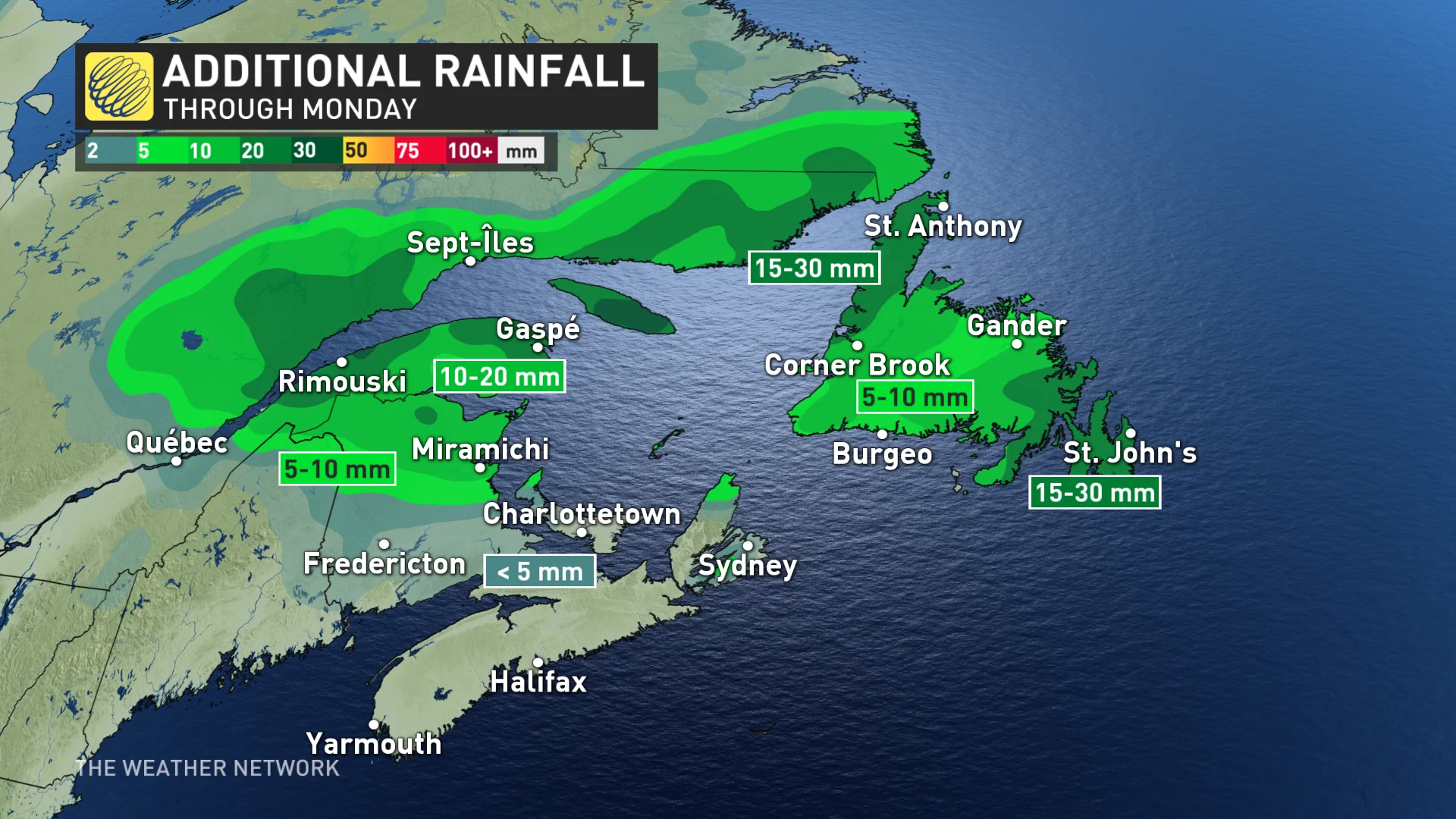
Rain for most of the region, heaviest in Newfoundland, 30-50 mm possible.
Laura to restrengthen next week, but remain south of the region
Cooler temperatures in the region to start the week
Keep on top of weather ALERTS in your area.
SUNDAY: SUNDAY: DELUGES AND STRONG WINDS
A system moving through the region has plenty of downpours to bring Sunday, boosted as it is by the moisture-laden remnants of former Hurricane Laura.
Clearer skies return first to the Maritimes, while the rain continues through much of Sunday into Monday for Newfoundland. The former will see mostly moderate amounts, but the latter is set for more significant rainfall totals, particularly the Avalon and Burin peninsulas, where 30-50 mm is possible over the course of the entire event, heaviest Sunday morning.
There will be some chance of thunderstorms as the system passes in both the Maritimes and the island, though any that do spark look to remain non-severe.
The storm’s strong winds will also be an issue, gusting as high as 100 km/h on the Avalon and significant elsewhere. Aside from potential damage to structures, it’s also bringing strong storm surge, some 3-4 metres above normal in Nova Scotia in the early morning hours of Sunday and peaking in Newfoundland later in the day.
NEXT WEEK: COOL TEMPERATURES TO START, MORE UNSETTLED WEATHER POSSIBLE
Beyond, the rain clears out of Newfoundland Monday and temperatures will remain relatively cool across the region for the early part of the week, though not far off from seasonal in Newfoundland.
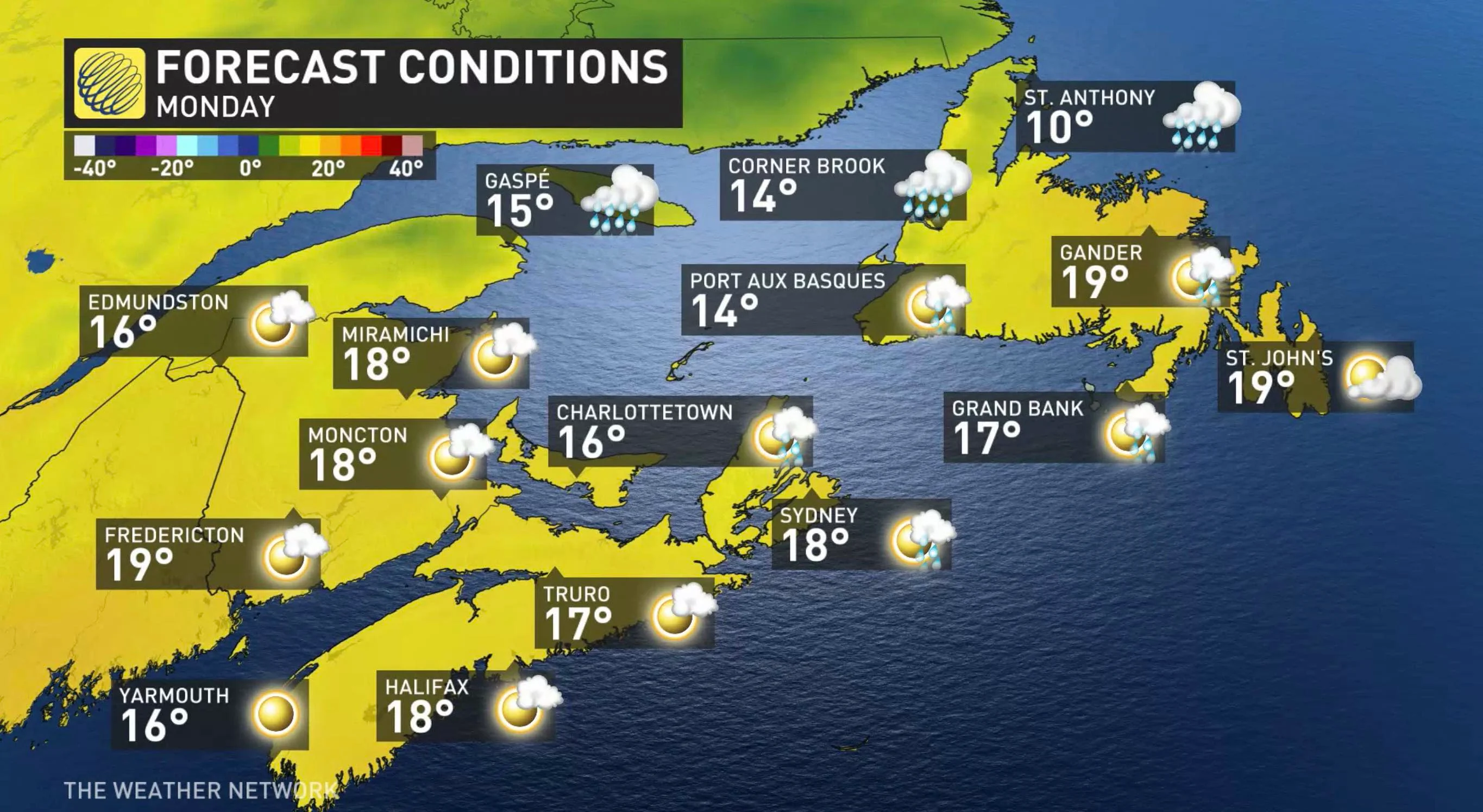
A warming trend beckons for mid or late week, with near or above seasonal temperatures heading into the long weekend.
Meanwhile, multiple systems could bring unsettled weather to the region late next week with near-seasonal or slightly above seasonal temperatures.
Check back for updates as we continue to monitor the forecast.