Late week snowstorm threatens 20+ cm over parts of northern Ontario

A Colorado low will bring a snowstorm to a large part of northern Ontario late Thursday night through Saturday.
Forecasters are closely watching a late week system -- one that threatens heavy snow, freezing rain and ice pellets over a large section of northern Ontario. This potent wintry mix will have a major impact on travel across the region, so drivers are being urged to plan accordingly for the poor conditions ahead. Behind the system, colder than seasonal temperatures will dominate the next couple of weeks as we slowly slide into the official start of winter. More on the timing and impacts expected, plus a look at the major pattern change coming to southern Ontario as well, below.
MUST SEE: A snowstorm and tropical system set to collide over Eastern Canada
Thursday night through Saturday: Potent winter-like storm takes aim
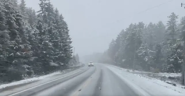
Although parts of northern Ontario have already seen early tastes of winter-like weather so far this season, an incoming system is set to bring more widespread wintry impacts to the region starting Thursday night.
A Colorado low is set to develop late Wednesday night, making its way towards Lake Superior. Rain will begin over northern Ontario, before transitioning into snow and mixed precipitation as temperatures fall.
A swath of very heavy snow is forecast to fall from northwestern Ontario, through the northeast and into western Quebec as the weekend begins.
Between 20-30+ cm of snow is possible in the heaviest band for areas west and north of Lake Superior, including Thunder Bay and an extensive stretch of the Trans-Canada Highway. This will without a doubt have a major impact on travel across the region.
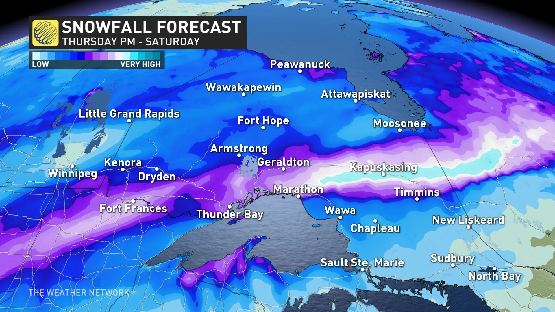
Extensive blowing and drifting snow are also likely with the windy conditions that accompany the system.
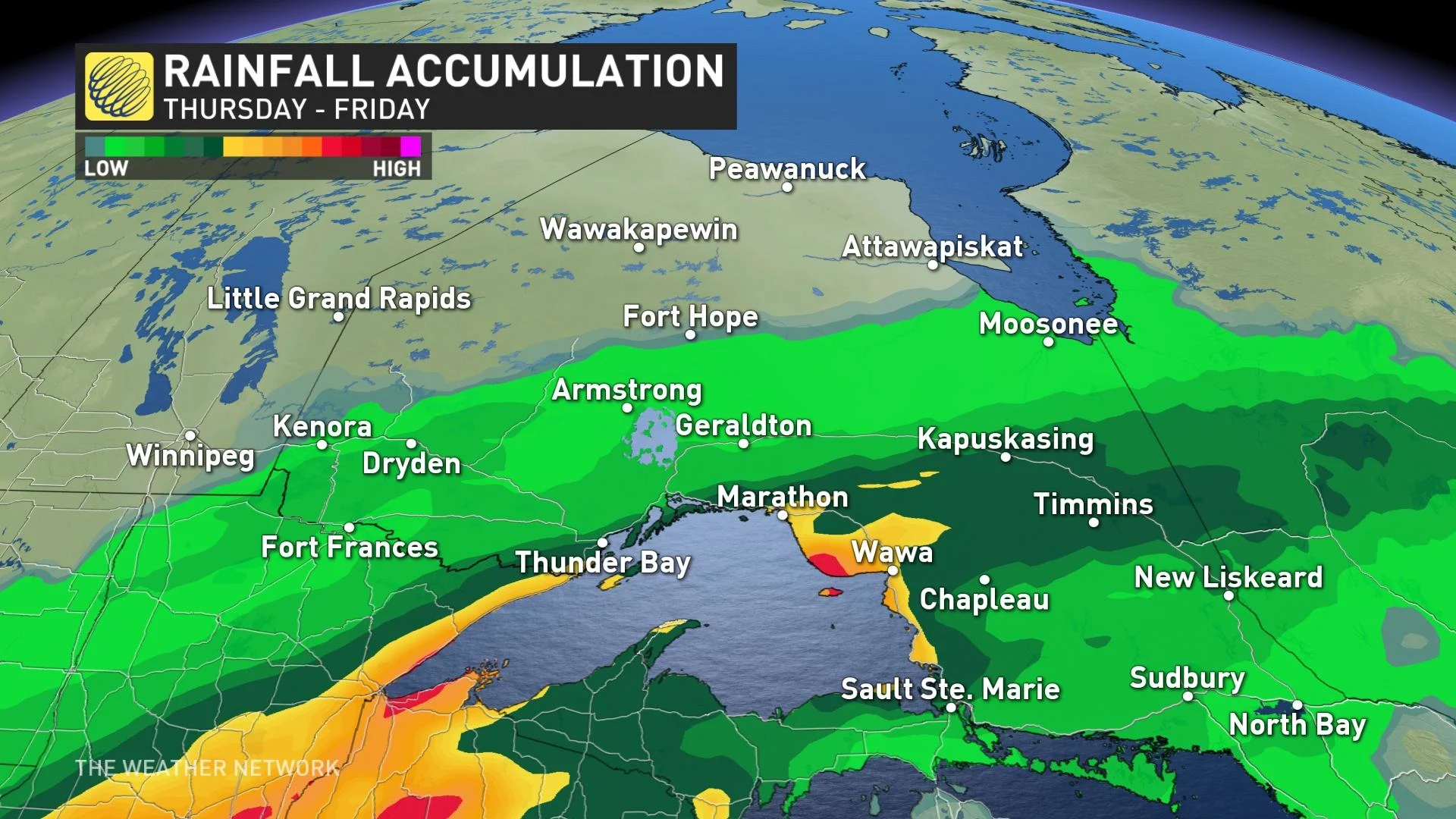
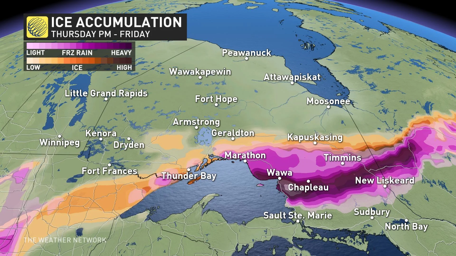
Along the warm front, there is the risk for an extensive swath of freezing rain and ice pellets, which will cause icy conditions northeast and east of Lake Superior. Before the freezing rain starts there is the chance for upwards to 50 mm of rain for the eastern shores of Lake Superior.
Additional snow showers are expected into early next week as colder than seasonal temperatures are set to dominate through the end of November.
Major pattern change expected across southern Ontario this weekend
The warming trend across the south will continue to bring daytime highs into the mid to upper teens across much of southern Ontario through Friday, but with a major pattern change expected to begin this weekend.
"We will be closely watch the track of Nicole, a subtropical storm in the Atlantic, later this week, as subtropical moisture will surge north ahead of a strong cold front as it tracks across southern Ontario late Friday night and Saturday," says Dr. Doug Gillham, a meteorologist at The Weather Network. "Heavy rain is possible for parts of the region, especially eastern Ontario and into southern Quebec."
Conditions will also turn blustery and much colder behind the front.
Widespread colder than seasonal temperatures are expected to dominate next week and beyond and this will likely bring significant lake-effect snow to the traditional snow belt areas east of the Great Lakes.
SEE ALSO: Nicole gaining power as it puts Bahamas and U.S. in its crosshairs
Be sure to check back for the latest weather updates across Ontario.