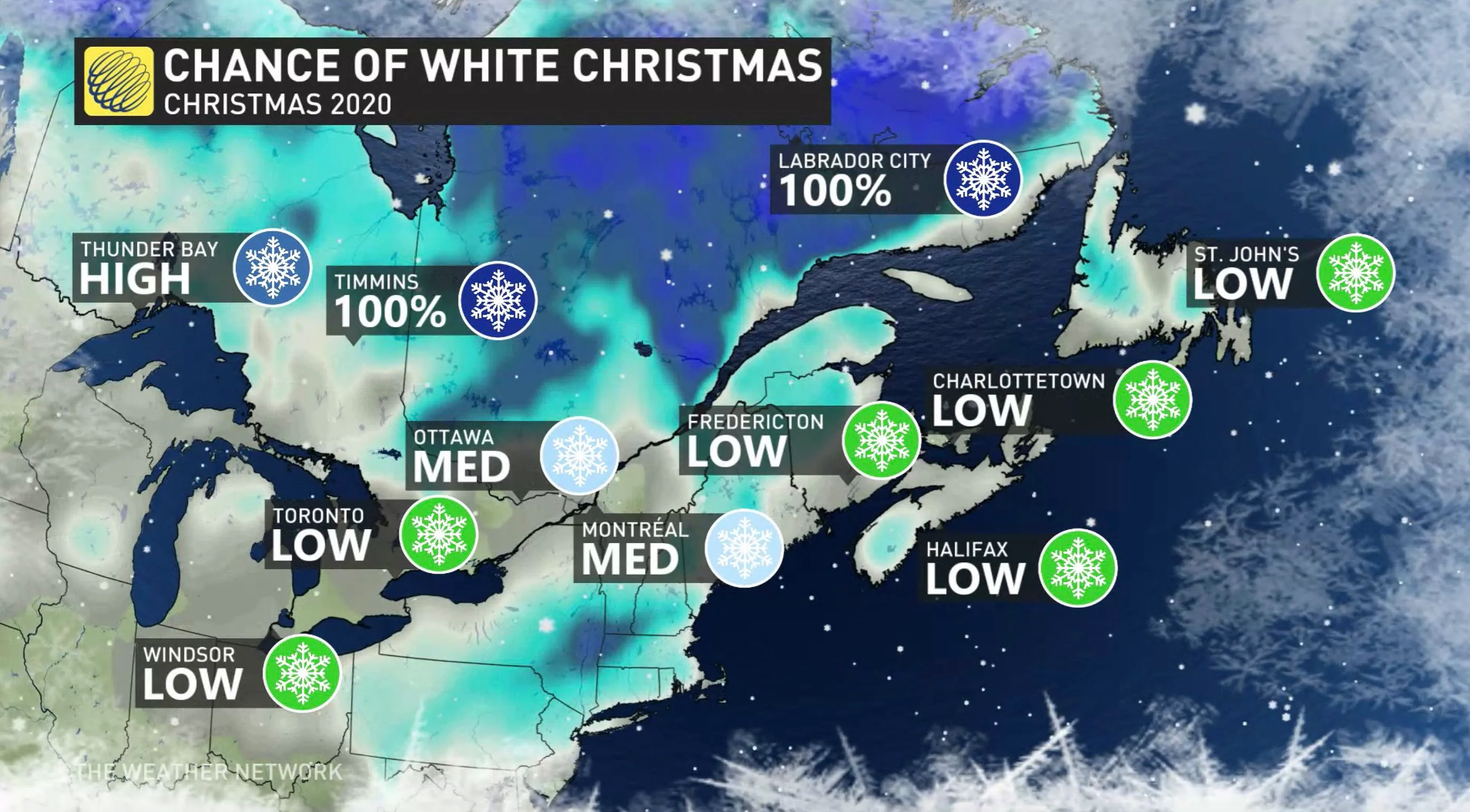
Last-minute uncertainty with white Christmas potential in Ontario

A potent low will track into southern Ontario late week, but will it bring snow in time for a white Christmas?
WEATHER HIGHLIGHTS:
Changeable pattern during the week, with low to bring in snow, rain Christmas Eve/Day, depending on location
Rain moves in Wednesday night, becomes widespread during the day on Christmas Eve
Precipitation switches to snow on Christmas Day, but timing, accumulations still uncertain
Visit our Complete Guide to Winter 2021 for an in depth look at the Winter Forecast, Canada's ski season, and tips to plan for everything ahead!
WEDNESDAY TO FRIDAY: LOW TO BRING RAIN, SNOW, BUT WILL THERE BE A WHITE CHRISTMAS?
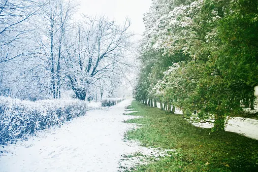
With days until Christmas, whether it will be green or white will come down to the very last minute in southern Ontario. The definition of a white Christmas means having at least two cm of snow on the ground.
A Pacific low tracking through Western Canada Monday and Tuesdaywill be boosted by a deep upper trough as it moves into the Great Lakes region for Christmas Eve and Day.
Wednesday night will see warmer air and rain pushing into the northern and eastern shores of Georgian Bay and southwestern Ontario. Widespread rain will then trek across southern and eastern Ontario by Thursday afternoon.
Thursday evening will see rain switching over to snow across central and southwestern Ontario, including the GTA. Rain continues in eastern areas.
On Christmas morning, rain will switch to snow for the Ottawa area, while scattered flurries will fall across the GTA and light snow will impact cottage country, southern Georgian Bay and Lake Huron. Friday evening will see lake-effect snow bands develop off Georgian Bay and Lake Huron.
Dreaming of a snowy festive season? Click here to find out if your holiday wishes will come true!
Because we're still several days away, there is still uncertainty with the timing and accumulations. There is higher confidence in the fact that there will be a system impacting the region.
"This has the potential to bring a period of significant snow to parts of the region during Christmas Eve and into early Christmas Day, but it is still much too early to have confidence in who will see enough snow to pull off the buzzer beater with snow just in time for Christmas," says Weather Network meteorologist Dr. Doug Gillham.

Beyond, the colder temperatures will hang on through Boxing Day, but then trend milder for the final days of December.
Check back as we continue the monitor the forecast for a potential white Christmas in the coming days.