
Severe weather threat hangs on in Alberta this weekend

Severe storms dropped hail the size of tennis balls for parts of Alberta Thursday, Friday featured more severe risk, and Saturday looks to start stormy as well. Temperatures remain above seasonal through the first half of the weekend across the Prairies, though some moderation is ahead. Details and timing, below.
WEATHER HIGHLIGHTS:
Severe storm risk along the Alberta foothills Saturday
Northwestern Ontario carries most non-severe risk Saturday
High pressure keeps much of the rest of the region clear to start the weekend
Keep on top of active weather ALERTS in your area
SATURDAY: STORM RISK ACROSS ALBERTA, EASTERN PRAIRIES CATCH A BREAK
While Saskatchewan and Manitoba enjoy a break from the severe weather through the long weekend, the same can't be said for Alberta. A slow-moving trough moving east in the province could spark severe storms along the foothills late Saturday afternoon and early evening
The risk extends all the way from Grand Prairie to the U.S. border.
bring another round of storms in the late afternoon and evening hours, with the risk of isolated severe storms.
Storms that do cross that threshold will feature small hail, heavy rainfall and strong wind gusts.
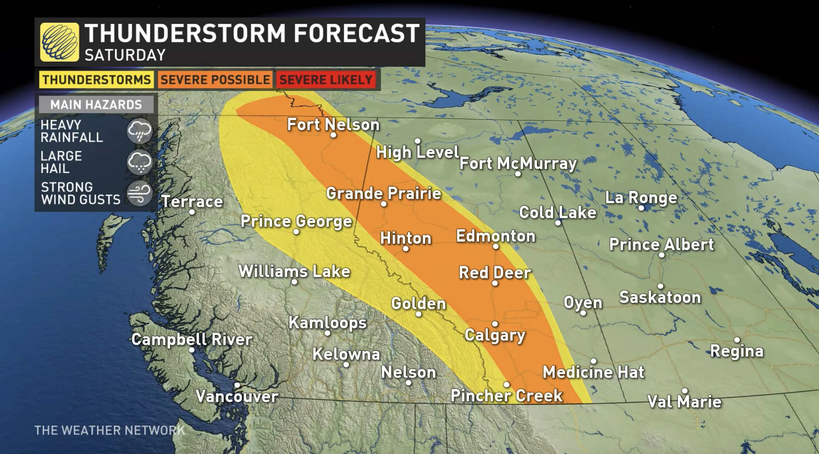
Far to the east, storms will continue overnight into early Saturday morning in northwestern Ontario, though any storms that do continue through the day will be scattered and non-severe.
Meanwhile, a ridge of high pressure in eastern Prairies will give Saskatchewan and Manitoba a break from the recent stretch of severe weather, providing a pleasant and clear-sky Saturday.
In addition to the storm threat, the heat will also be confined to Alberta, with daytime highs approaching or hitting the 30-degree mark in central, southern areas.
SUNDAY: THREAT FOR SEVERE STORMS LINGERS IN ALBERTA
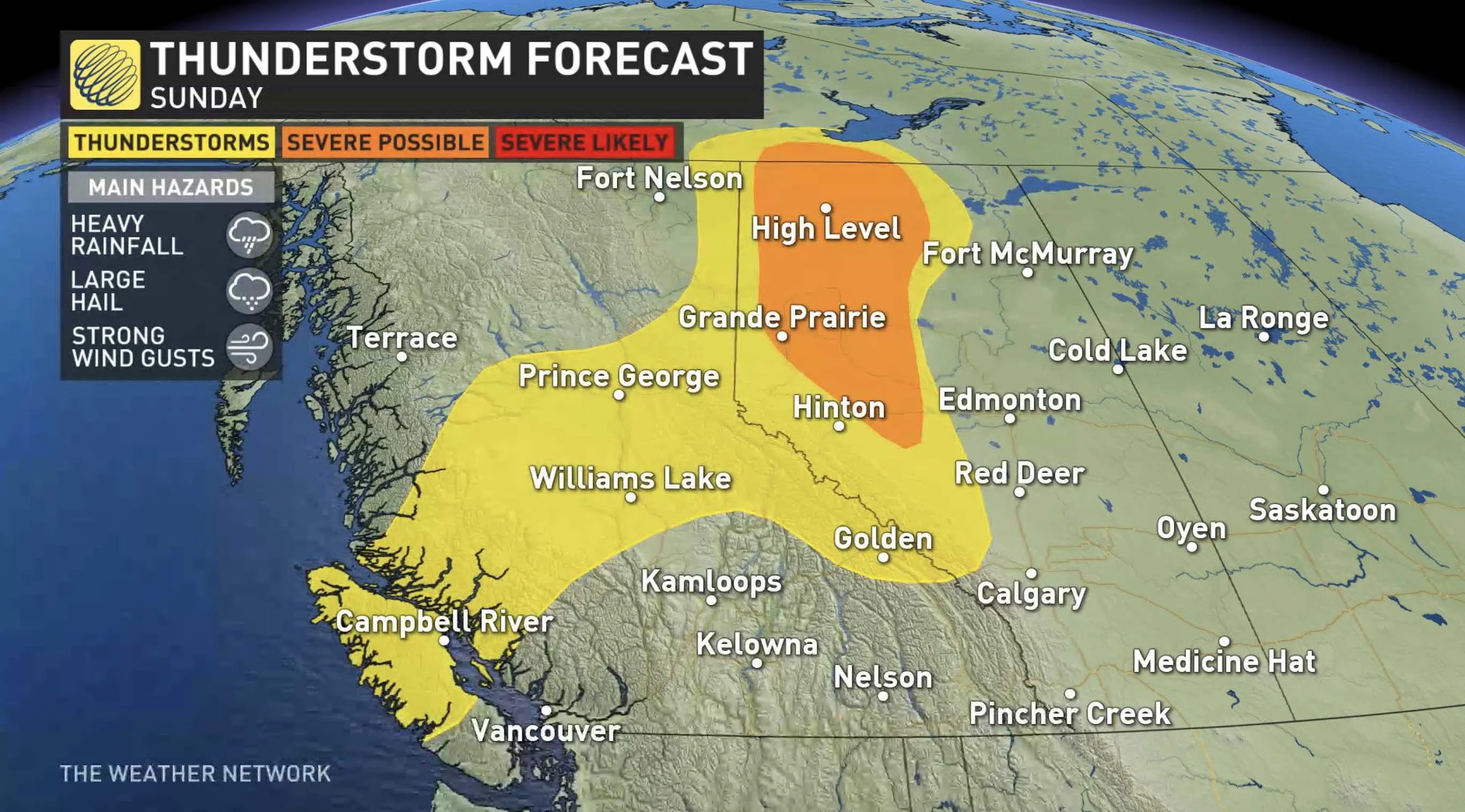
A slight cooldown is expected for Sunday.
Keep an eye on the forecast through the weekend.


