Travel remains tricky in parts of Ontario as lake-effect snow lingers

Lake-effect snow will persist in areas off Lake Huron and southern Georgian Bay Wednesday morning, accompanied by the coldest temperatures of the week.
The lake-effect snow machine came roaring to life once more Tuesday in southern Ontario, bringing moderate accumulations for parts of the traditional snowbelt regions. The snow is expected to linger into Wednesday morning before diminishing and tapering off to flurries by midday. However, travel may remain tricky due to blowing snow from gusty winds. Wednesday is also expected to be the coldest day of the week, ahead of a pattern change that will bring a more consistent cold pattern on the weekend. Before then, another shot of light snow is expected Thursday with a clipper tracking through. More on the timing and impact, below.
WEATHER HIGHLIGHTS:
Temperatures will transition from above seasonal temperatures to more typical winter conditions this week
Lake-effect snow squalls will linger into Wednesday morning for Lake Huron and Georgian Bay, diminish by midday
Eyes on a clipper system for Thursday, which could bring more widespread light snowfall totals
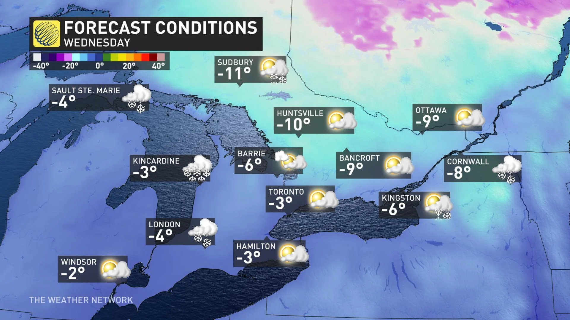
WEDNESDAY: COLDEST TEMPERATURES THIS WEEK, LAKE-EFFECT SNOW SQUALLS EASE OFF
Wednesday is expected to be the coldest day of the week, though temperatures will still remain within the seasonal mark. Cold, westerly winds will keep lake-effect snow squalls near Lake Huron and southern Georgian Bay lingering into the morning hours before tapering off to some flurries by midday.
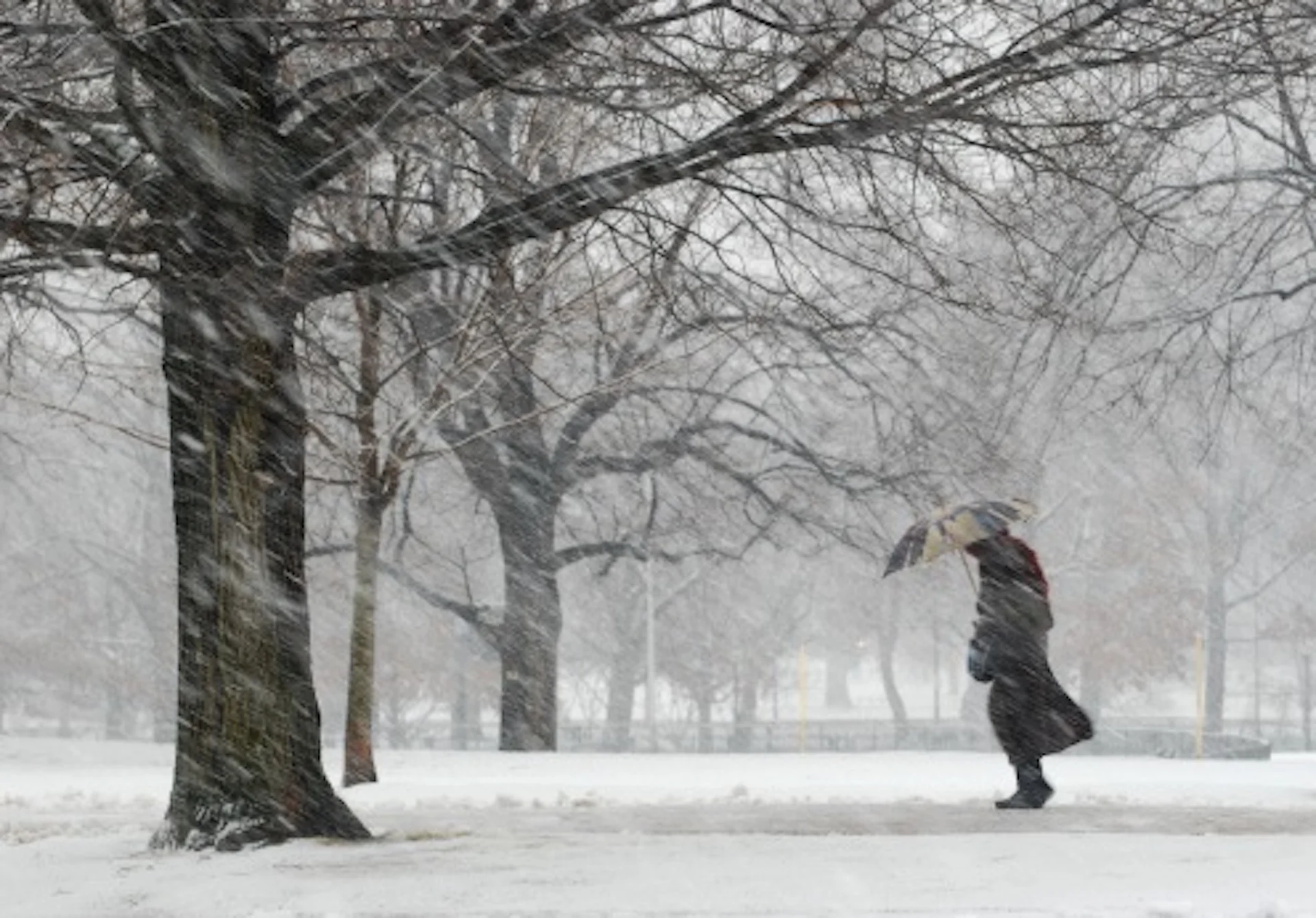
Travel will remain tricky in these regions as gusty winds will allow for blowing snow to persist, possibly causing near-zero visibility at times.
Winter weather travel advisories remain in place across Barrie, Orillia, parts of Grey-Bruce, Parry Sound and Muskoka.
By the time the snow eases off Wednesday, parts of Grey-Bruce region may see accumulations of 10-15+ cm of snow, with less than 5 cm for the GTA, Niagara region and areas south of London.
MUST SEE: Potent storm dumps 20-30 cm of snow on eastern Ontario, Quebec
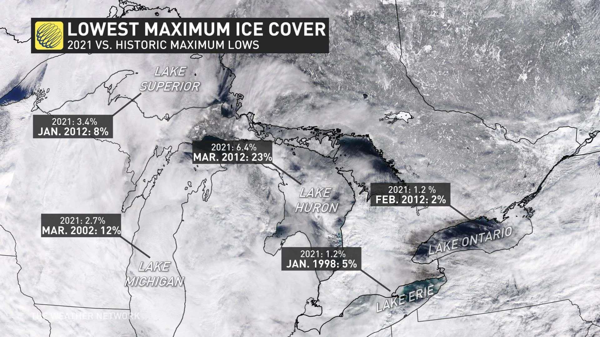
The lack of Arctic air this winter has prevented the number of significant snow squall events from happening across the region, even with the Great Lakes remaining mostly ice-free.
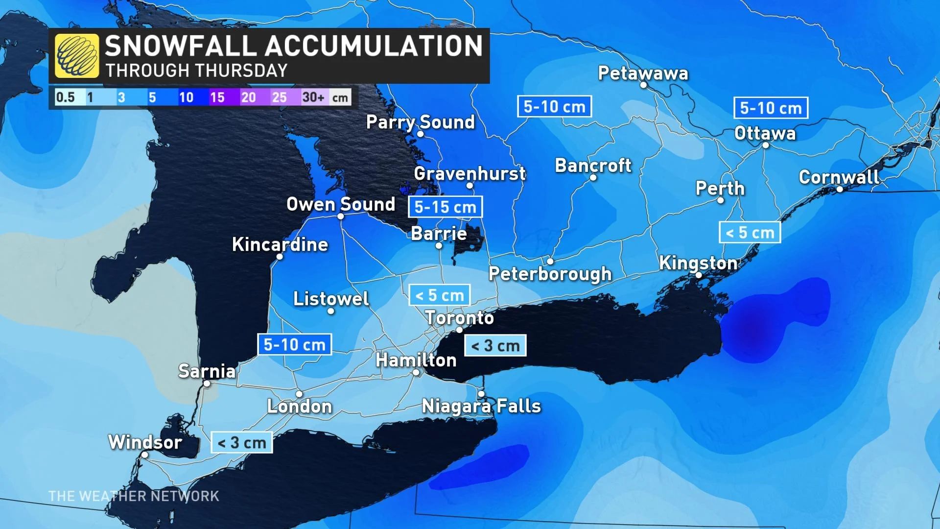
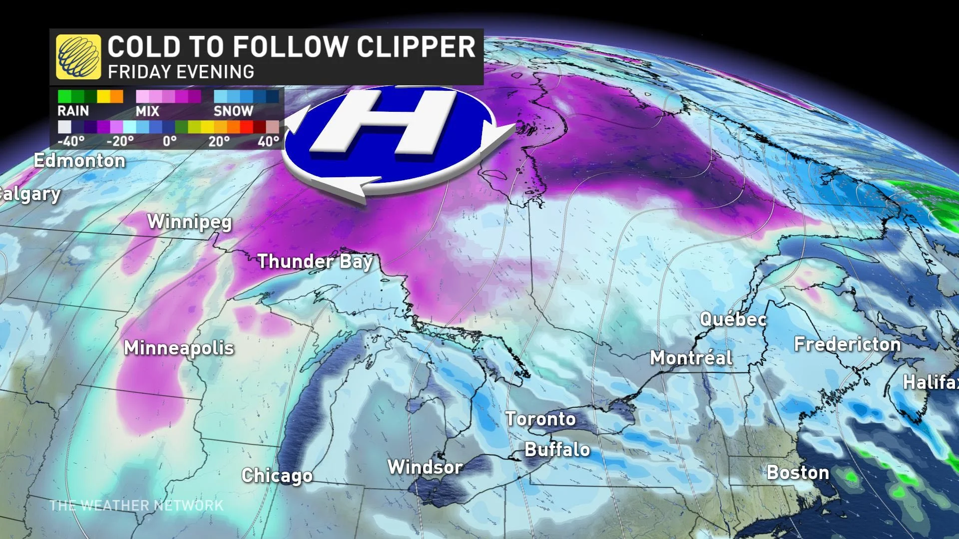
THURSDAY: EYES ON A CLIPPER SYSTEM WITH MORE WIDESPREAD SNOW
Eyes are also on a clipper system for Thursday, which will bring more widespread light snow to the region. By the afternoon hours however, temperatures will climb well above freezing once again across the south.
5-10 cm is expected for central northeastern ontario, accompanied by gusty winds. Areas south of cottage country will see 3 cm of snow or less. Much milder weather surges into southern Ontario with temperature rising well above the freezing mark.
LOOK AHEAD: PERSISTENT COLD PATTERN LOCKS IN ON WEEKEND
With the passage of the clipper, a more persistent cold pattern will begin on the weekend and continue into next week. The city of Toronto could actually reach -10°C for the first time so far this winter.
"If this happens, it will be at least 20 days after the previous latest first -10°C day (Jan. 3, 2016)," says meteorologist Dr. Doug Gillham.
Beyond the weekend, forecasters are watching the potential for a Colorado low to approach or track south of the Great Lakes region early next week. It is too early to have confidence in the exact storm track, timing and impacts, but this may bring significant snow and ice to southern Ontario.
"Of course, storms this far out can turn into total misses and there are models that have the storm track too far south to impact the region," Gillham says. "But, after a very quiet month, this is a potential system to watch."
Near to slightly below seasonal temperatures are expected to dominate next week.
Be sure to check back for updates on the gradual transition to more typical winter weather across Ontario.
Thumbnail courtesy: Getty Images