June snow is coming to parts of Ontario of this week

This part of Ontario will see snowflakes while cities further south will see temperatures approaching 30°C.
Heat warnings currently cover a large chunk of southern Ontario and it's hard to imagine the threat of snowfall in the province. Even though the official start of summer is just a couple of weeks away, an unusually powerful low pressure system will draw down cool air from Hudson Bay and could bring snow to parts of northern Ontario this week.
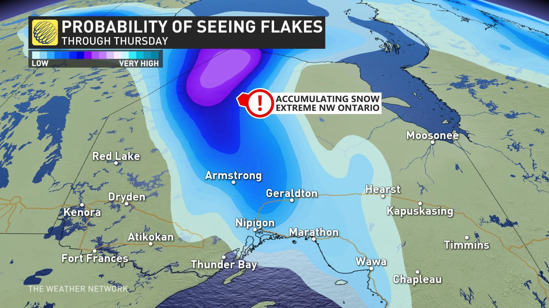
The low will move across Lake Superior on Wednesday morning at a pressure approaching 980 millibars, which is quite an outlier for June and will set up the necessary dynamics to produce severe weather in southern Ontario on Wednesday. The graphic below highlights the threat to see flakes, with no accumulation expected near Lake Superior.
While the prospect of snow in June is downright frightful, snowfall does occur from time-to-time in northern Ontario during this part of the year.
Take Timmins for example.
Digging through the climate record, there are at least 16 instances of measurable snow in the month of June for the city. The climate record also highlights several other cities across parts of Ontario that have recorded a few days of rare June snow.
Sudbury has recorded two instances of snow falling during the month of June: 0.4 cm fell on June 21, 1992 and 5.1 cm fell on June 5, 1929. Sault Ste-Marie has one lonely June snow transcribed in history on June 3, 1964 when 0.8 cm accumulated.
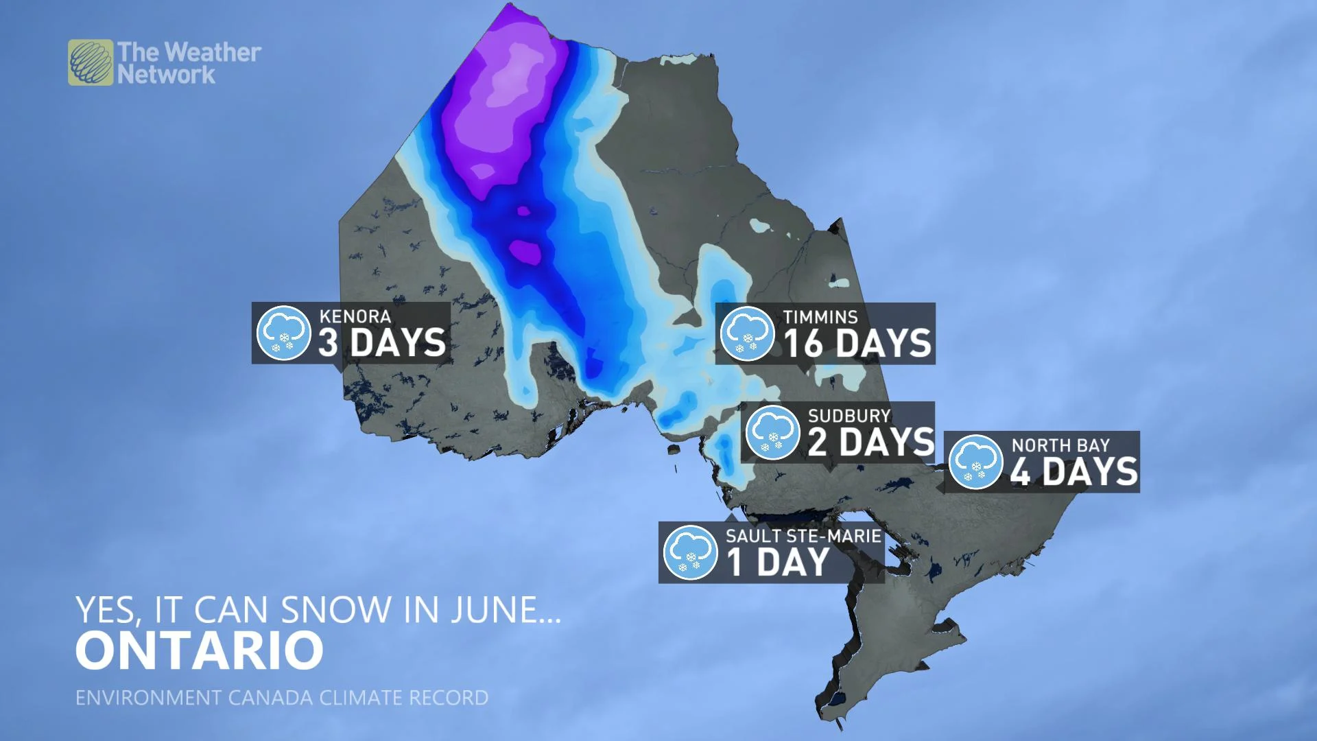
Timmins has even recorded snow in July, which happened on Canada Day in 1939 when 0.3 cm was recorded.
Forecasting snow is tricky at the best of times and with surface temperatures so marginal, most places won't see accumulation unless you venture towards the northwestern tip of the province.
The temperatures will be undeniably chilly at nearly 15°C degrees below normal on Thursday across a swath of northwestern Ontario.
By late Thursday evening, the low pressure loses some steam and pulls away from the region towards Quebec, but the colder air will lag behind.
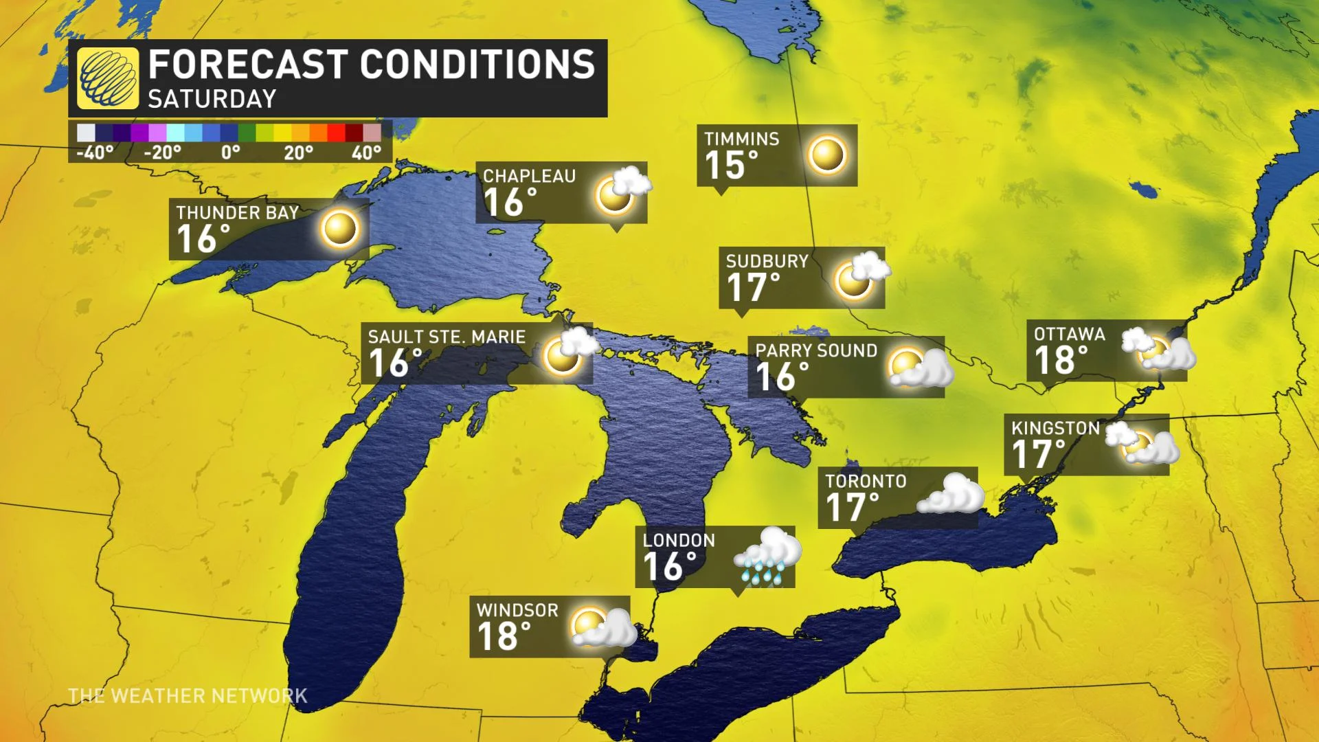
The upper trough will continue to tumble over the province into the weekend and will suppress temperatures nearly 10°C below seasonal in most cities.


