Mudslides, flooding underway in B.C. amid 100-200 mm of rainfall

A potent "pineapple express" is unloading substantial rainfall amounts to the South Coast after bringing heavy snowfall to the mountain passes.
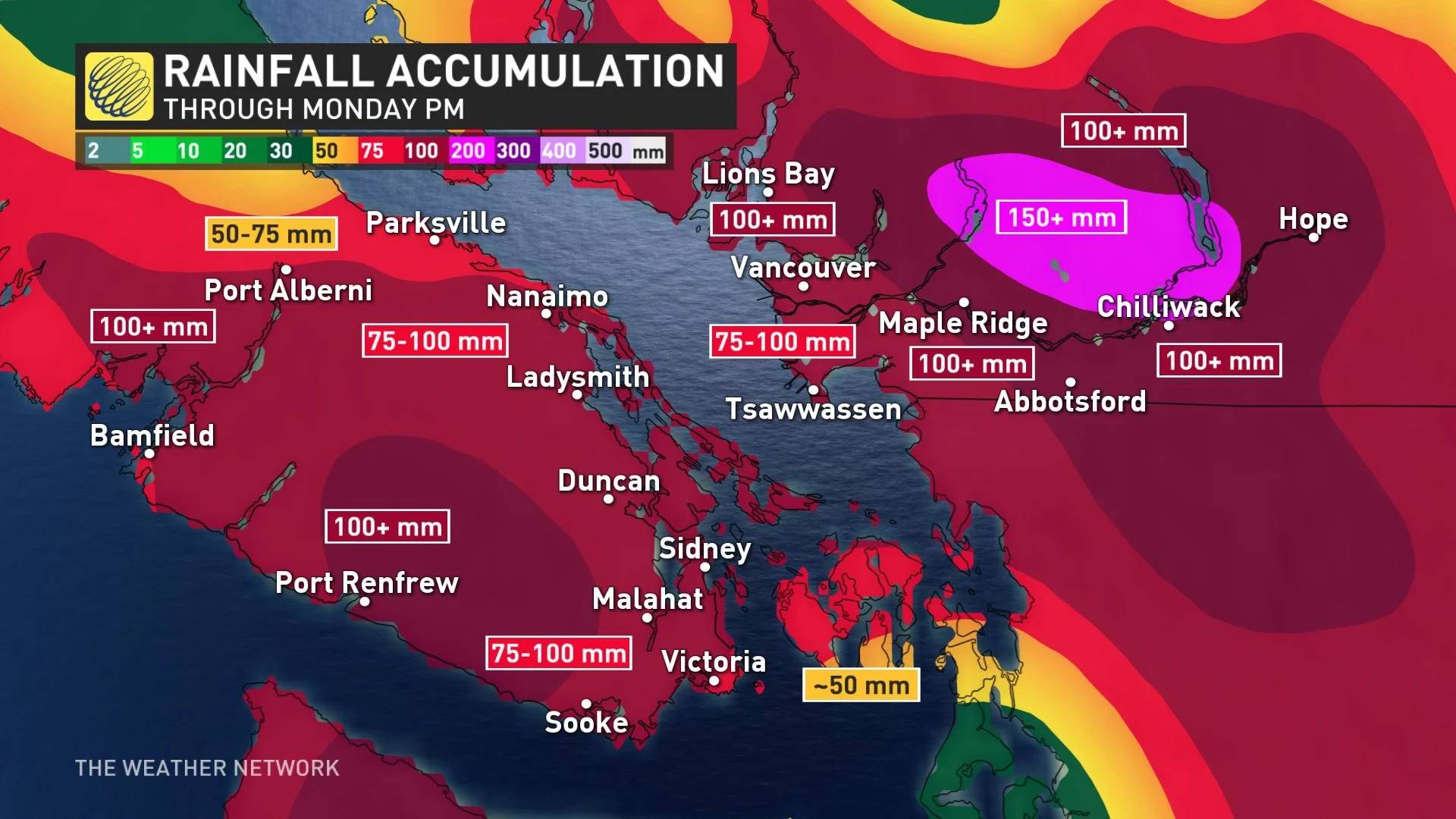
A major atmospheric river is flowing through B.C., and will drop substantial amounts of rainfall on the coastal sections through Monday. Rainfall warnings are in effect, with 100 mm forecast for Metro Vancouver through Monday afternoon, while more than 200 mm is anticipated for higher-elevation areas of the Lower Mainland and southern Vancouver Island. Strong winds and challenging travel conditions are expected for the mountain passes. Details and timing, below.
Visit our Complete Guide to Fall 2021 for an in-depth look at the Fall Forecast, tips to plan for it and much more!
MONDAY: EXTREME RAINFALL, INTENSE WIND GUSTS
B.C. has been on the receiving end of a potent atmospheric river, absorbing moisture from the deep tropics near the Hawaiian Islands.
Many regions will see at least an additional 50 mm of rainfall on Monday. The good news is that a brief break from the soggy conditions is on the way due to a cold front that will track through the region and push the precipitation out of the region. However, there will still be lingering impacts from the heavy rainfall.
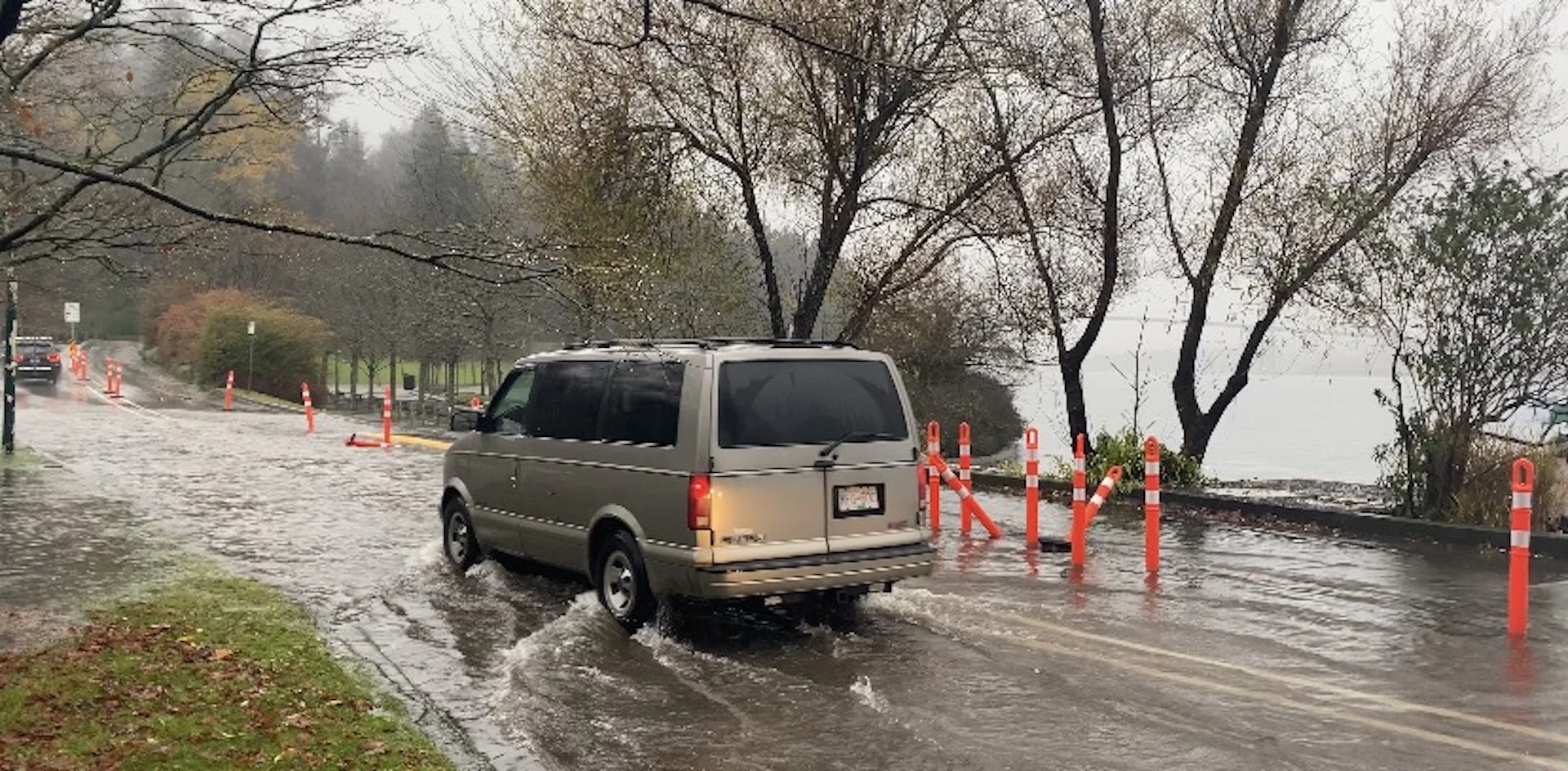
"This could result in possible washouts, debris flow and pooling water. Local river levels will rise and river flows will increase as a result of the heavy rain. Heavy downpours can cause flash floods and water pooling on roads. Watch for possible washouts near rivers, creeks and culverts," says Environment and Climate Change Canada (ECCC) in the rainfall warning for Vancouver.
The Government of B.C. issued flood watches at 3:00 pm PST on Sunday for the Fraser Valley including surrounding tributaries, Fraser Canyon tributaries, including tributaries around Hope, Chilliwack River, Englishman River, Tulameen River and tributaries, and Coldwater River.
"Temperatures have been rising, with temperatures in the 5-7°C range being observed at automated snow weather stations across the region. Snowmelt is being observed at mid- elevations and is adding additional runoff to rivers."
According to DriveBC, a mudslide resulted in the closure of the Coquihalla highway in both directions on Sunday.
The rainfall has created wet, sloppy conditions on the mountain passes and travel will still be difficult as a result.
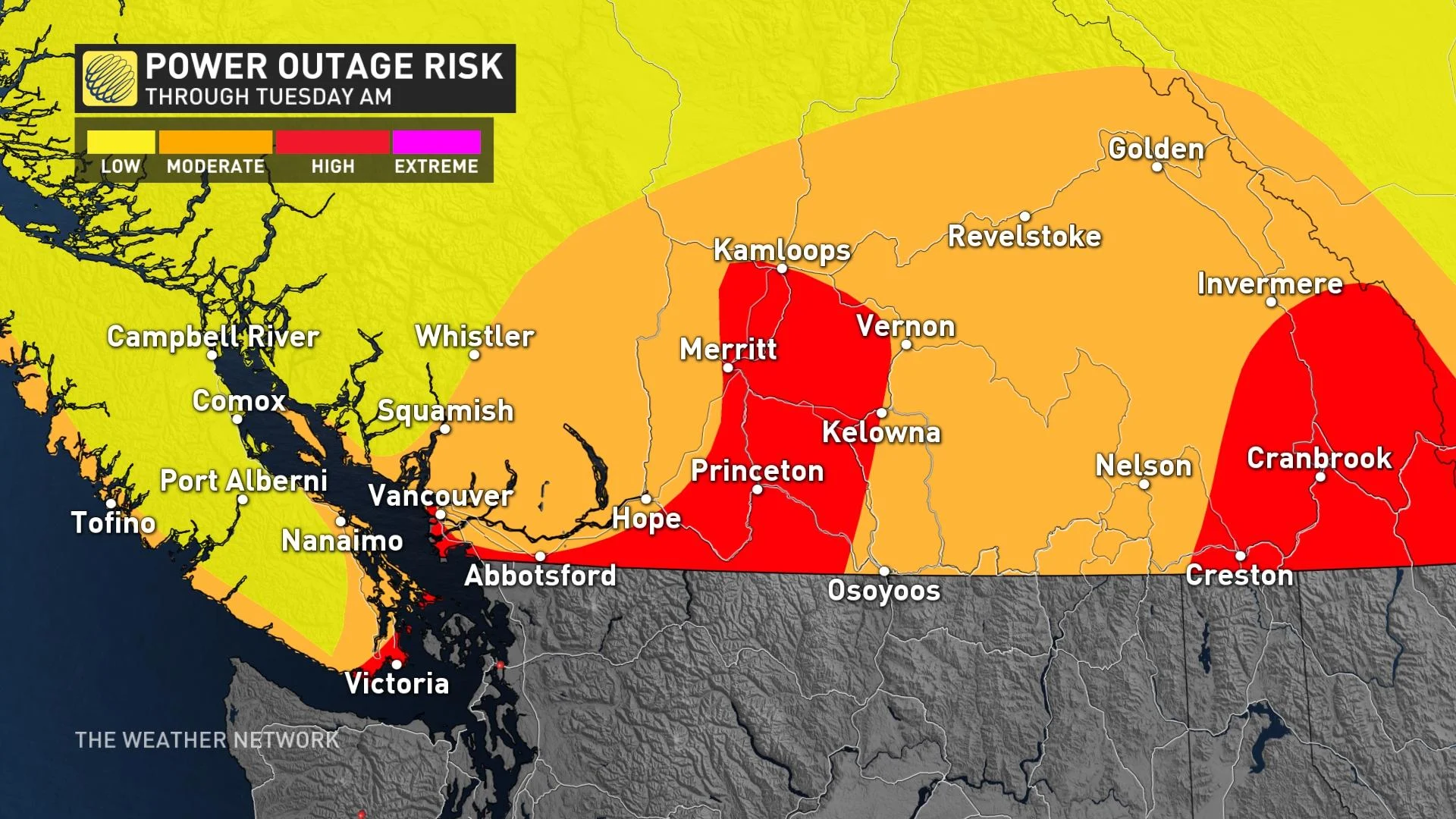
The winds will ramp up again on Monday morning in the Strait of the Georgia, southern Vancouver Island, Lower Mainland and the Interior and gusts will reach 50-70 km/h.
Environment and Climate Change Canada says that the winds will impact many regions, including Metro Vancouver, and could toss loose objects or cause tree branches to break. This increases the potential for power outages.
Beyond, a bit of a break from the precipitation and a drier pattern for mid- and late this week with cooler than seasonal temperatures through mid-week, then becoming milder late week.
Be sure to check back for the latest updates on the ongoing parade of systems in B.C.