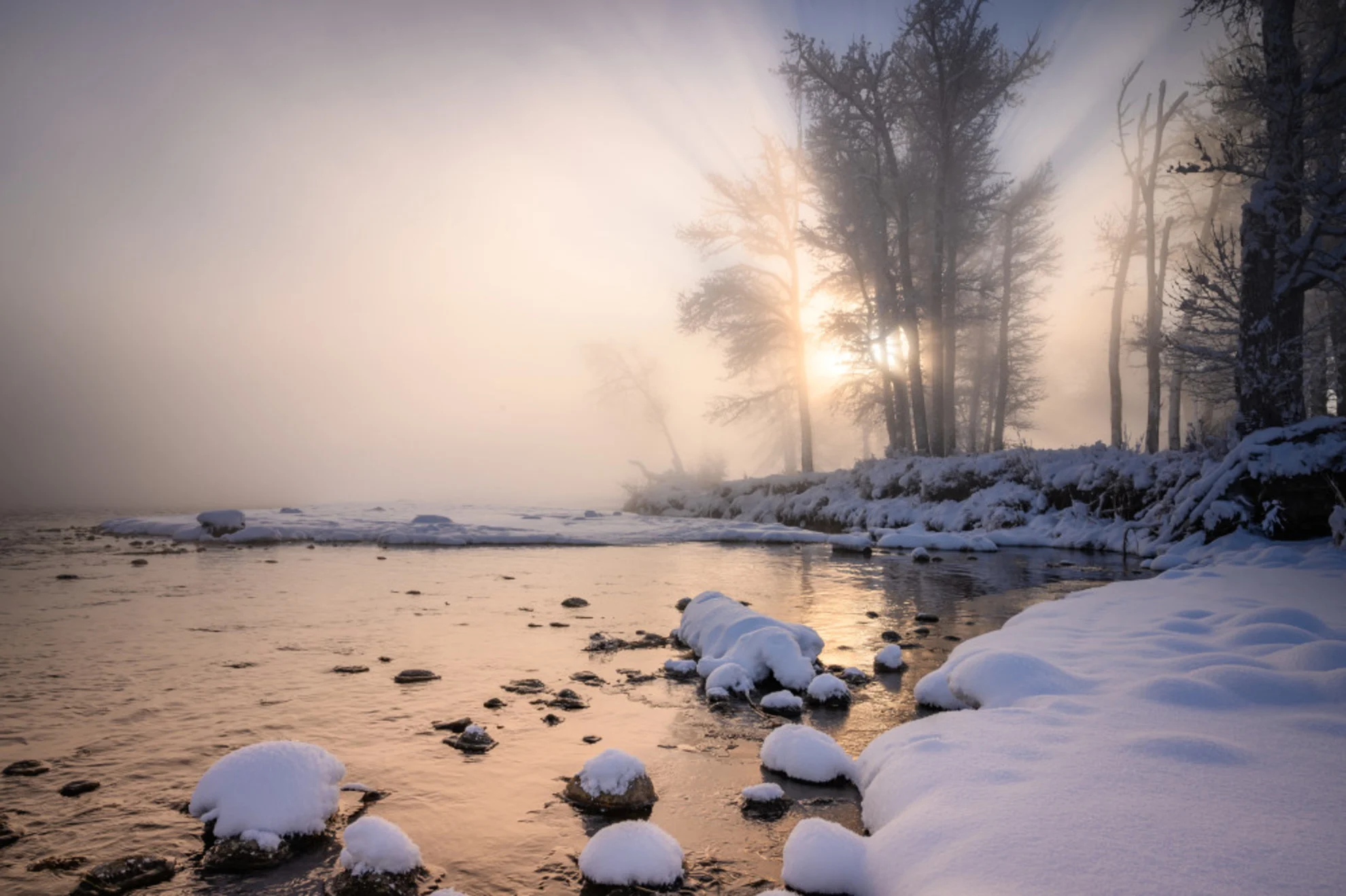
It's not one season fits all: How winter weather varies across Canada

While Canada is known for its cold winter climate, the frosty season can actually look very different across the country depending on where you are.
Canada is famously known for being a cold, snowy country in the winter. However, how winter presents itself to Canadians can be drastically different depending on where you are located in the country.
Canada is big. As the second largest country in the world, it spans over 5,000 km east to west and over 4,500 km north to south at its longest. With that comes some pretty wide variation in topography, and thus, climate. For example, the western provinces have the Rocky Mountains, while just to the east are the Prairies. Topography is a large influencer of weather and climate, so these differences are part of what creates the winter variation we see each year.
Terms used in winter forecasts can also differ slightly depending on where you are. For example, those on the coasts may see the term “sea-effect snow” come up, while those in Ontario or even parts of Manitoba might see “lake-effect snow” instead. Both processes are very similar, but occur over different types of bodies of water.
Average temperatures will be discussed in this article and are from between 1980-2010, as climate averages are recorded over 30-year timeframes. This means that the next recorded timeframe will be from 2010-2040. The average temperatures per geographic region in this article are listed as ranges to show how different climates can be not only between regions, but within them as well.
RELATED: 20 winter weather words you need to know
Territories
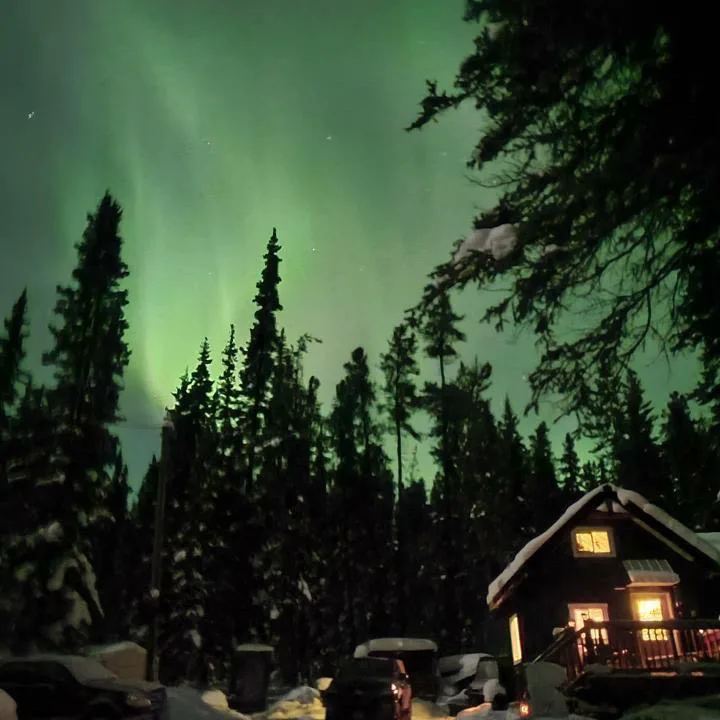
The aurora borealis vibrantly dancing in the sky above a snow-covered home in Yukon. (Brandy Golebski/Submitted)
Winter temperatures in the Territories average between -16°C and -32°C. The explanation for this is quite simple – the Arctic Circle. In fact, some of Nunavut’s islands are located within the Arctic Circle, with the northernmost habited location being Alert.
Winter in the Territories may be a little more representative of what someone might imagine when thinking about stereotypical Canadian winters – cold. There’s also snow, but not as much as you might think.
“In fact, it's often too cold to snow in significant amounts across far northern Canada,” explained Tyler Hamilton, a meteorologist at The Weather Network. “Canada's biggest snowfalls tend to fall well south of the Arctic Circle.”
British Columbia
Average winter temperature ranges between 2°C in the south-easternmost edge to -18°C at the northernmost edge of the province, bordering the Territories.
The reason temperatures are so mild along the coast is because of the Pacific Ocean. The ocean currents bring warm water up from the tropics and as air moves in from the west, heat and moisture is pushed inland towards the Rockies. However, this may not always be the case.
“The Pacific Ocean really works to moderate the temperatures at the coast, but occasionally, Arctic air can seep towards the coast (known as Arctic outflow) when high pressure builds inland,” said Hamilton.
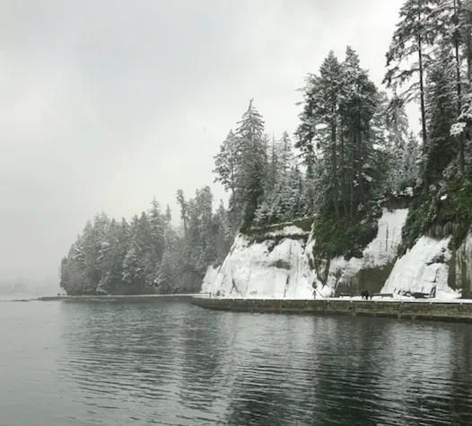
Stanley park seawall in B.C. during a winter storm, February 14, 2020. (Dennis Ding)
Those in British Columbia may also be more familiar with the term “atmospheric river” than others. In short, an atmospheric river is a long, narrow stream of moisture in the atmosphere. These rivers can bring extreme amounts of precipitation to coastal regions, often prompting rainfall warnings for affected areas.
Beyond the mountains, the weather in the interior regions of the province can have a stark difference to the mild, wet conditions seen on the coast.
“The interior valleys are much drier but often cooler than the coast. The interior mountain ranges intercept most of the precipitation from the Pacific Ocean,” added Hamilton.
Prairies
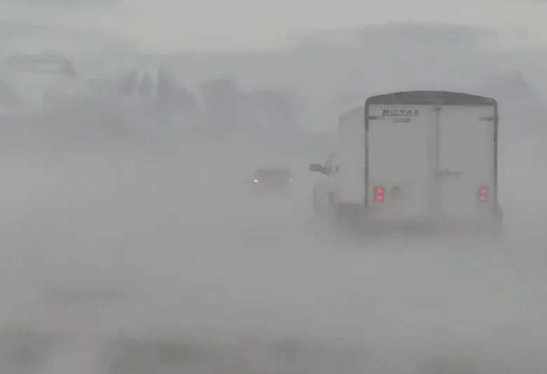
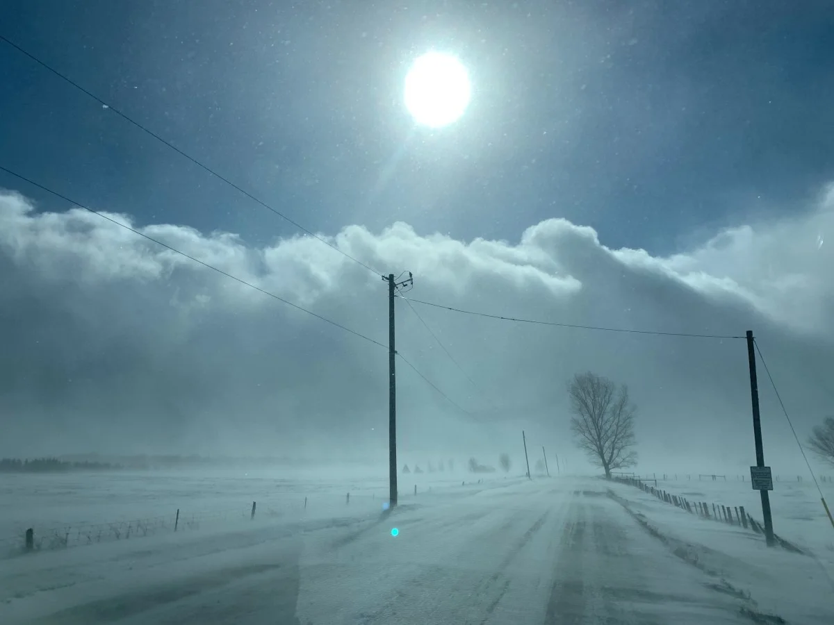
Blowing snow over a roadway, creating whiteout conditions in Calgary, Alberta. (Kyle Brittain/The Weather Network)
Due to its flat, open landscape, air mass is able to move freely across the Prairies with little friction to slow it down. While the average temperature ranges between -4°C and -24°C in the winter, it may feel much colder due to the wind chill.
Another major driver of winds on the Prairies are the Rockies. As warm, moist air from the Pacific ocean rises up the mountains, it cools and condenses, eventually descending on the other side of the mountains towards southern Alberta. As the air descends, it loses its moisture and quickly warms back up, creating strong wind gusts. These winds are known as Chinooks. The Chinook winds are also responsible for the discrepancy in average winter temperatures between the southern and northern regions of the Prairies, as they are strongest to the south.
Central Canada
Central Canada encapsulates Ontario and Quebec. The average temperature in the winter has a large range of -2°C to -22°C due to the province’s large sizes. Climates within these provinces themselves vary widely.
Northern Ontario and Quebec experience much colder average temperatures than southern Ontario. This is likely because southern Ontario is nestled in a peninsula between all of the Great Lakes, which regulate air temperatures and provide moisture in the atmosphere. This is also why southern Ontario is more likely to experience ice storms and freezing rain events than the more northern regions.
A towering snow squall in southern Ontario. (Mark Robinson/The Weather Network)
The Great Lakes Basin, which stretches from the north shores of Lake Superior and Lake Huron, encapsulating southern Ontario, all the way down to the southern point of Lake Huron in the United States. In Ontario, many areas along the east coasts of Lake Superior and Lake Huron are victim to lake-effect snow and are aptly referred to as the “Snowbelt”. These areas can see much greater amounts of snowfall in the winter than other regions of Ontario due to cold air moving along the open waters of the Great Lakes, building moisture and speed, until making landfall again and unleashing its fury of snow and wind.
READ MORE: Why the Great Lakes produce some of the world’s heaviest snow
Lake-effect snow is a type of snow squall and can create whiteout conditions for travellers in these areas, so it’s always important in the winter when travelling to check your local forecast for current and future conditions.
Atlantic Canada
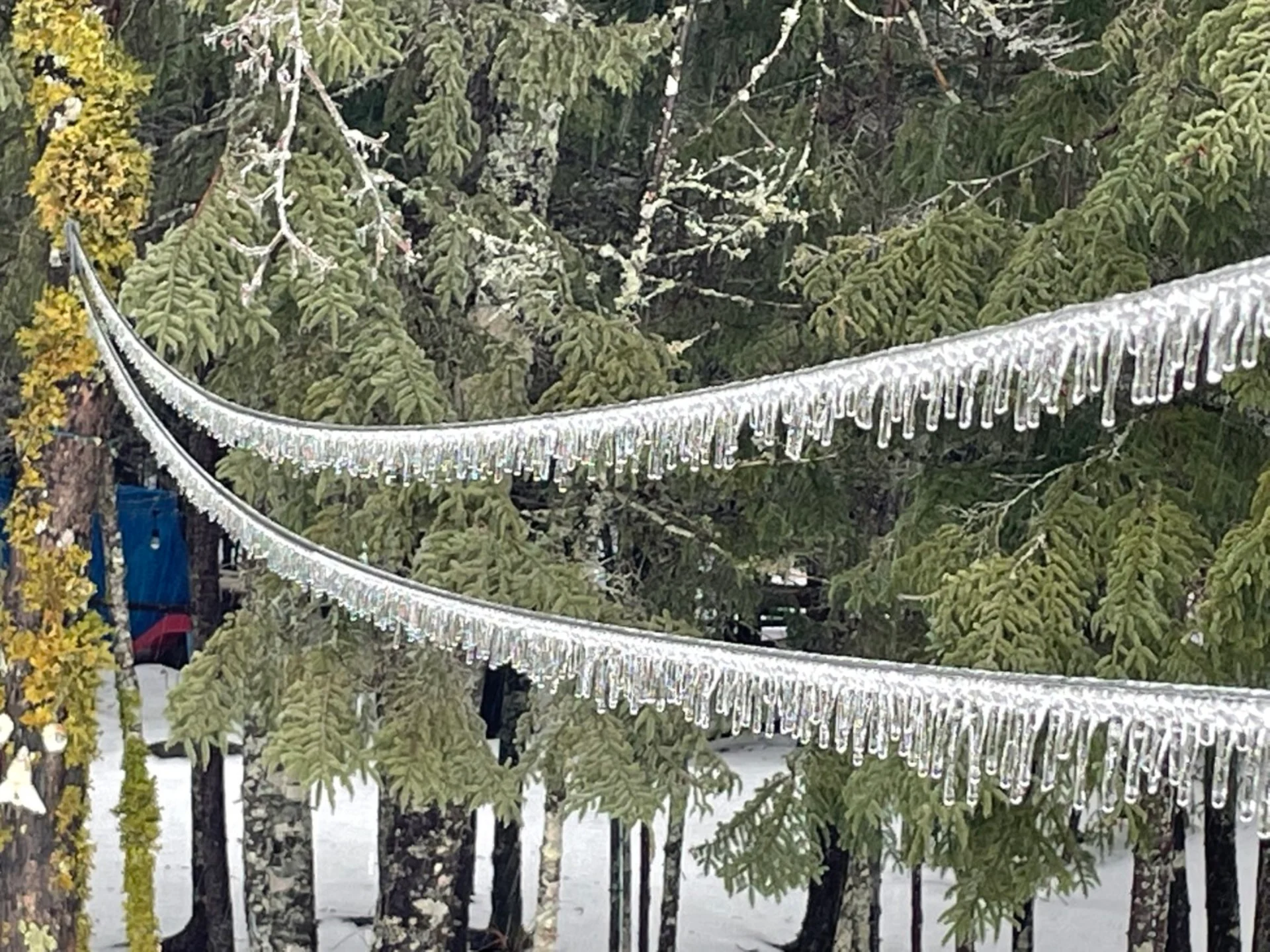
Icicles dangling on a line like little decorations from freezing rain in Halifax, Nova Scotia. (Mike MacDonald/Submitted)
Despite being on the coast, Atlantic Canada experiences colder winters than the West Coast, with average temperatures ranging from -2°C to -20°C. This is due to the Atlantic Ocean and its currents. The Atlantic Ocean currents bring down cold water from the Arctic, and unlike the West Coast, air masses are moving into Atlantic Canada from inland, where it has cooled over the cold continental surface.
Here, the term “nor’easter” may be commonly used in forecasts, describing a strong low pressure system that develops off the coast of the Carolinas in the United States and rapidly tracks toward the East Coast. When the forecast says a nor’easter is developing, residents in the Atlantic provinces can expect to see a wallop of all kinds of precipitation, from rain to snow, and strong northeasterly winds.
WATCH: If you get stuck in your car this winter, do this
Canada is still a cold country overall in the winter time. However, how someone may experience winter in one part of the country may be quite different from how someone else may experience it in another.
“As is often the case, opposite weather is often occurring on either side of the country, as the jet stream amplifies across the country during the winter months,” Hamilton explained. “If a cold snap is entrenched across Western Canada, the upper-level winds dive south; consequently, further east is likely to experience milder weather with the jet stream arcing north.”
When asked what are some important things for people to understand when receiving their winter forecasts, Hamilton said, “The freezing levels could be important for those travelling across higher terrain, determining what precipitation and road conditions they'll see,” adding, “How localized certain winter weather patterns are - including lake-effect snow and fog (which tends to occur more in fall/winter with a weaker sun angle).”
Winter weather can oftentimes pose hazardous situations for many across the country. It is important to understand your local forecast so that you can adjust your daily schedule accordingly to keep yourself and others safe.
Thumbnail courtesy of Kyle Brittain/The Weather Network


