Intense system with snow, rain set to impact Atlantic Canada this week

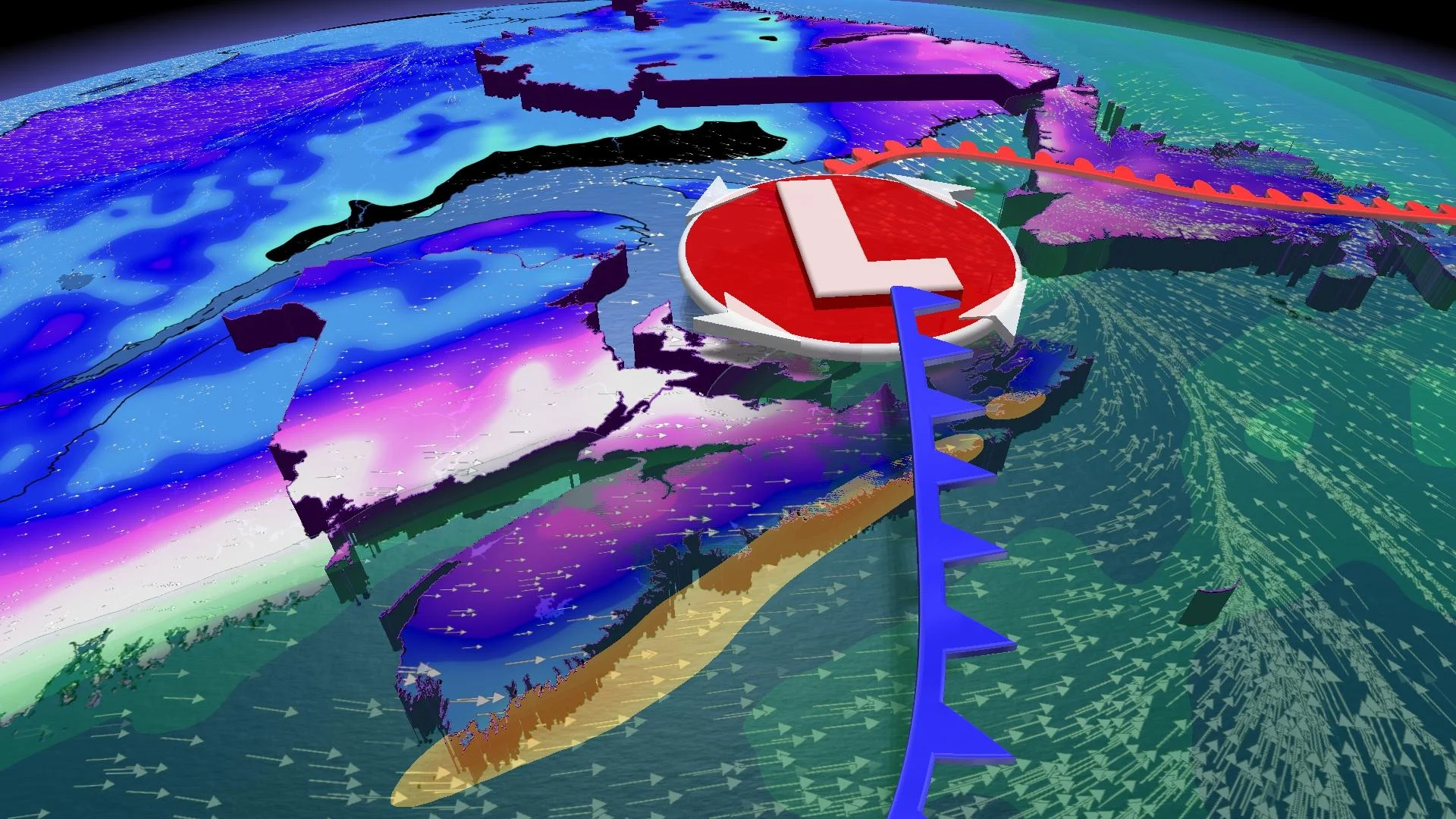
A potent low pressure system that is approaching Atlantic Canada has the potential to be one of the more severe storms the region has seen this season with significant snowfall, heavy rain, and strong winds.
Environment and Climate Change Canada (ECCC) has issued snowfall and rainfall warnings across the Maritimes, which state that travel disruptions are likely during the early part of this week.
Rachel Modestino, a meteorologist at The Weather Network, states that parts of northern Nova Scotia should prepare for “potentially the biggest snow event of the season.”
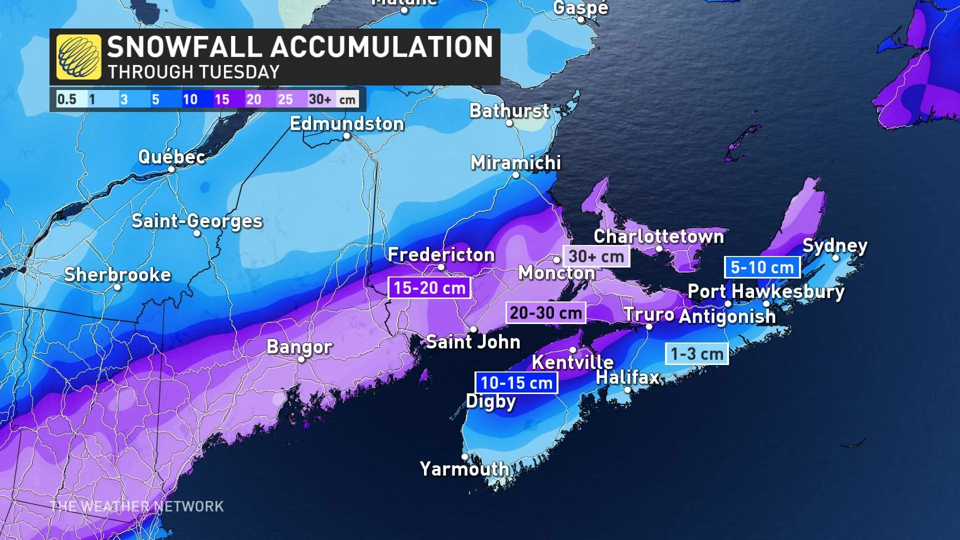
Snowfall will begin in the Maritimes on Sunday evening and continue into Monday morning.
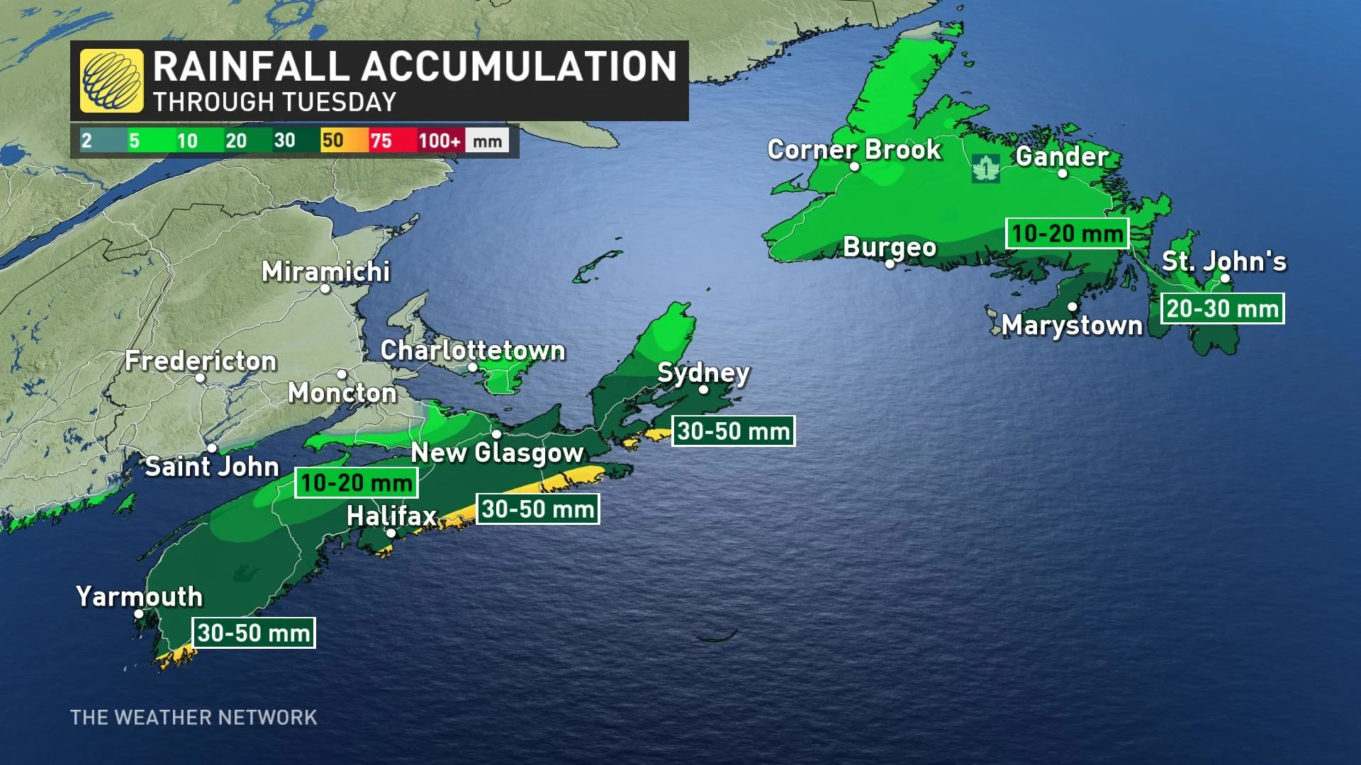
A transition into rain is expected for Nova Scotia's southern coastline due to a warm front rapidly increasing temperatures through the day on Monday.
Nova Scotia's freshly fallen snowpack will be shortlived and a rapid melt is expected to accompany 30-50 mm of rainfall, which will be heavy at times through Monday. Because of this, localized flooding is a concern. The forecast rainfall has the potential to push Halifax into the top ten rainiest Januarys on record.
The Bay of Fundy, southern New Brunswick, and P.E.I will remain slightly colder. Wet snow that will be heavy at times is expected to persist through Monday and could result in over 25 cm in the hardest-hit regions.
Gusty winds could lead to whiteouts or blizzard conditions in P.E.I. starting on Monday morning. There is considerable confidence in gusty winds over 60 km/hr as the system departs, which could lead to blowing snow and reduced visibility for commuters on Tuesday morning.


