Eyes on an extreme ice smasher headed for the Arctic

This storm is about two months early for the Arctic.
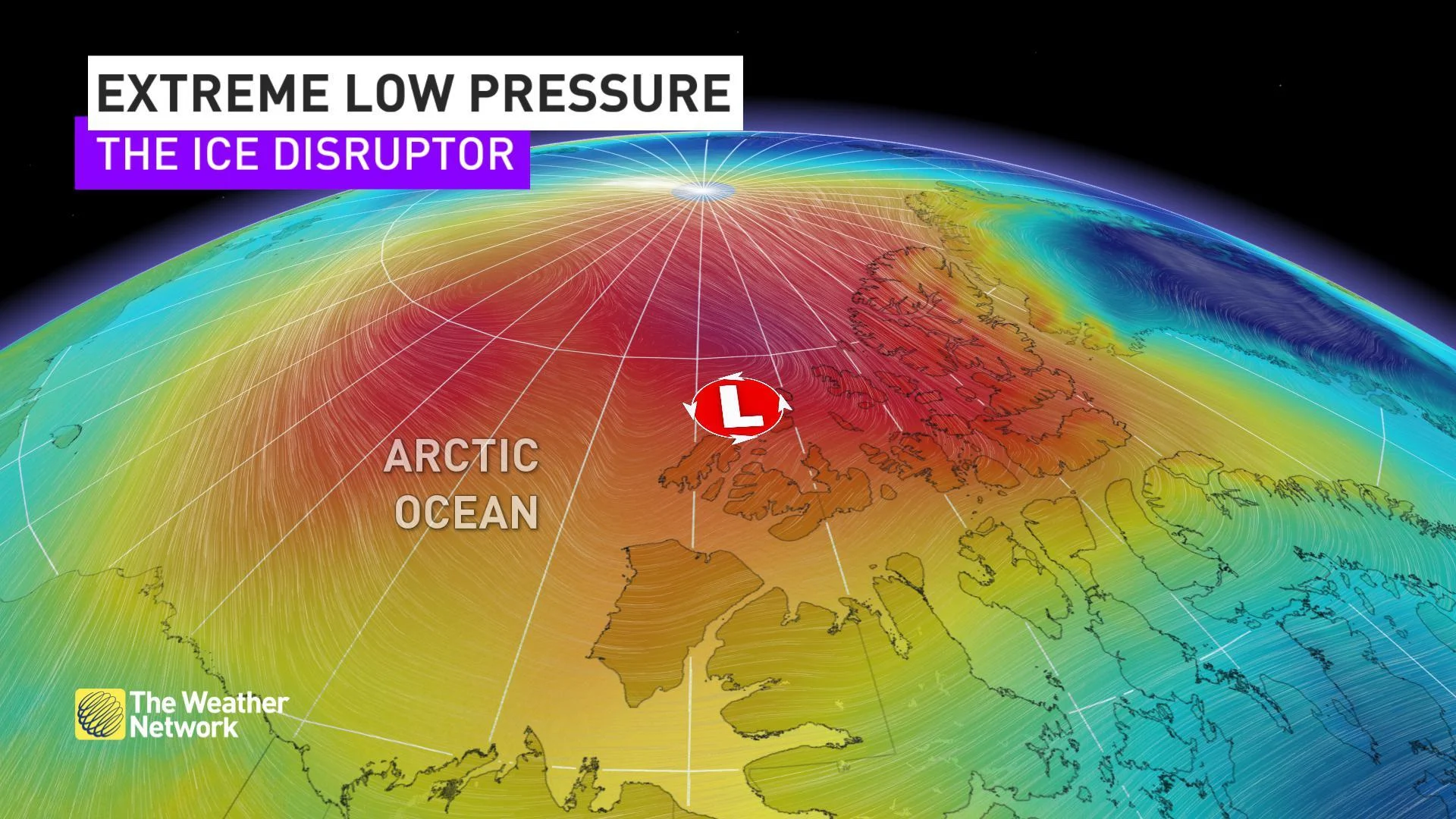
Later this week a rare system will make its way into the Arctic Ocean. This system's pressure centre is expected to dip to an unusually low value for the month of August.
Just how low?
When you look at other climatology tools, the outlier even becomes more apparent, hinting at the extreme anomaly:
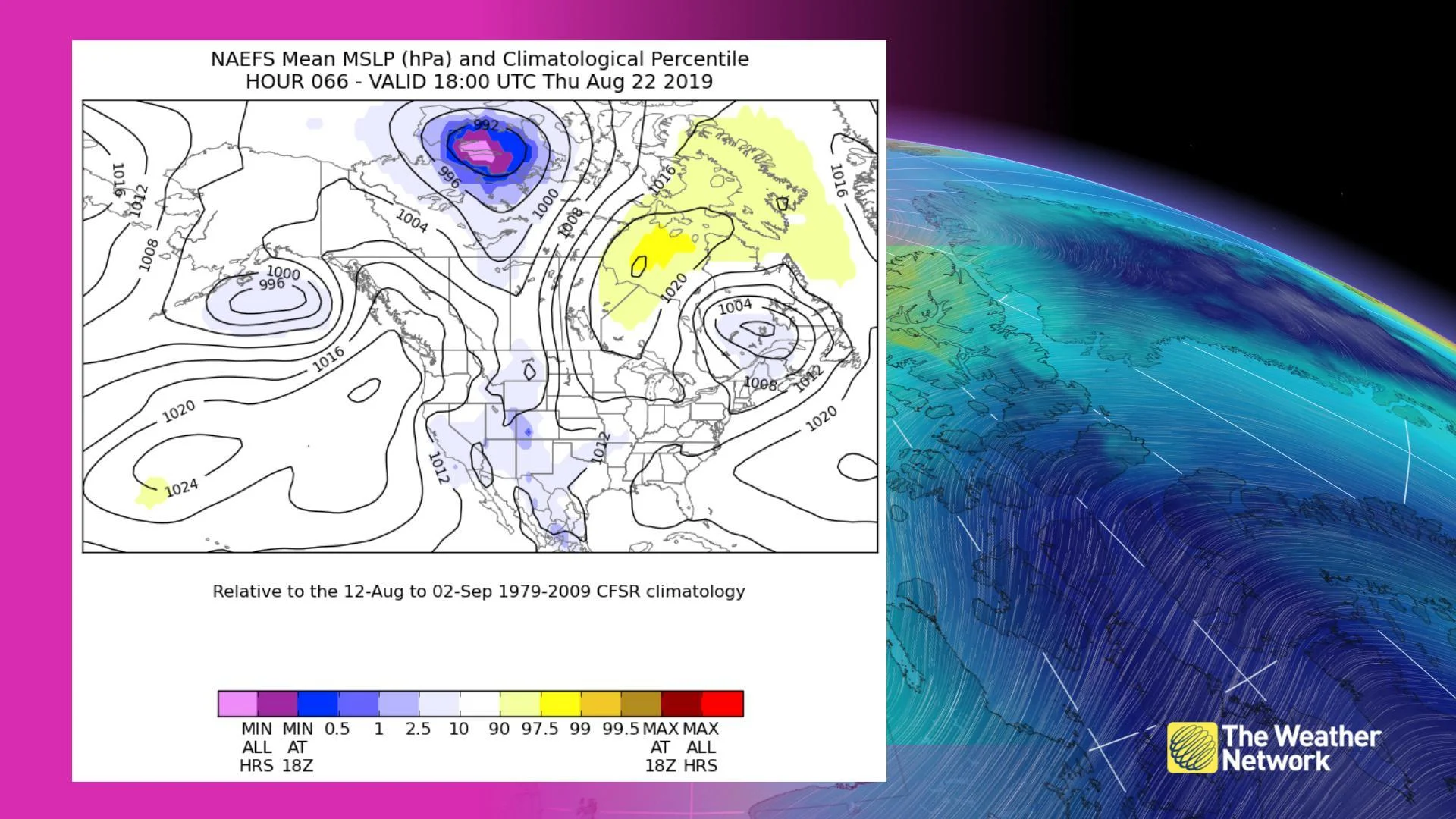
Image courtesy NOAA
The blue and pink blob over northern Canada represents the forecast position of the low pressure centre. The blue indicates atmospheric pressure values at some of the lowest values on record. The pinks show where the pressure is expected to fall out of the range of climatology and near the extreme minimum benchmarks for the August 12th to September 2nd time period. Quite the summer storm; this low would be more typical in late-September or early October.
Strong winds associated with such a robust area of low pressure will spur larger waves -- waves that will be highly effective at breaking up the fragile sea ice during the summer months.
Currently, the arctic sea ice annual minimum is projected to be the second-lowest on record, only behind the 2012 minimum, shown below with the yellow dot marker.
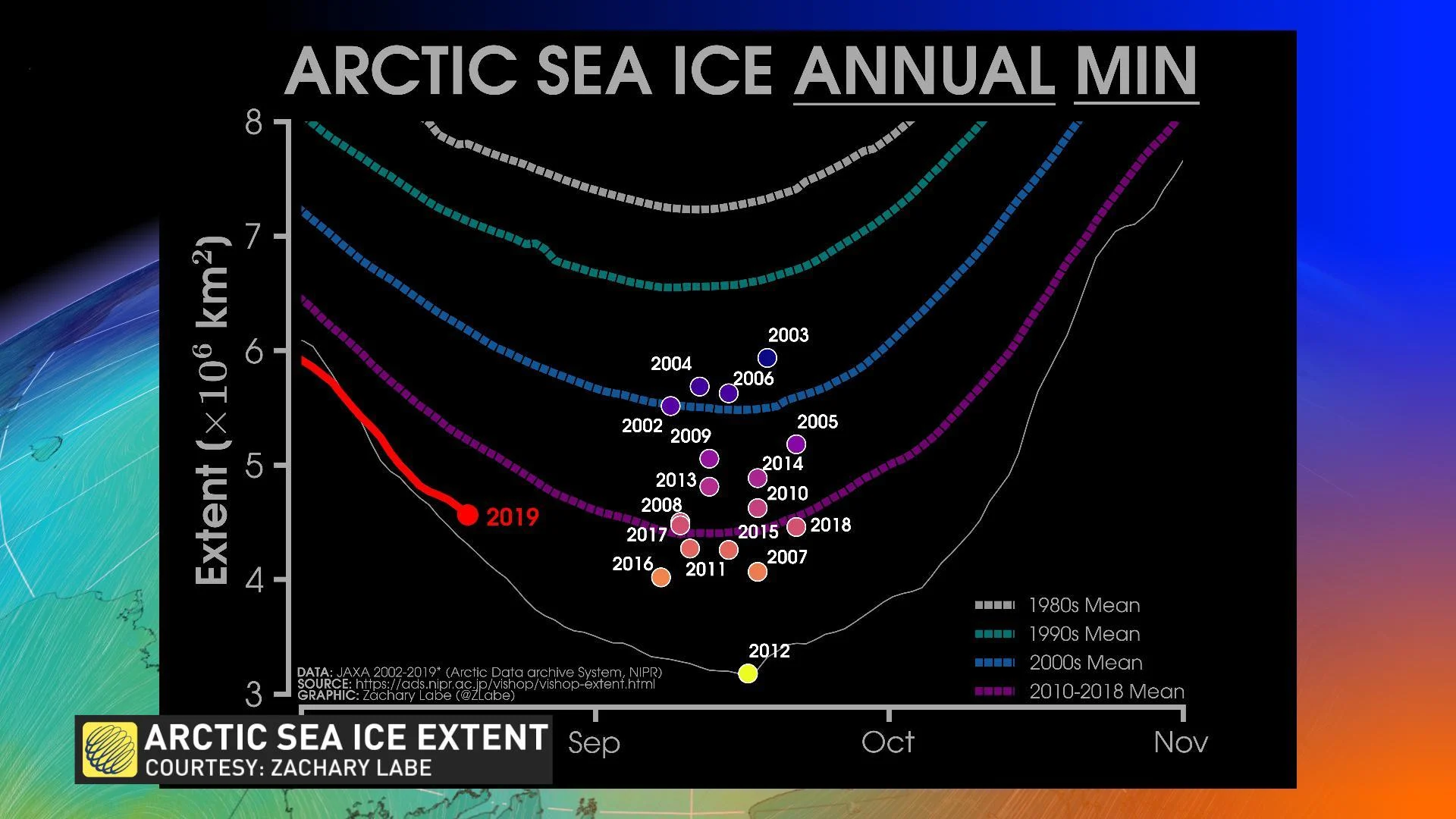
For reference, the current sea ice extent is similar to the 2010-2018 minimum mean, with approximately another three to four weeks of sea ice decline expected before ice starts to rebuild, according to historical trends.