Impactful low pushes through B.C. with copious snow, rain and winds

A storm moving down the B.C. coast will bring heavy rain to lower elevations and heavy snow to the mountains, continuing into Monday, as well as intense wind gusts.
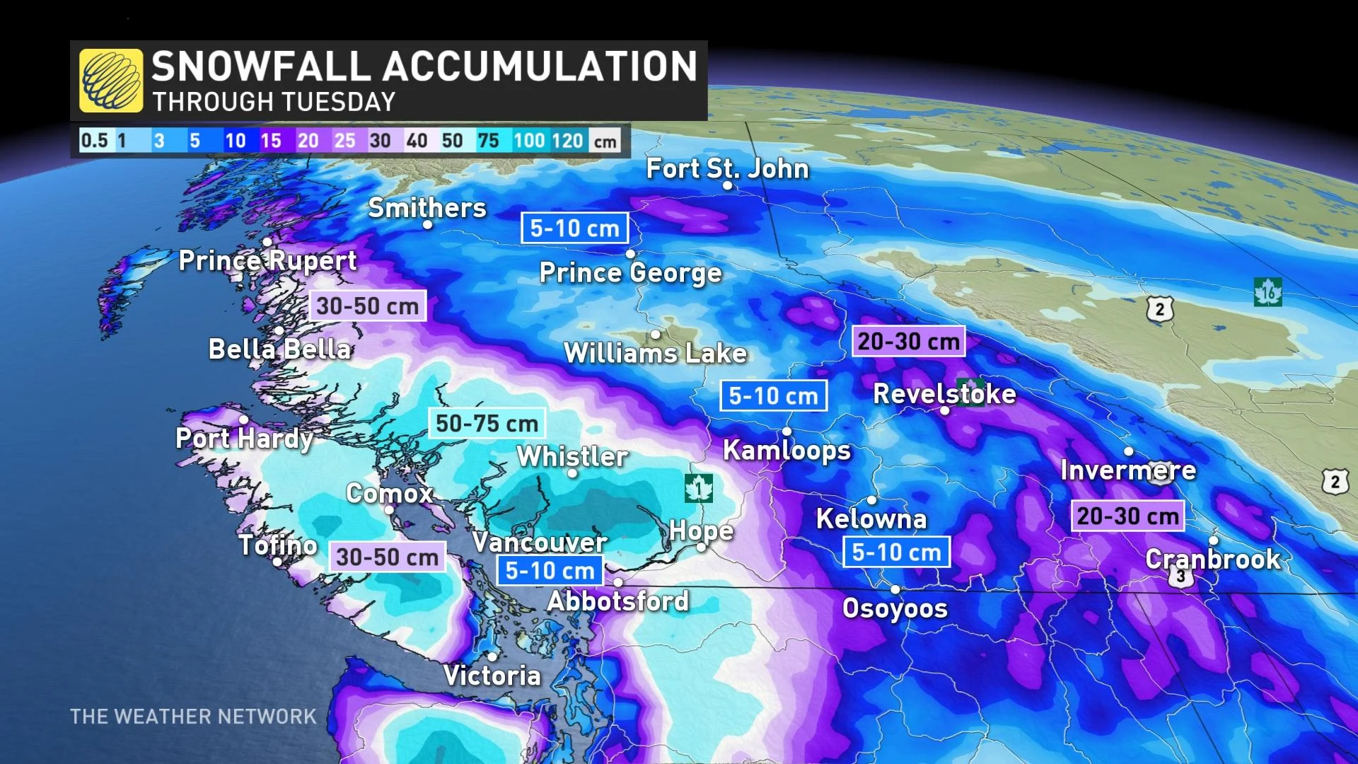
B.C. is in the midst of the impact from a potent Pacific low, with heavy mountain snow, to copious rainfall and blustery wind gusts near the coasts, with effects lingering into Monday. Rainfall amounts along western Vancouver Island could top 100 mm, while some mountain passes may see locally 50+ cm of snow. Winter storm, wind and snowfall warnings are in effect. More on what to expect Sunday and beyond, below.
MONDAY AND BEYOND: STORMY AND WINDY, BUT MILDER
A Pacific low sliding south along the B.C. coast continues to bring a bout of heavy snow, rain and strong winds as the first work week of 2022 beckons.
This system has been flush with warm Pacific air, so even though it began as snow early Sunday for the Lower Mainland, it soon changed over to rain, though some more flakes were possible Monday night.
Southwestern Vancouver Island will be the target of the heaviest rains over the course of this system, with 100+ mm expected. Metro Vancouver, meanwhile, could see 30-50 mm of rainfall, with 20-30 mm for the rest of the Lower Mainland by Tuesday morning.

However, freezing levels are low enough that that Pacific air won't advance too far into the higher elevations, meaning this system's moisture will manifest as VERY heavy snow for the mountains.
As far as the mountain passes go, some 50+ cm of snow is forecast for the Sea to Sky, 15-30 cm forecast for the Coquihalla from Hope to Merritt, and Allison Pass from Hope to Princeton. Winter storm and snowfall warnings were still in effect Sunday night.
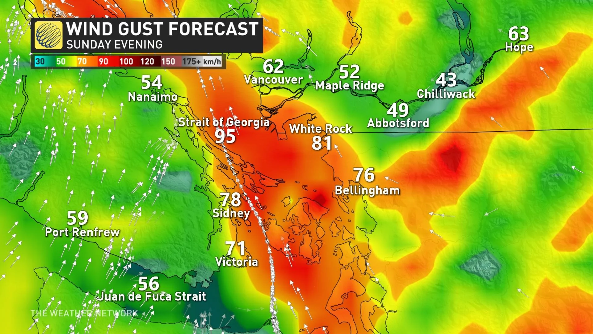
In addition to the rain and snow, winds will be quite intense for the B.C. coast. Southeast winds through the Strait of Georgia will bring wind gusts of 70-90 km/h through the pre-dawn hours Monday. There will be the risk of power outages.
Avalanche terrain should be avoided as the avalanche danger rating will be high through Monday for the South Coast, Vancouver Island and Sea to Sky -- from the alpine to below treeline.
Beyond, an active pattern is expected for most of this week, with the potential for Arctic air to briefly return during the middle of next week. With it, there will be some potential for snow levels to drop back down to near sea level.
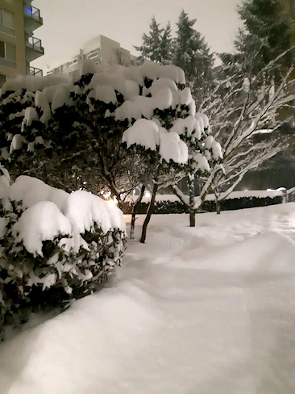
Thumbnail courtesy of Bam Dixon, taken in Burnaby, B.C.
Check back for updates as we continue to monitor this system.