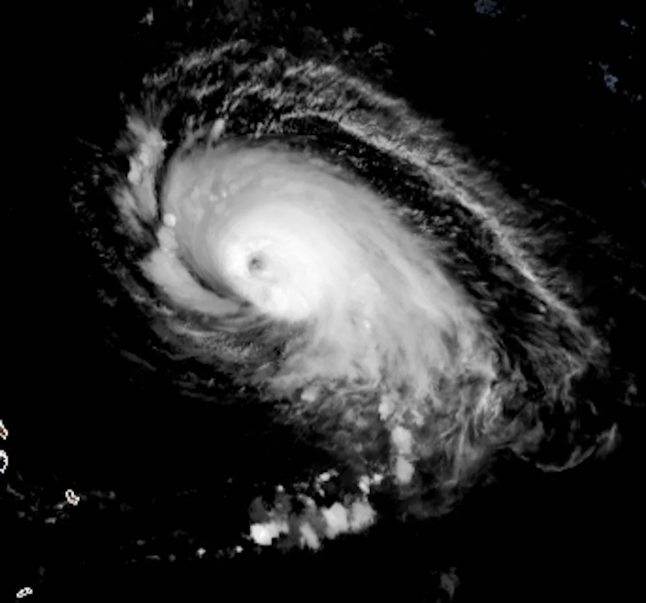
Sam solidifies Category 4 ferocity, prepares to head towards Canada

With Hurricane Larry still on the minds of many on Canada's East Coast, parts of the region are on alert as forecasters eye potential impact from Hurricane Sam into next week.
The warm, open waters of the Atlantic is allowing for Sam to continue its trajectory as a major, Category 4 hurricane. While not posing a threat to land in the short term, forecasters are closely watching its long-range impacts, but the trend is your friend, and odds of direct impacts are slowly decreasing across Atlantic Canada.
MUST SEE: Hurricane season is heating up again. What happens when we run out of names?
As of the Tuesday evening update, the U.S. National Hurricane Center (NHC) said the hurricane was 855 km east of the northern Leeward Islands, moving northwest near 15 km/h. On the forecast track, Sam will pass well to the east or northeast of the northern Leeward Islands through Wednesday.
Sam is staying the course as a major hurricane, regaining its Category 4 status, with maximum sustained winds near 215 km/h and even higher gusts.
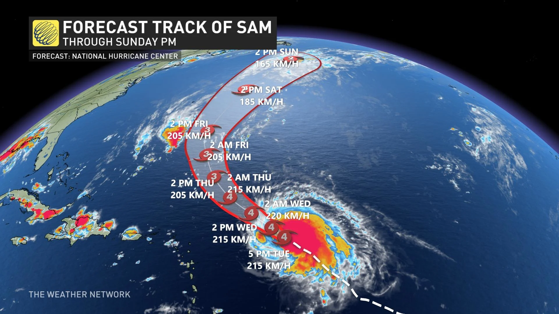
"Some fluctuations in intensity are expected during the next couple of days, but Sam is forecast to remain a major hurricane through late this week," the NHC says.
Swells generated by Sam will impact the Lesser Antilles for the next several days. Swells are expected to reach Bermuda and the Bahamas in a couple of days, and then spread to the United States East Coast late this week. These swells could cause life-threatening surf and rip current conditions.
CLOSELY EYEING CANADIAN IMPACT, NEWFOUNDLAND ON ALERT
Sam is being watched closely for potential Canadian impacts, especially with the damage recently caused in Newfoundland by Hurricane Larry.
"The most likely scenario is that Sam will track well south and east of Newfoundland. This track would bring dangerous ocean conditions to the region, but minimal impacts to land with just rain showers and gusty winds possible," says Dr. Doug Gillham, a meteorologist at The Weather Network. "However, this is still 5-6 days away (Sunday-Monday) and it is too early to rule out a more westerly track and possibly even a track into Newfoundland."
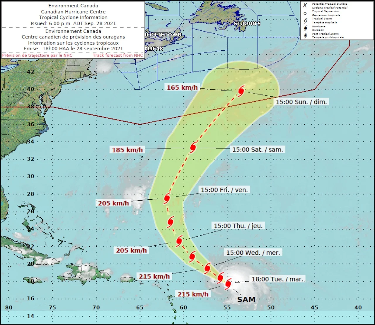
(Canadian Hurricane Centre)
In a lower probability scenario that would bring Sam into Newfoundland, torrential rains and a risk for hurricane-force winds would be on the table for the region.
RELATED: Hang on safely through the Atlantic hurricane season with these tips
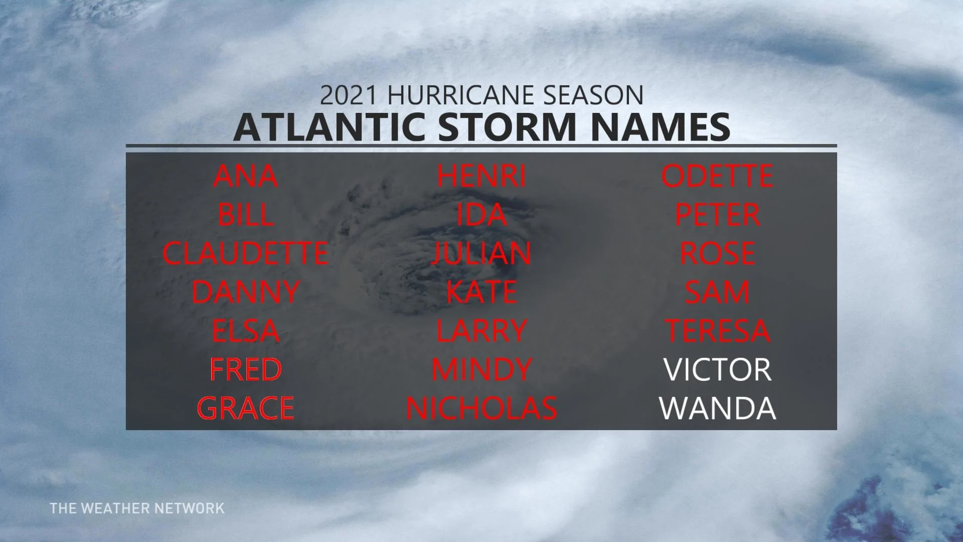
Besides Sam, forecasters are monitoring two more systems in the eastern Atlantic.
Both are expected to organize and develop into tropical storms this week, ultimately being named Victor and Wanda, which would complete the main list of 2021 names. These storms are starting further to the south, but it currently looks like both of these storms will quickly turn to the north and not have an impact on North America.
Meanwhile, the remnants of Peter continue to meander in the central Atlantic with a moderate (30 per cent) potential to redevelop, but not currently posing a threat to land.
Sam is the seventh hurricane of the 2021 Atlantic season. Hurricane season traditionally runs from June 1st to Nov. 30, with substantial flexibility on either side of that range.
Thumbnail courtesy of NOAA.
Be sure to check back for the latest updates on the Atlantic hurricane season.