Hurricane Larry threatens U.S., Canada with large, dangerous swells

The U.S. and Atlantic Canada could see 'life-threatening' conditions from the significant swells caused by Hurricane Larry. It has the potential to trek south of Newfoundland as a Category 1 hurricane or intense post-tropical storm.
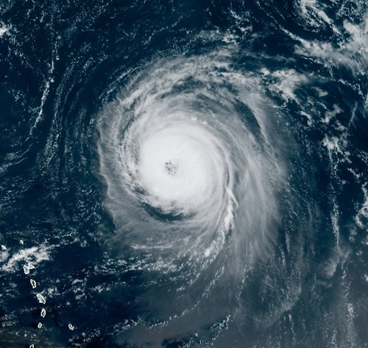
Forecasters continue to keep a close eye on Hurricane Larry, churning in the mid-Atlantic and taking a path that may take it near the North American mainland.
The U.S. National Hurricane Center (NHC)'s Monday evening update says Larry's maximum sustained winds have increased slightly after an early-day dip, now at 205 km/h with higher gusts – still a high-end Category 3. Some fluctuations in intensity are possible during the next couple of days. Thereafter, some gradual weakening is forecast.
The NHC also states Larry will continue moving across the central Atlantic and will approach Bermuda by late week, likely as a high-end Category 2 hurricane. This means that the island could see howling winds, heavy rain, and coastal flooding.
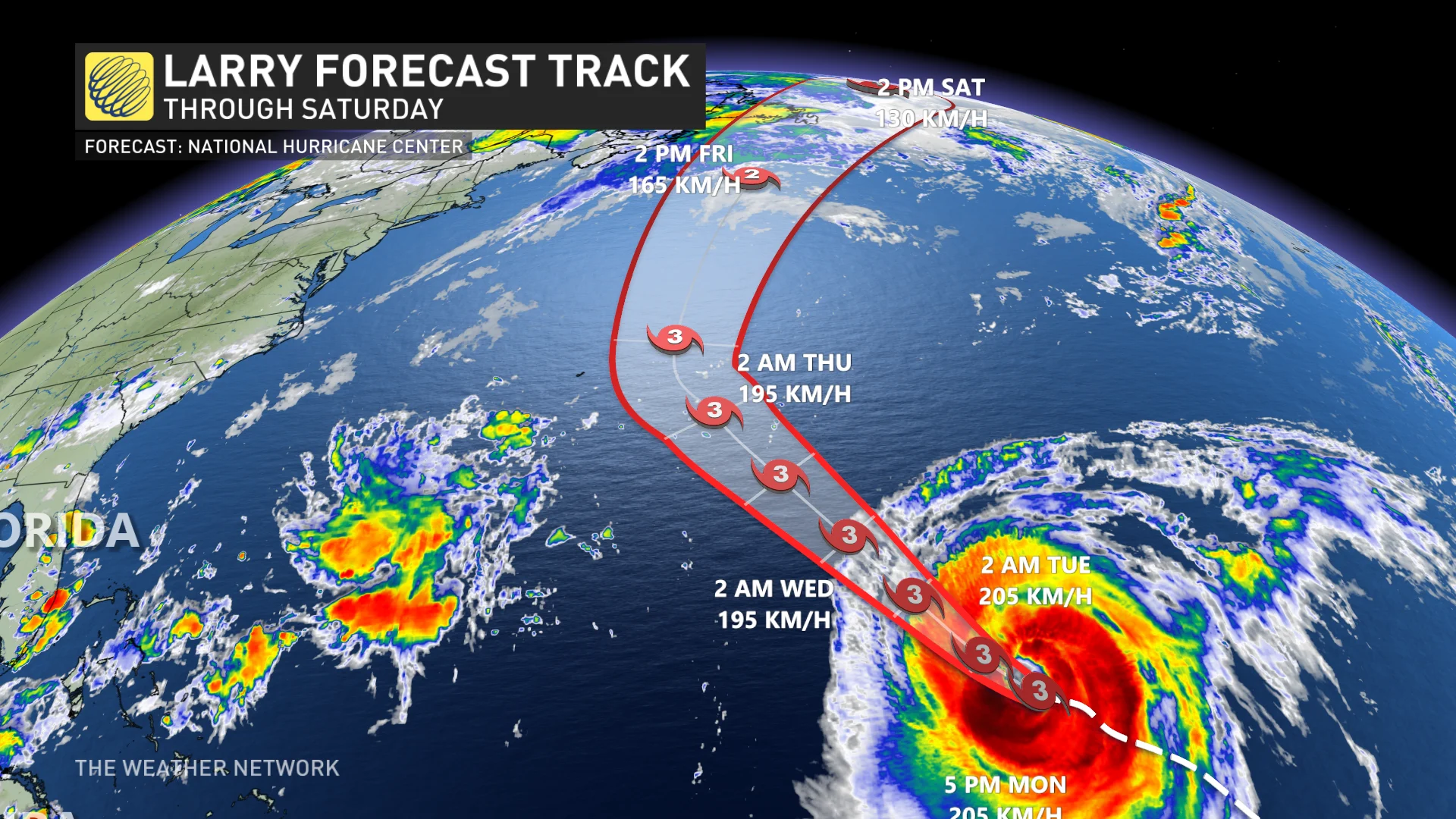
The storm is so powerful that swells generated by Larry will spread westward to portions of the Greater Antilles, the Bahamas, and Bermuda on Monday and Tuesday. Tropical storm-strength winds could reach Bermuda by Thursday.
Significant swells should reach the East Coast of the United States mid-week and Atlantic Canada on Thursday, continue affecting these shores through the end of the week.
“These swells are likely to cause life-threatening surf and rip current conditions,” the NHC warns.
TROPICAL CYCLONE STATEMENT ISSUED
The Weather Network meteorologists are monitoring the potential impacts that Larry could bring to Newfoundland by Friday or this weekend as it tracks into the North Atlantic.
Environment and Climate Change Canada (ECCC) has issued a tropical cyclone statement, but the agency says it is still very early to say for certain whether Larry will directly influence weather in Newfoundland. The probability of this is about 25 per cent at this stage.
The agency warns there is the potential for Larry to skirt south of the island as a Category 1 hurricane or intense post-tropical storm.
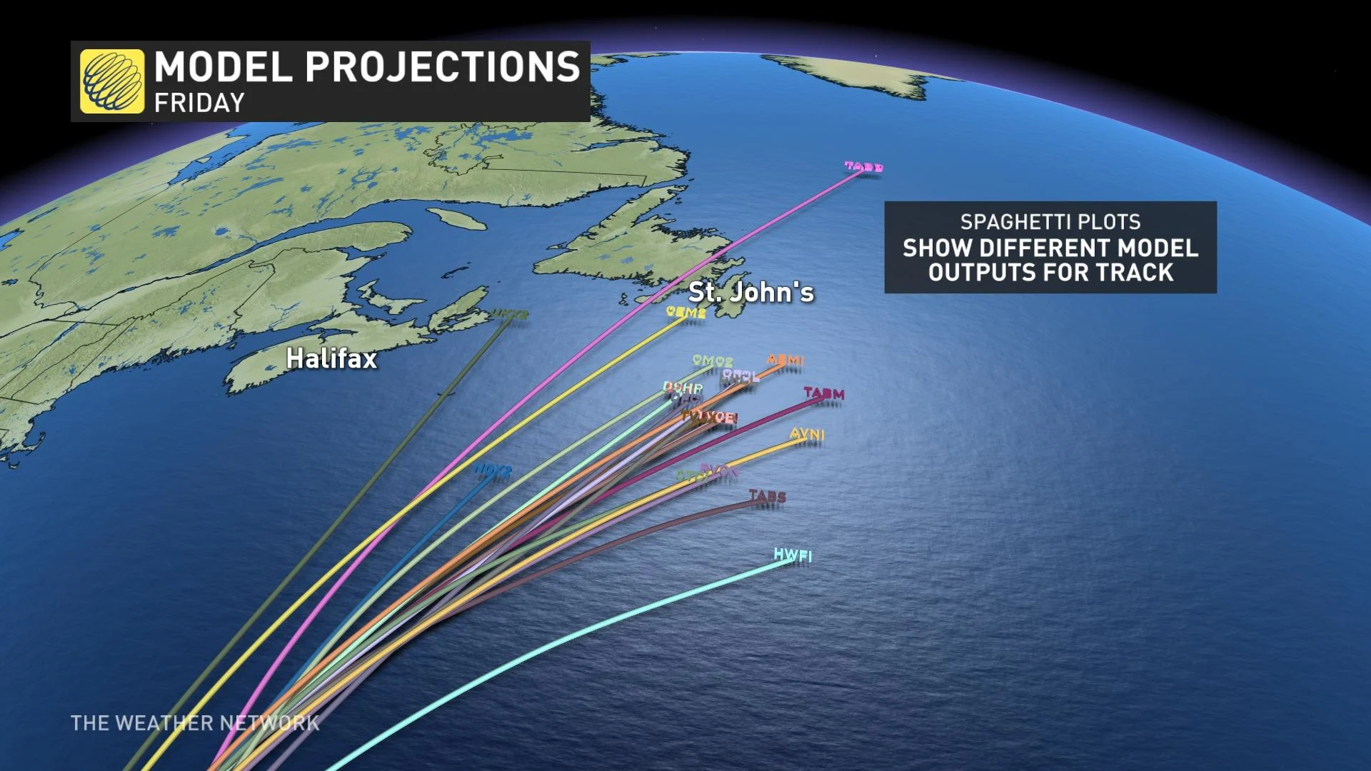
"Weather models since Friday have been consistently predicting Hurricane Larry to move northward to the east of Bermuda then tracking northeastward thereafter. About 90 per cent of these models are predicting the centre of the storm to track south of Newfoundland across the Grand Banks as a strong Category 1 hurricane or intense post-tropical storm," ECCC says in the statement.
As well, large ocean waves stirred up by Larry will arrive along the Atlantic coast of Nova Scotia and southern Newfoundland Thursday. These waves will be particularly large on Friday, presenting a hazard to those close to the water.
Currently, the most likely scenario is for Larry to recurve out to sea and just clip southeastern Newfoundland, though still with a major impact potential on shipping and fishing with dangerous waves.
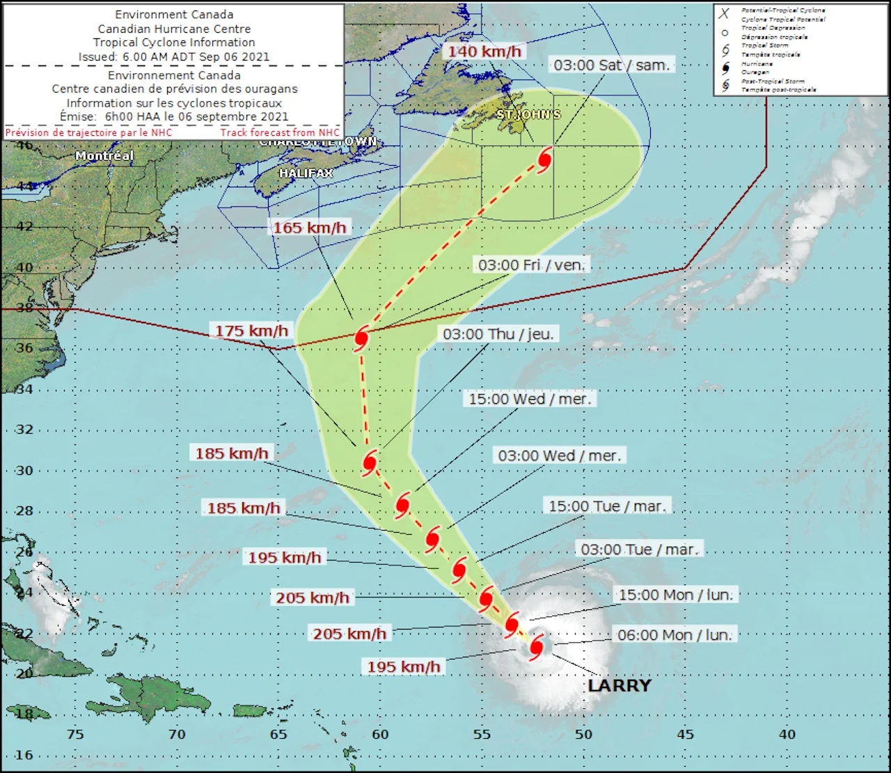
(Canadian Hurricane Centre)
However, there are some computer models that also show a risk for Larry’s track to be close enough to bring strong winds and heavy rain to parts of Newfoundland, especially the Avalon, this weekend.
Regardless of its eventual impacts, Larry will continue to be a powerful storm as it tracks into the North Atlantic, with very dangerous waves extending a long way out from the track of the storm.
Though Larry is still several days distant, people in Atlantic Canada should start taking an interest in its progress beginning this week.
A LOOK AT THE CURRENT HURRICANE SEASON
The Atlantic hurricane season took off with force in May and June, but there was somewhat of a lull throughout the month of July as the stormy impacts came to a bit of a halt. Tropical storm activity picked up in full intensity once again during August, with forecasters still calling for an above average season that's set to peak September 10 and last right through November.
"After a record-setting start, the Atlantic 2021 hurricane season does not show any signs of relenting as it enters the peak months ahead," said NOAA administrator Rick Spinrad in the updated hurricane forecast released last month.
The latest outlook reflects that the number of expected named storms with winds of 62 km/h is 15-21, including 7-10 hurricanes (winds of 119 km/h or greater), of which 3-5 could become major hurricanes (Category 3, 4, or 5 with winds 178 km/h or greater). The forecast is a slight increase from the one NOAA released in May.
IDA IMPACTS
The most recent and devastating impacts have been felt over this past week with Ida, as the Category 4 hurricane made landfall over Louisiana last Sunday, with wind gusts upwards of 275 km/h. Though later losing its tropical characteristics, Ida's remnants went on to trigger catastrophic rainfall and flooding in the U.S. Northeast before crossing into Canadian waters and dumping 100+ mm of rain over one day in the Maritimes.
Thumbnail courtesy of NOAA.
Stay tuned to The Weather Network for the latest forecast updates on Larry.