Howling, 70-100 km/h winds ramp up in B.C., power outages reported

Damaging winds, gusting up to 100 km/h at their strongest, and still strong across more populous areas of the B.C. coasts, putting a big strain on the province's power grids. Meanwhile, snowfall warnings are in effect for some of the high mountain passes, with accumulating snow set to make travel difficult.
WEATHER HIGHLIGHTS
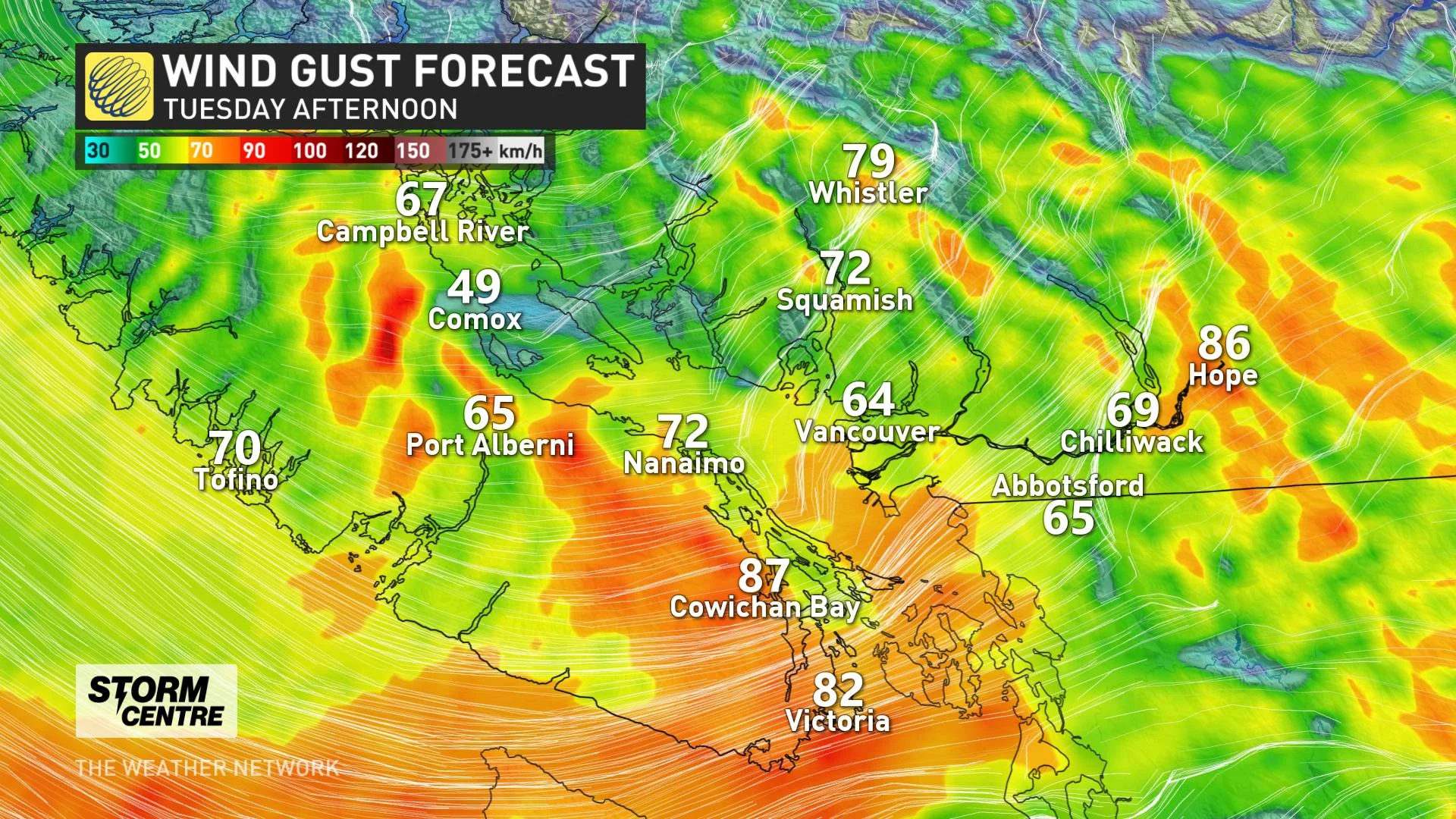
Winds peaked Tuesday afternoon and evening, gusts up to 100 km/h for western Vancouver Island, 70-90 km/h for southern Vancouver Island, 50-70 km/h for Metro Vancouver
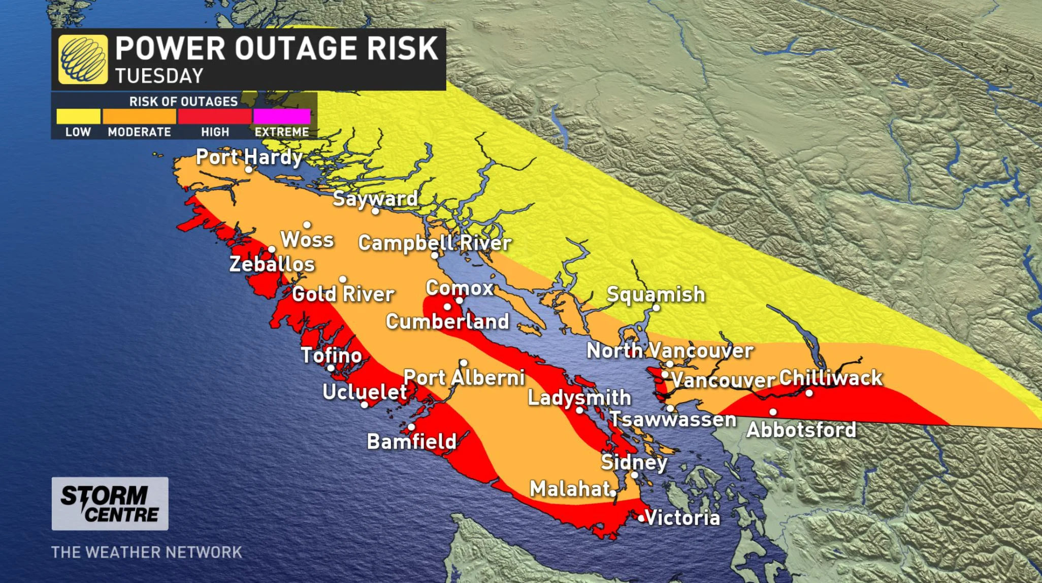
Moderate-to-high risk of power outages in Vancouver Island
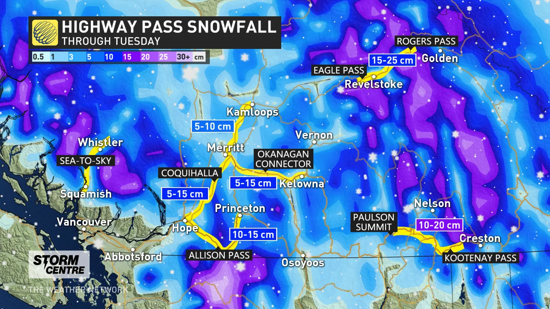
5-15 cm of snow for mountain passes
Power outage updates can be found here
TUESDAY: POTENTIALLY DAMAGING WINDS, POWER OUTAGES POSSIBLE
A strong low-pressure system is to blame for the incoming winds, which were already intensifying in the early morning hours of Tuesday. By the afternoon and evening, they will be at peak strength, particularly along western Vancouver Island, where gusts could reach 100 km/h.
Those will be the strongest from this system, but the expected peaks won't be too far off elsewhere: 70-90 km/h for southern Vancouver Island and 50-70 km/h for areas of Metro Vancouver nearest the coast, diminishing further inland.
Aside from likely causing ferry and flight delays or cancellations, these winds are strong enough to make widespread power outages a real possibility, particularly given most trees still have most of their foliage, and the ground will be somewhat loose from the regular rounds of rain over the past few days.
“Previous lows of this intensity have knocked tens of thousands of customers off the power grid. Parts of the South Coast are particularly vulnerable to power outages with fall foliage hanging on in early October,” Weather Network meteorologist Tyler Hamilton says.
This system has been bringing rain to the region as well, winding down just as the winds will be intensifying, but amounts won't be out of the ordinary compared to the deluges of late last week.
More impactful will be the snow. Temperatures are such that freezing levels are sitting comfortably at around 1,000 metres Tuesday, meaning significant accumulations for some of the mountain passes, even as Interior communities will see little more than a few flakes.
WATCH BELOW: MIA GORDON BREAKS DOWN BIGGEST THREATS FROM THIS SYSTEM
Snowfall warnings are in effect for Highway 3 - Paulson Summit to Kootenay Pass, Trans-Canada Highway - Eagle Pass to Rogers Pass, and Okanagan Connector - Merritt to Kelowna.
MUST SEE: Snow piles up during Thanksgiving weekend in parts of B.C.
BEYOND: UNSETTLED TREND CONTINUES
Beyond the long weekend, cooler and unsettled weather is expected to continue into mid-week, with daytime highs consistently in the mid-teens. However, forecasters are watching the potential for a period of warmer and drier weather during the second half of the coming week.
WATCH BELOW: A DEEPER LOOK INTO WHAT VANCOUVER ISLAND CAN EXPECT
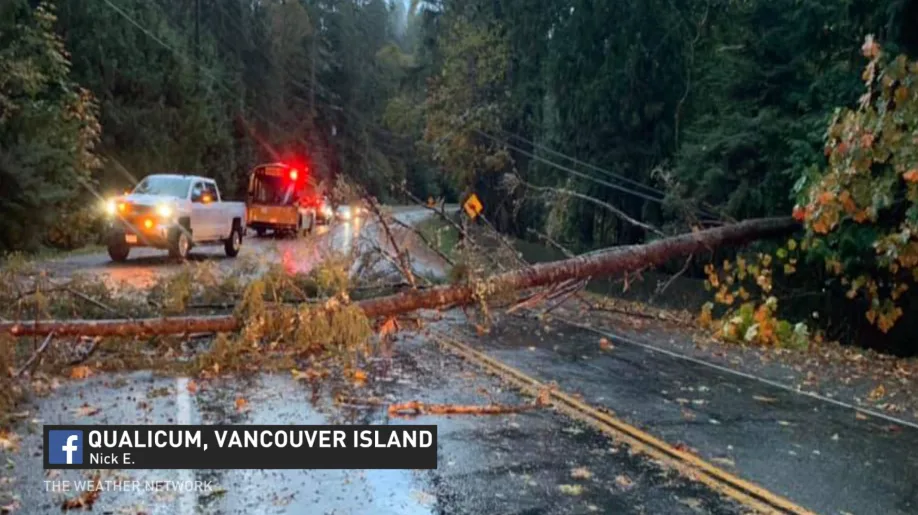
Thumbnail courtesy of Nick E. via Facebook