How vivid thundersnow stole the show in Toronto's big snowstorm

The most memorable snowstorm of the season hit southern Ontario on Friday night, but the snow took a backseat to the real showstopper.
The major March snowstorm that blew through southern Ontario will forever live in the region’s weather legend—but for an unexpected reason.
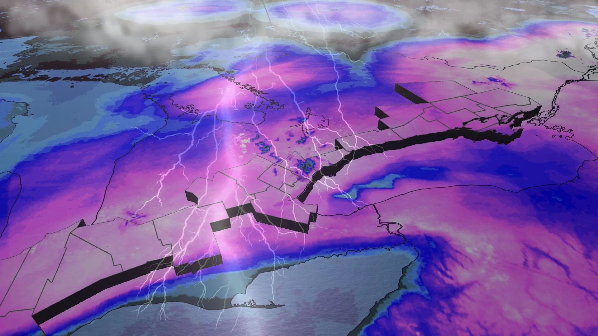
Arguably the snowstorm of the season, this fast-moving wintry blast dropped 20-30 cm of wet, wind-driven snow on the Greater Toronto Area on Friday night. But the snow itself took a backseat to the vivid display of lightning and thunder that rocked the area.
PHOTOS: Winter storm illuminates skies and buries roads in Ontario
Hundreds of lightning strikes lit up the sky across southern Ontario during the storm’s peak late Friday evening, sending folks throughout the region racing to the window with amazement at the rare sight unfolding outside.
The roots of this unforgettable event grew from the heart of a historic storm that broke longstanding records for its unusual ferocity.
A historic setup aimed squarely at southern Ontario
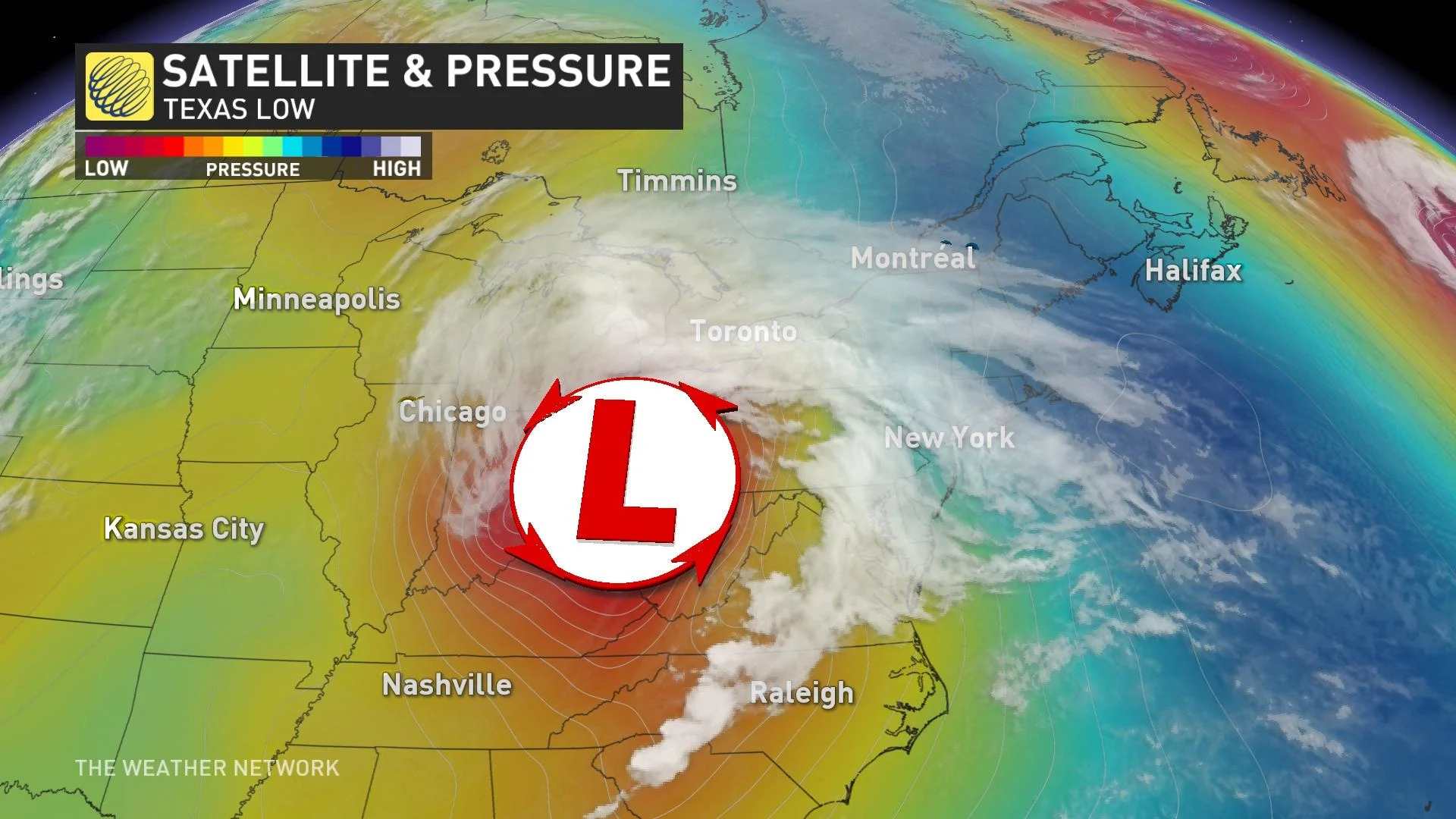
A powerful Texas low developed over the southern United States on Wednesday, taking advantage of a volatile pattern that brought rare wintry weather to California just days earlier.
Winds roaring through the upper levels of the atmosphere crash together and spread out as they twist and turn through the jet stream. When these winds spread out, or diverge, at high speeds, it leaves a major void in the upper levels that air from the surface has to rush upward to fill.
DON’T MISS: ‘Weather bombs’ are explosive storms that create ferocious conditions
This process leaves less air, and a centre of low pressure, at the surface. Stronger and longer-lasting divergence creates stronger and more impactful low-pressure systems.
As the low-pressure system developed amid such a favourable setup for rapid intensification, it sparked multiple rounds of deadly severe thunderstorms that produced high wind gusts, hail as large as baseballs, and several destructive tornadoes throughout the southern states.
The storm system reached its peak strength over the Ohio River Valley on Friday, potentially shattering the record for the lowest air pressure readings ever measured in seven cities, including the cities of Louisville, Paducah, and Bowling Green in Kentucky.
All that energy moved toward the Great Lakes on Friday night, setting the stage for southern Ontario’s epic bout of thundersnow.
WATCH: 'The night of thundersnow'; Winter and spring clash over Ontario
Intense dynamics triggered a wintertime thunderstorm
The dynamics within such an intense and impressive low-pressure system don’t stop in the upper levels of the atmosphere. Winds swirling around the low itself have a major influence on the weather we experience here on the ground.
MUST SEE: After the storm report card: How our Ontario snowfall forecast fared
Winds were ripping along at more than 100 km/h just a few kilometres above the surface as the low neared the eastern Great Lakes and snowfall rates picked up across southern Ontario.
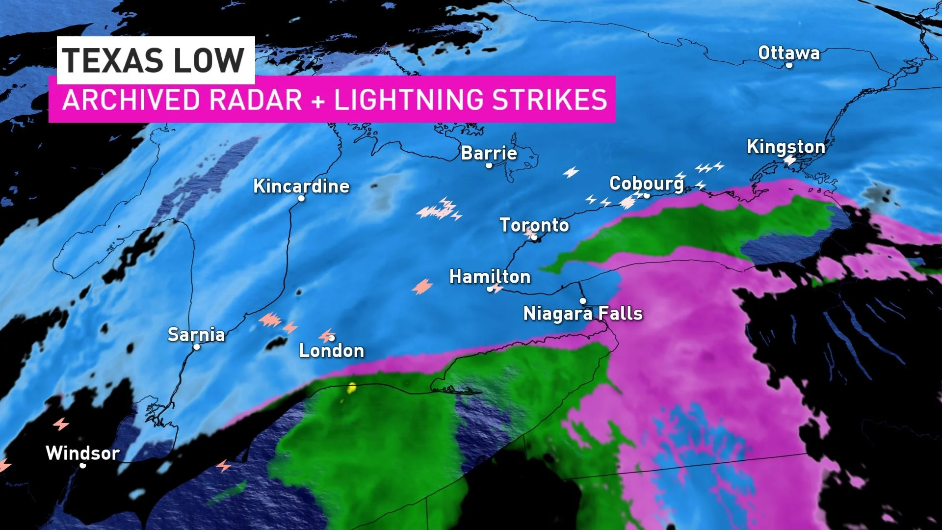
Air doesn’t move in a perfect circle around a centre of low pressure. As a result, the strong winds of a powerful low are always pushing against the atmosphere around the storm. This effect is greatest on the northwestern edge of a storm—right where southern Ontario wound up on Friday night.
As the strong winds of this vigorous storm pushed against the air over southern Ontario, the winds spread out and stretched the atmosphere over the region. Just like we saw earlier, that divergence and stretching caused a void that air had to rush upward to fill.
This intense upward motion over southern Ontario had a similar effect to the lift of a strong cold front or stout lake breeze, creating intense bands of convective snow over the region.
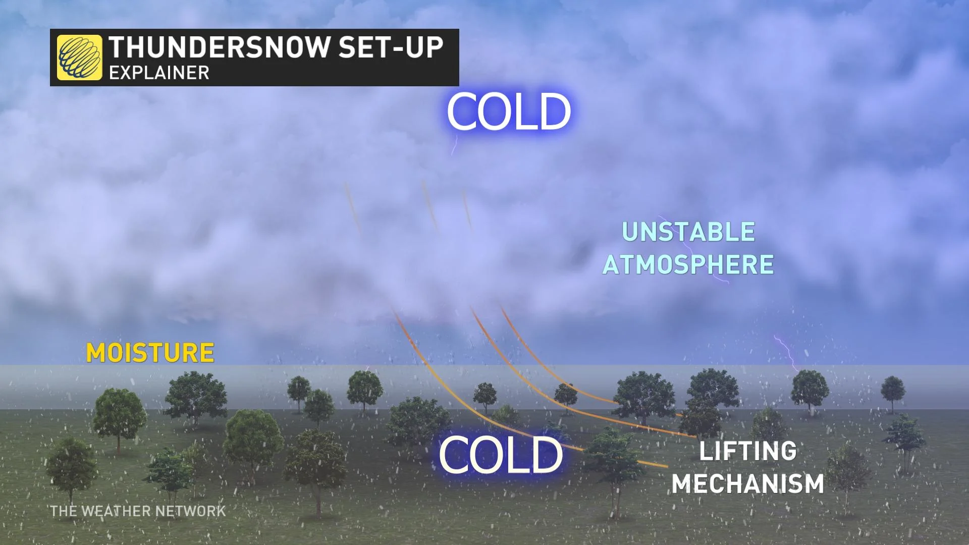
The convection grew so intense that what residents experienced was essentially a lively wintertime thunderstorm, producing heavy snowfall (in lieu of torrential rains), vivid lightning, and loud claps of thunder.
Thundersnow is relatively rare to begin with. It takes lots of key ingredients lining up just right for such an intense thundersnow event to occur over such a wide area. Folks who experienced the core of this storm on Friday night witnessed something they could go decades without ever seeing again.


