
Stormy Sunday likely for some as cold front crashes across Ontario

Sunday looks to be another hot and muggy day for southern Ontario. A cold front will send temperatures falling—but not without a risk for afternoon thunderstorms.
--
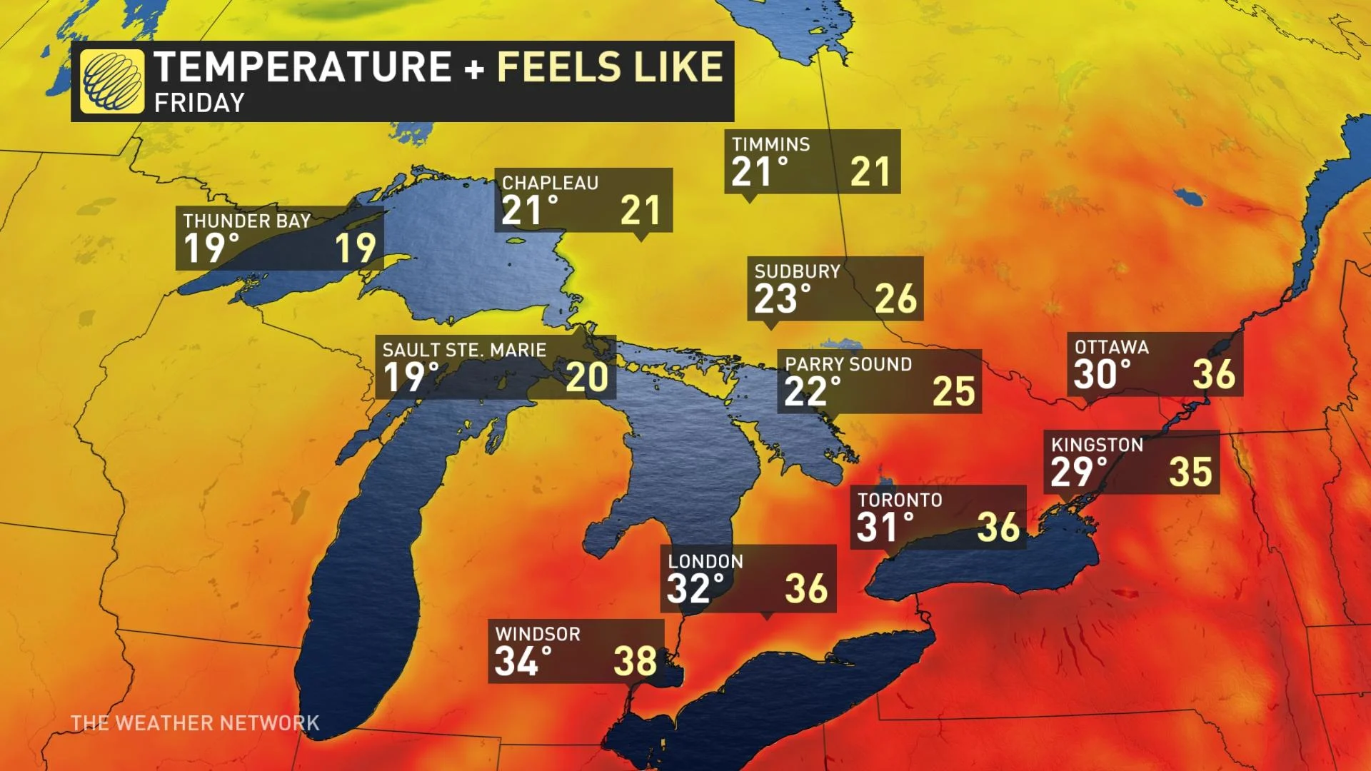
Sunday looks to be another hot one across southern Ontario as heat and humidity build across the province once again. A cold front will crash the summer party, though, and bring with it a chance for hit-or-miss storms throughout the region. Some relief from the muggy air will settle in for Monday. More on what you can expect Sunday and beyond, below.
DON'T MISS: The best fans to make it through summer heat waves
THIS WEEKEND: HEAT AND STORM RISK RISES
Heat warnings remain in effect through the day on Sunday for Toronto, Mississauga, Brampton, Windsor, Leamington, and Essex County as hot temperatures and high humidity build across the region. Daytime highs will climb into the low 30s for most of the area.
A cold front sagging south across the province will bring the opportunity for scattered showers and thunderstorms through the latter half of the day.
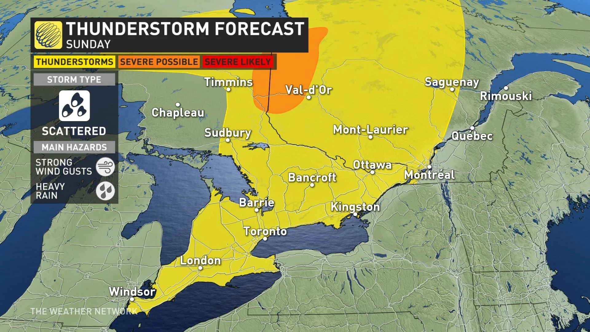
Sunday won’t be a washout by any means, and not everyone will see a storm, but the front plowing into the muggy air will create a risk for pop-up storms here and there.
Expect the risk of thunderstorms to bubble up around noon, continuing into the evening as the front pushes through.
Any thunderstorms that pop up could produce locally heavy rainfall and strong wind gusts.
While storm activity will be scattered across southern Ontario, we’ll see more widespread activity across cottage country and into northern Ontario. The greatest chance for organized severe weather will fall across far northern Ontario toward James Bay.
TIPS FOR HEADING OUTSIDE IN THE HEAT
--
LOOK AHEAD: REPRIEVE FROM HEAT AS TEMPERATURES COOL OFF, BUT COULD RETURN FOR CANADA DAY
Temperatures and humidity levels will both fall behind the front, leading to a much more comfortable Monday for southern Ontario.
Cooler weather will linger through early next week, with temperatures coming in several degrees below seasonal. Daytime highs will fall into the low 20s to start the last week of the month.
Temperatures will then trend closer to near seasonal for the middle of next week with a risk for thunderstorms.
Forecasters are also watching the potential for one or two days of hot and humid weather late week, including on Canada Day. Heat is most likely for southern Ontario but there is lower confidence for the Ottawa Valley.
However, an approaching cold front is expected to bring a threat for thunderstorms followed by cooler weather for the rest of the long weekend.
Stay tuned to The Weather Network for the latest forecast updates for Ontario and Quebec.