Screaming winds set to rattle Atlantic Canada into Saturday

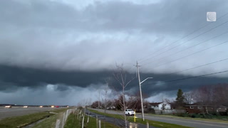
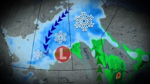
The system responsible for a historic, continent-wide cold snap and widespread blizzard conditions in Ontario will make its presence known across Atlantic Canada heading into the long weekend as howling winds and a sloppy mix of rain, snow, and ice blanket the region.
MUST SEE: Far-reaching storm sweeps North America, impacting millions ahead of Christmas
Every community in the Maritimes is under a wind warning through at least Saturday. Rainfall warnings are in place for most of Nova Scotia and New Brunswick, while snowfall warnings are up for parts of northern New Brunswick and the Gaspé Peninsula.
Expect hazardous travel during the storm, especially across areas expecting snow or ice. Remain mindful that flight cancellations or delays are likely due to winds and bad weather affecting major hubs like Toronto and Montreal.
RELATED: WestJet cancels flights out of B.C. and Ontario due to winter storms
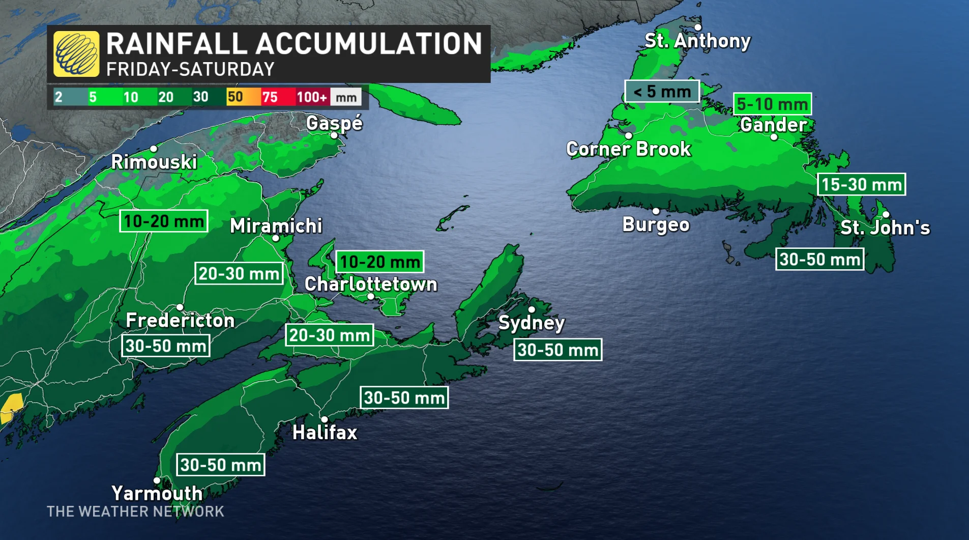
Heavy rain will continue across the Maritimes Friday night into Saturday morning as the system sweeps across the area. Wintry precipitation remains possible in northern New Brunswick and Quebec’s Gaspé Peninsula.
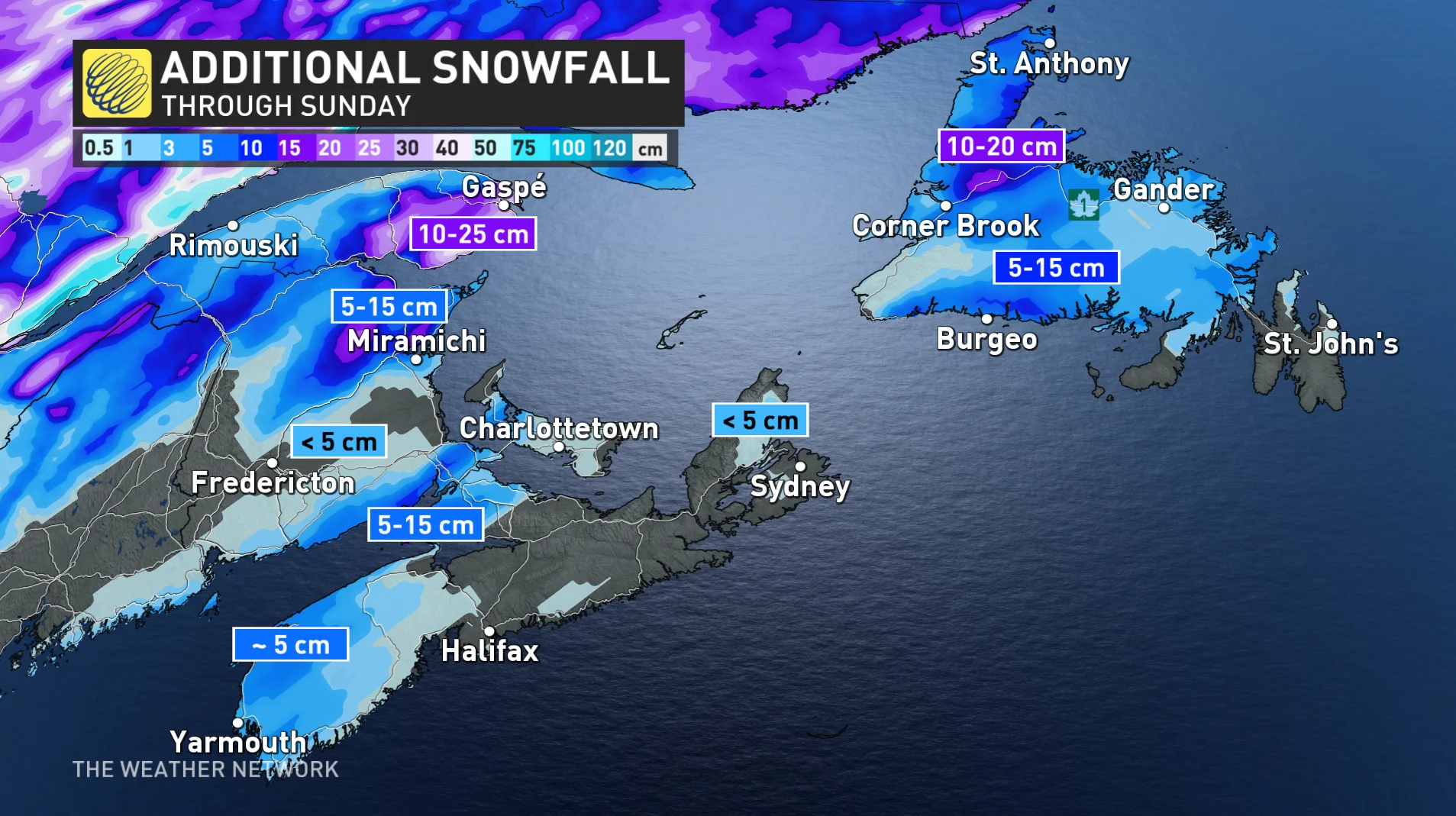
Precipitation will reach Newfoundland early Saturday morning, starting out as snow or freezing rain before gradually changing over to rain as warmer air wins out. Significant ice accretion is possible for western and central Newfoundland before the changeover to rain. Showers will continue across the island into Christmas Day on Sunday.
Port aux Basques, a region still rebuilding and cleaning up after post-tropical storm Fiona, is under a storm surge warning.
"Storm surge warnings are issued when water levels pose a threat to coastal regions," Environment and Climate Change Canada (ECCC) said in the warning, stating that high storm surge levels and large waves are expected to impact the coast in south facing shorelines from Burgeo to Port aux Basques.
Forecasters expect rainfall totals of 30-60 mm for southwestern New Brunswick, Nova Scotia, and southern Newfoundland.
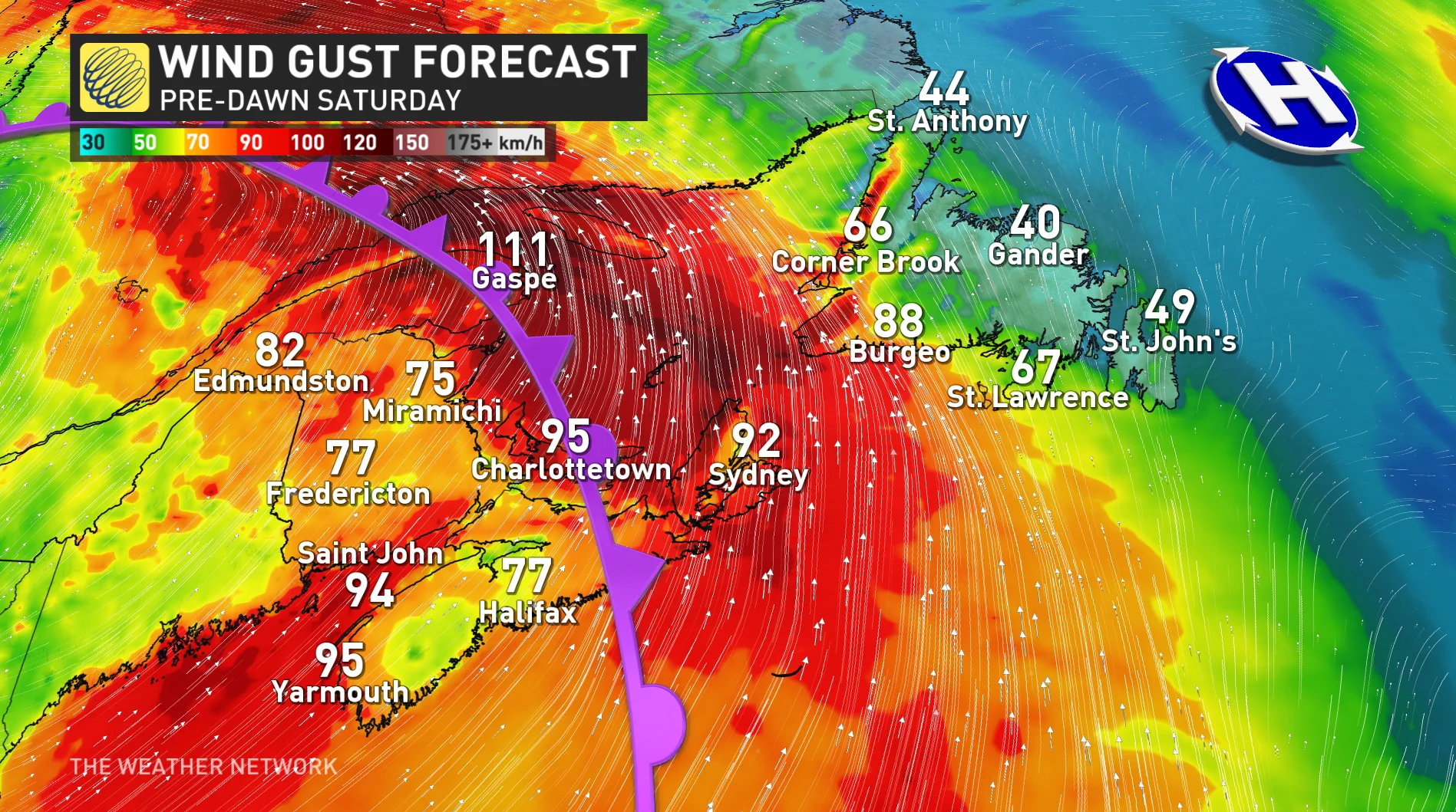
Winds across the Maritimes will gust to 80-100+km/h overnight into Saturday, especially along the coastline. Some localized power outages are possible.
The heaviest snow will remain over Quebec’s Gaspé Peninsula, where forecasters expect 25-50 cm of snow through the weekend. Northern New Brunswick could wind up with 15-30 cm of snow by the end of the storm. Western Newfoundland could see 10-20 cm of snow before the changeover.
The only bright spot through this storm is that the East Coast will largely miss out on the tremendous temperature swing that much of the rest of eastern North America will experience as a result of this storm.
Warm air surging north ahead of the system could send Friday’s high temperatures into the lower teens across Nova Scotia.
Readings will fall behind the storm as cooler air moves into Atlantic Canada, with several days of cooler-than-seasonal temperatures expected. Conditions will turn mild again by New Year’s Eve.
Stay tuned to The Weather Network for the latest forecast details for Atlantic Canada.