Thunderstorm risk in Ontario on Thursday as humidity decreases

The heat and humidity will once again increase again and make for more uncomfortable conditions.
There will be a lingering risk of thunderstorms in southern Ontario on Thursday, however, any storms that do occur are expected to be non-severe in nature. A high pressure system will track into the region and will create relatively calm conditions before the heat and humidity soar this weekend. Details and timing, below.
WEATHER HIGHLIGHTS:
Lingering, isolated storms possible Thursday
Humidity, temperatures on the rise, reaching uncomfortable levels by the weekend
Keep an eye on weather ALERTS in your area
THURSDAY: LINGERING, BUT ISOLATED STORM RISK
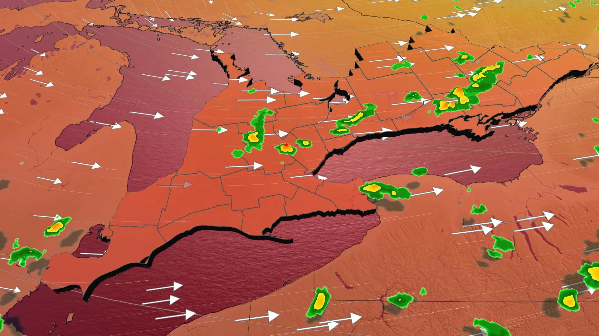
A trough trailing behind Wednesday's cold front may spark pop-up, isolated but non-severe thunderstorms in southern Ontario on Thursday afternoon.
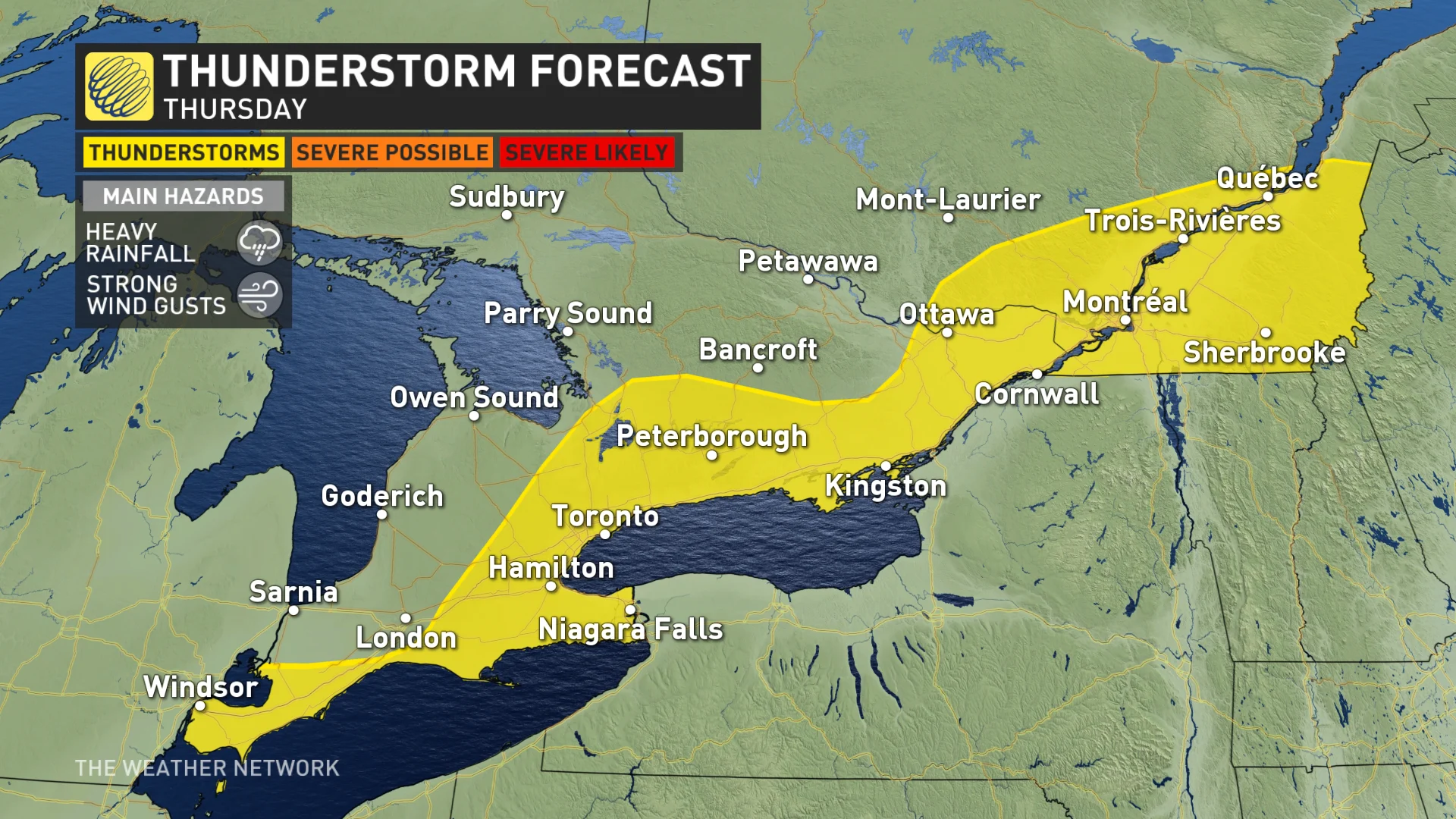
The threat will stretch from southwestern Ontario through to southwestern Quebec. Any storms that do develop may bring heavy rainfall and strong wind gusts.
Temperatures will remain nearly unchanged, though slightly less humid. Daytime highs will stay in the mid- to upper-20s for most locales in the south, with humidex values in the low 30s.
LOOK AHEAD: WEEKEND HEAT, HUMIDITY
The Weather Network meteorologist Tyler Hamilton says that a high pressure system will track into southern Ontario on Friday, which will create calm conditions and an absence of thunderstorms. However, southwestern regions could see a few scattered showers. Daytime highs and humidex values will hover around the same marks as on Thursday.
By the weekend, however, the heat and humidity will increase again, making for more uncomfortable conditions. Daytime highs are expected to hit or exceed the 30-degree mark Saturday throughout the south and humidex values will reach the low 40s this weekend as a giant upper high heats most of the continent.
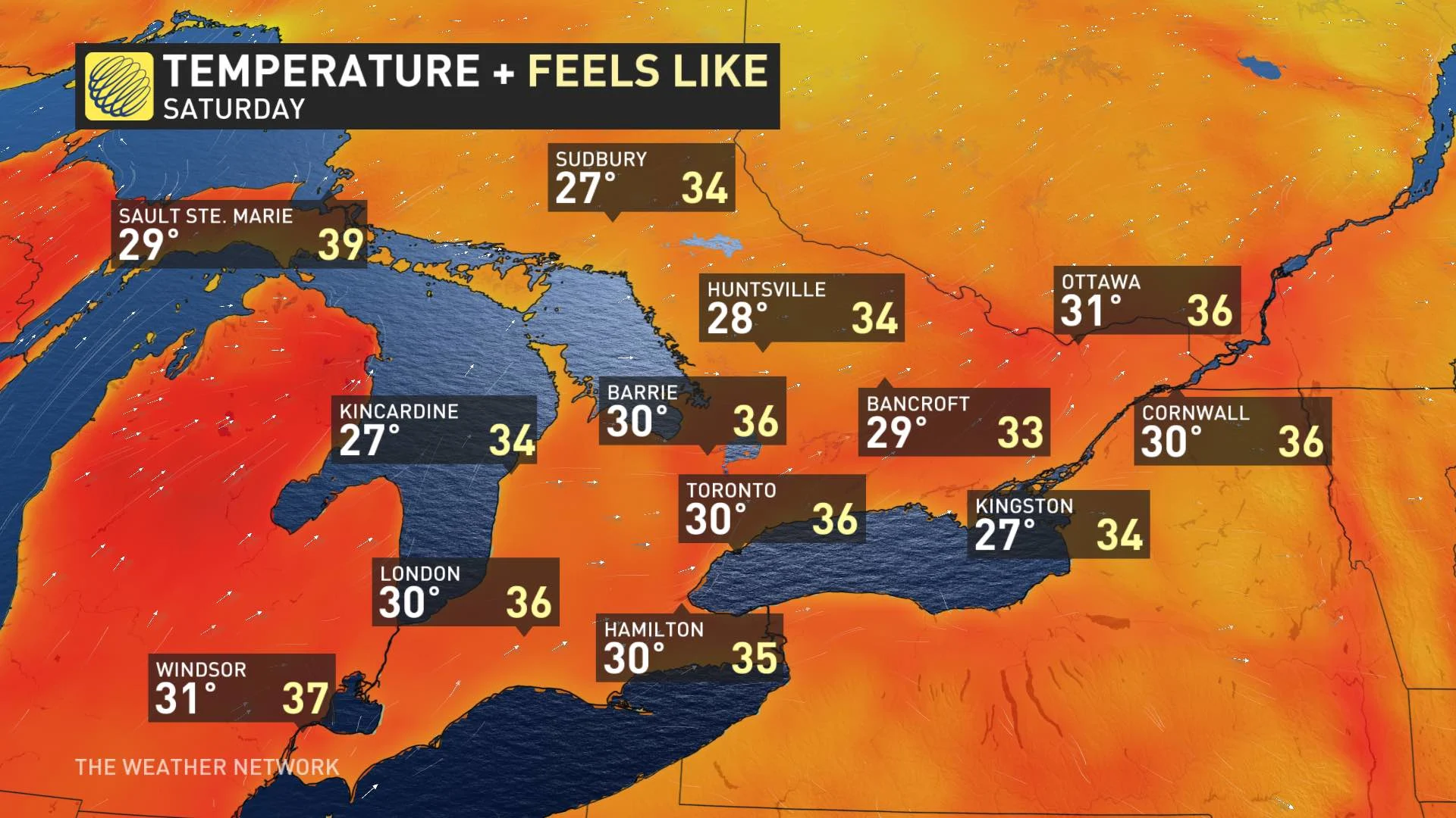
A peek ahead reveals not much in the way of relief from the heat, with temperatures staying at or a little below 30°C into at least early next week.
Check back as we continue to monitor the forecast.