Temperatures plummet in Ontario as lake-effect snow takes over

As southern Ontario deals with a heightened flood threat into Wednesday, the system will continue to bring snow and ice to parts of the province into the morning hours, making for difficult travel.
A complicated storm will be on its way out soon in Ontario, having brought a myriad of wintry precipitation that had some impacts across the entire province. Freezing rain will linger through the overnight hours in eastern sections, making for slippery roads, while the north sees heavy snow sticking around through Wednesday morning. The good news is that the flood threat in the south should stabilize by Wednesday. In behind the storm, temperatures will noticeably fall and the lake-effect machine will rev up Wednesday. More on the timing and impacts of this messy storm system, and a glimpse at the late-week snowfall, below.
MUST SEE: Pothole 101: Why February has been the worst month for roads
WEDNESDAY: FREEZING RAIN ENDS, GUSTY WINDS DEVELOP, LAKE-EFFECT SNOW PICKS UP
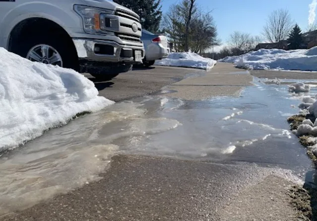
Residents are being urged to remain mindful of areas where water may pool and pond, and keep close tabs on flood alerts from local authorities. The rain will gradually ease off to isolated showers in southern Ontario Tuesday overnight.
Meanwhile, the freezing rain will linger in the overnight hours across eastern and central Ontario, then ending Wednesday morning. Surfaces such as highways, roads, walkways and parking lots may become icy and slippery, so extra precaution is advised. Temperatures in eastern sections will rise by the overnight hours to above freezing, so not all of the ice will accrete.
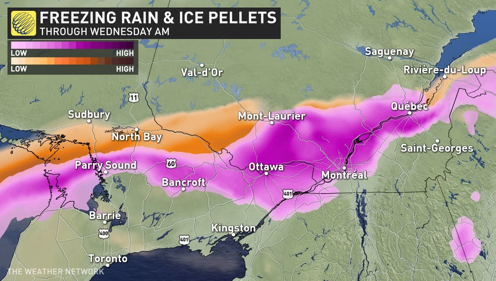
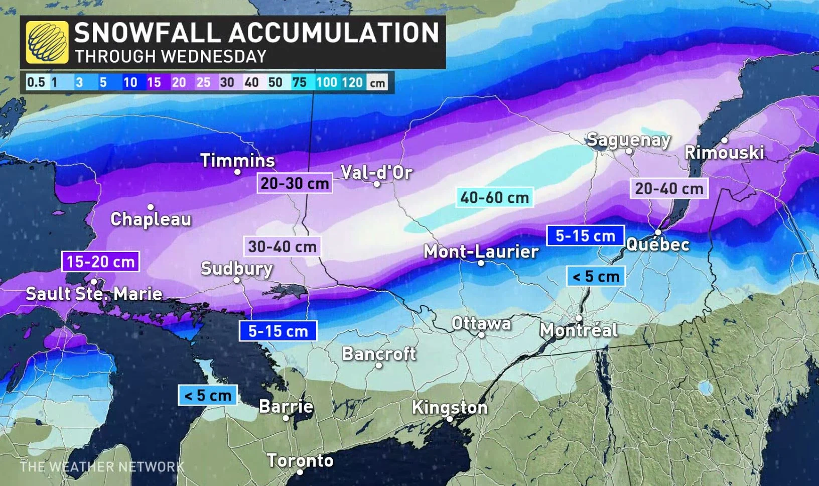
In the north, significant snowfall will continue through Wednesday morning. Visibility may be suddenly reduced at times in heavy snow. Total amounts may hit 15-40 cm by the time it wraps up by the afternoon.
Ontario will see cold northwesterly winds will filter in behind the system, sending temperatures below freezing for the remainder of the week. We could see a refreeze of standing water across southern Ontario on Wednesday morning.
The arrival of the cold winds could ignite lake-effect snow squalls off of Lake Huron and Georgian Bay during the day on Wednesday.
ANXIETY RISING IN BRAMPTON AFTER SIGNIFICANT FLOODING LAST WEEK
Residents in a small community that borders the Credit River in Brampton are on high alert, as last week's potent storm caused a major ice jam and significant flooding. Over 100 homes were evacuated on Thursday, with most residents able to return home by Saturday.
According to Brampton Fire Chief Bill Boyes, crews were still working to pump water from low-lying areas.
"We're still concerned though about future flooding that could happen in the coming days," Boyes said Monday. "As we know precipitation will be falling tomorrow."
LOOK AHEAD: LATE-WEEK SYSTEM COULD BRING HEFTY SNOW FOR SOME AS COLD AIR RETURNS
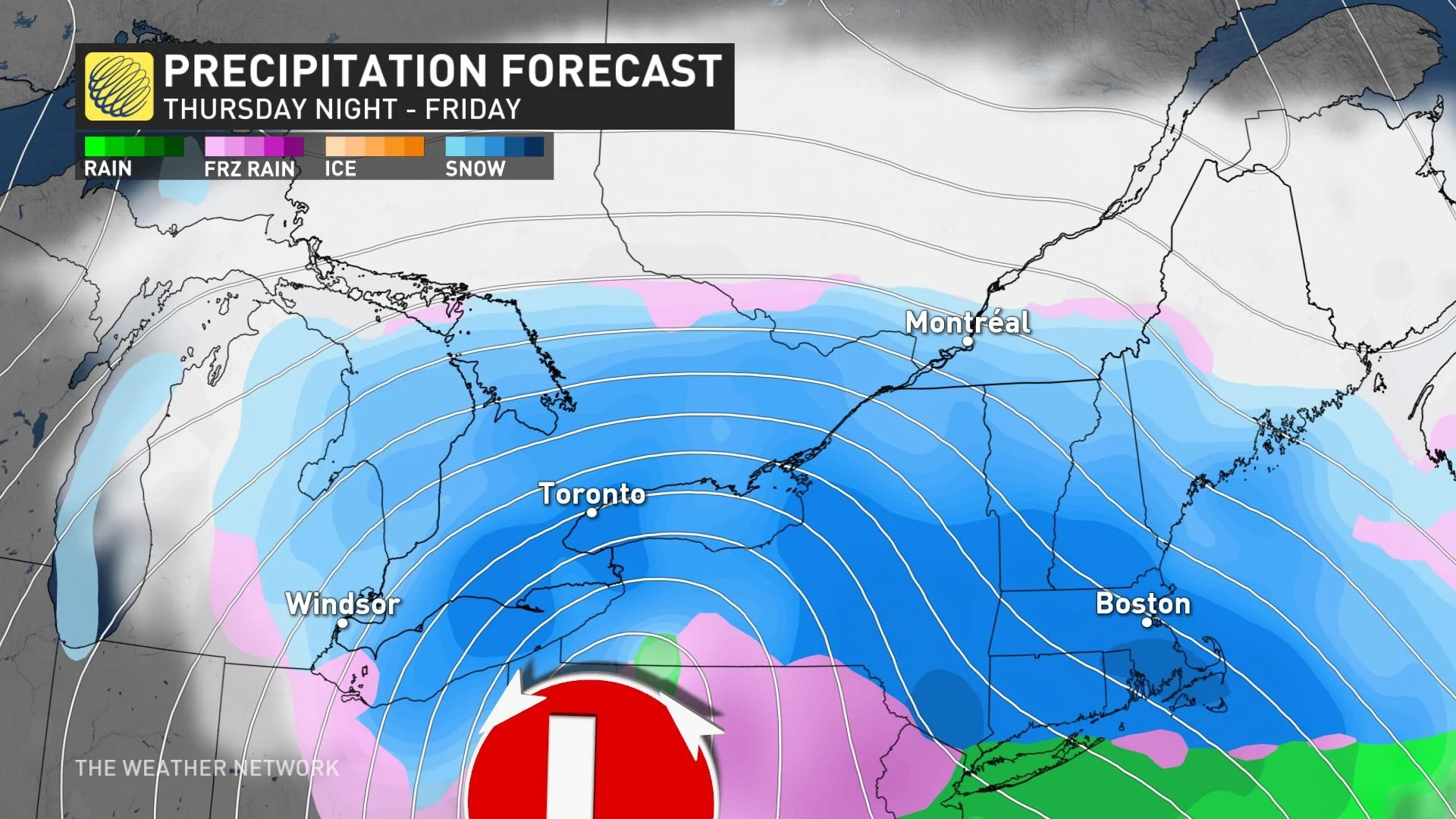
Beyond Wednesday, fair and very cold conditions across the region Thursday. Widespread snow for southern Ontario late Thursday night and Friday with 5-10 cm along the 401 corridor with very cold temperatures. Watching the potential for locally higher totals (10-20 cm) for areas around the west end of Lake Ontario due to lake enhancement due with the east-northeast wind off the lake.
A cold front will track across the region on Sunday with a quick period of snow and gusty winds. Fair and cold early next week as we make the transition from February to March. A warming trend mid-week with the potential for a few days of above seasonal temperatures late week and weekend.
However, watching we are watching the potential for a more wintry pattern to return during the second week of March with an active storm track through the region.
Subscribe to 'This Day in Weather History': Apple Podcasts | Amazon Alexa | Google Assistant | Spotify | Google Podcasts | iHeartRadio | Overcast
Stay tuned to The Weather Network for the latest forecast updates in Ontario.