Wintry blast snaps November heat wave in northern Ontario

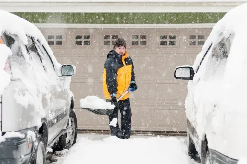
Hazardous winter conditions may challenge drivers in parts of northern Ontario through Wednesday morning.
A deepening low-pressure system from the southern U.S. Plains has put a quick and dramatic stop to the stretch of well above seasonal temperatures that have spanned much of Ontario. Parts of northern Ontario are on the receiving end of a decent wintry blast through Wednesday morning. More on the hazardous winter conditions expected and where up to 20 cm of snow could fall, below.
WEATHER HIGHLIGHTS:
Special weather statements in place for heavy snow in parts of northern Ontario, threat for freezing rain as temperatures drop below zero
Snow, freezing rain, rain taper off Wednesday morning
Eyeing a potent fall storm for the weekend with strong winds, rain and more snow on the table
INTO WEDNESDAY: RAIN, FREEZING RAIN AND SNOW PUSH IN
The stretch of warm, record-setting temperatures came to an abrupt end, with a potent low now bringing a wintry blast of rain, freezing rain, ice pellets and snow to northern Ontario into Wednesday morning.
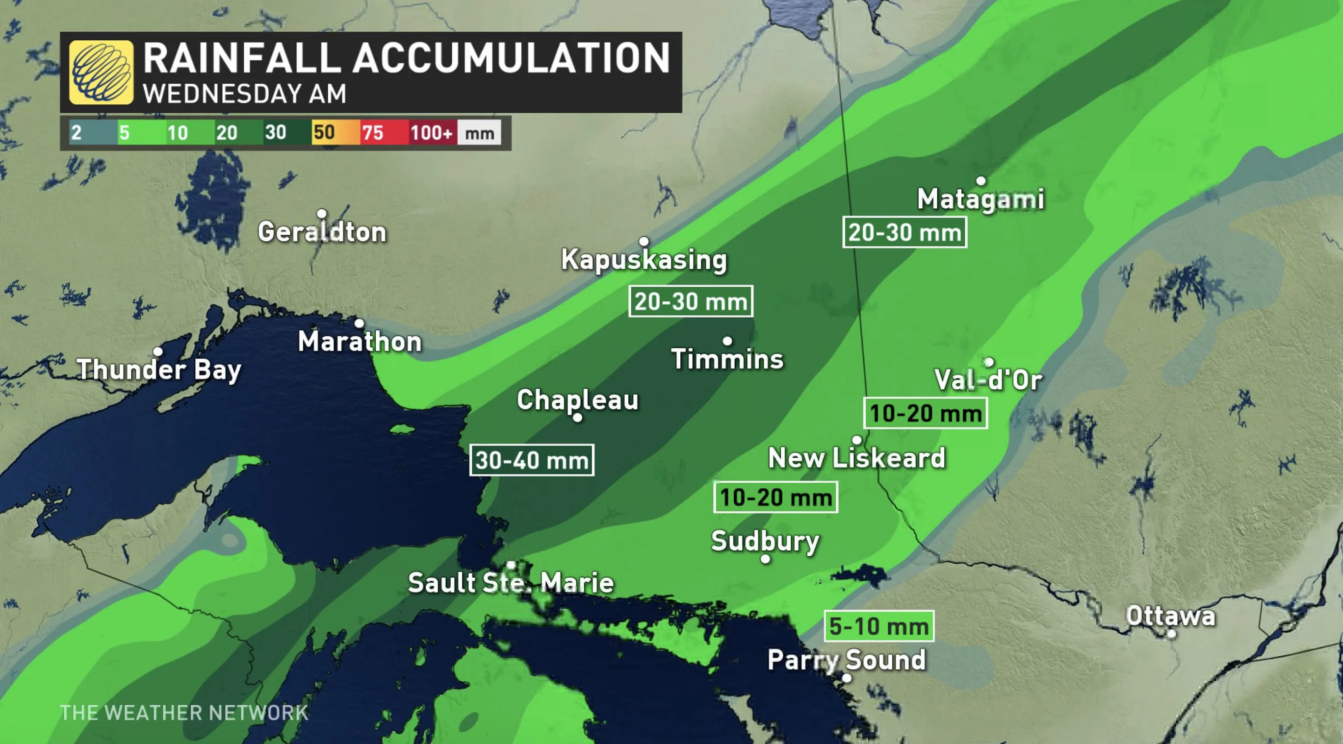
The heaviest rainfall will fall east-northeast of the Lake Superior shores into the Chapleau region. Totals will reach 30-40 mm.
MUST SEE: Resilient ridge sets new all-time monthly records
As well, a swath of freezing rain and ice pellets will push in the overnight hours, impacting highways 11 and 17.
Snowfall and freezing rain warnings are in place throughout, including Kapuskasing, Hearst and White River. That's as colder air from the north filters in and sends temperatures near or slightly below the freezing mark through the overnight hours.
"Hazardous winter driving conditions are expected tonight. Untreated roads may become snow covered and slippery," EC warns in the statment.
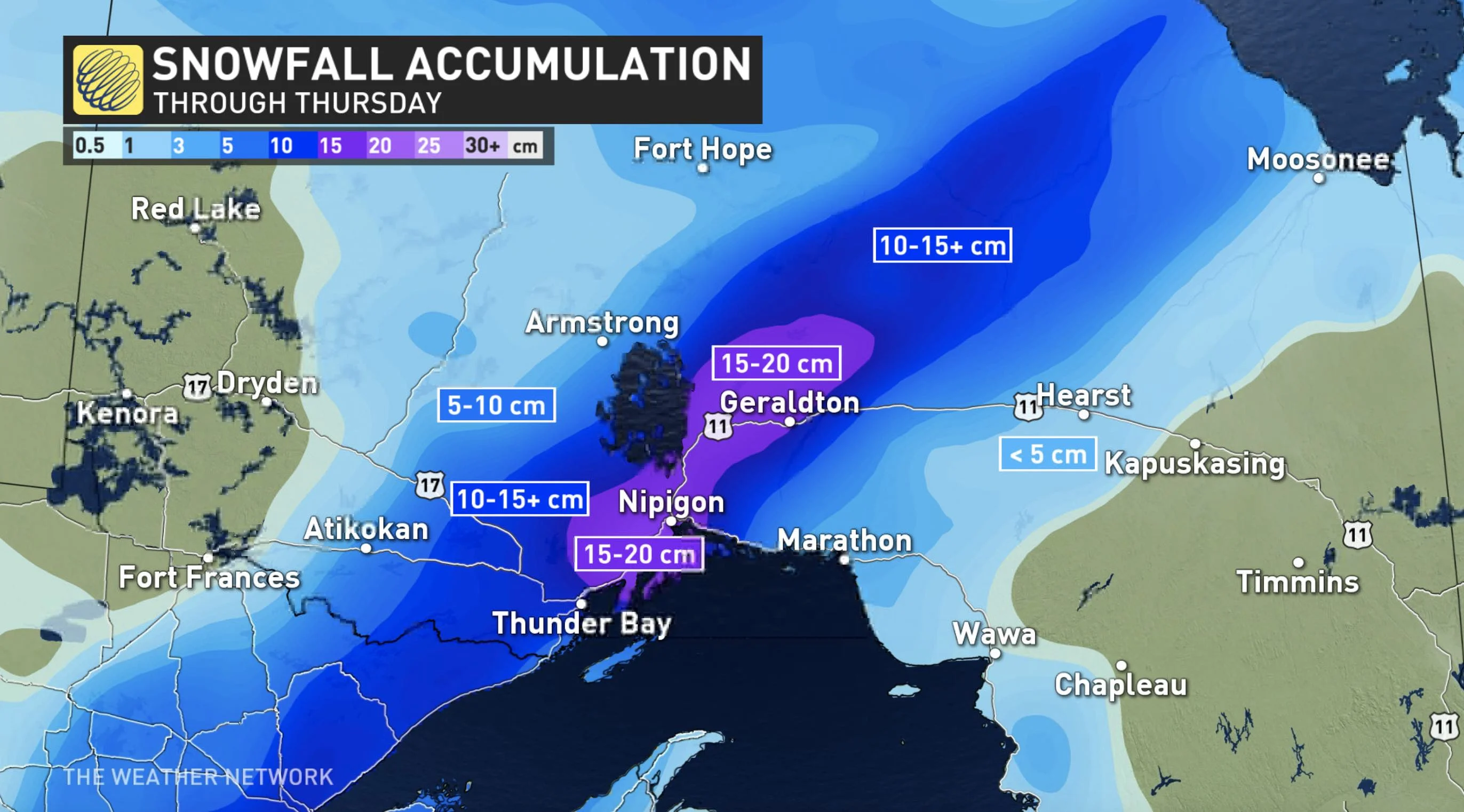
Meanwhile, snow pushes into Thunder Bay and areas west and north, heading through Geraldton. 15-20 cm is expected between Nipigon and Geraldton through Wednesday morning, when it will taper off, along with the rain, freezing rain and ice pellets.
Be prepared to adjust your driving with changing road conditions. Rapidly accumulating snow will make travel difficult. Visibility may be suddenly reduced at times in heavy snow. If visibility is reduced while driving, slow down, watch for tail lights ahead and be prepared to stop.
Flurries will reach northwestern Ontario Wednesday night, bringing a few centimetres west of Lake Superior.
STAYING LOCKED IN THE WINTRY PATTERN THIS WEEKEND?
Forecasters are also keeping a close eye on a potent fall storm for the Great Lakes region this weekend, which is expected to track from northern Ontario to northern Quebec late Sunday.
"This will bring strong winds and rain, but also the threat for heavy snow on the back side of the system," says Weather Network meteorologist Dr. Doug Gillham. "A couple days of chilly weather will also follow this system into next week."
Stay tuned to The Weather Network for the latest forecast details.