Severe storm threat in Ontario as front will eliminate the sweltering heat

A cold front sweeping through southern Ontario Monday will finally wipe out the heat and humidity, but will also bring the chance for severe storms in the afternoon and evening in parts of the region.
This story is no longer being updated. Follow along here for further updates
Good news for those seeking relief from the intense heat in Ontario -- an incoming cold front will drop temperatures back to seasonal on Tuesday. However, before it does, it may spark potentially severe thunderstorms across portions of southern areas Monday afternoon and evening. Depending on where you are in the south will determine the likelihood of severe storms firing up. Areas in the east and southwest are more favoured for them to develop. The GTA has a lower chance of seeing the storms. A closer look at what to expect, below.
WEATHER HIGHLIGHTS:
Severe storm risk across the south Monday, greater chance in southwest and eastern areas, as well as northeast
Temperatures return to seasonal for Tuesday, with chance of showers in south
Keep an eye on weather ALERTS in your area
MONDAY: SEVERE STORM POTENTIAL WITH FRONT PASSAGE
Monday will be the final day of the extreme heat and humidex values in the low 40s in southern Ontario, as a cold front is set to wipe them out once it passes.
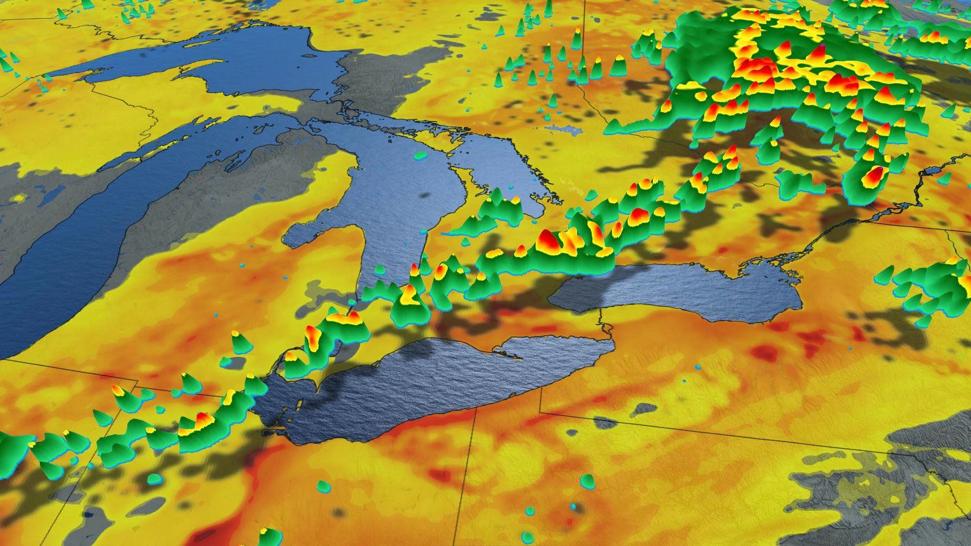
Before doing so, it may set off severe thunderstorms in eastern Ontario in the afternoon and the southwest in the evening hours. The GTA may see an isolated storm passing through after sunset. Northeastern Ontario may also see severe-level storms during the same time periods.
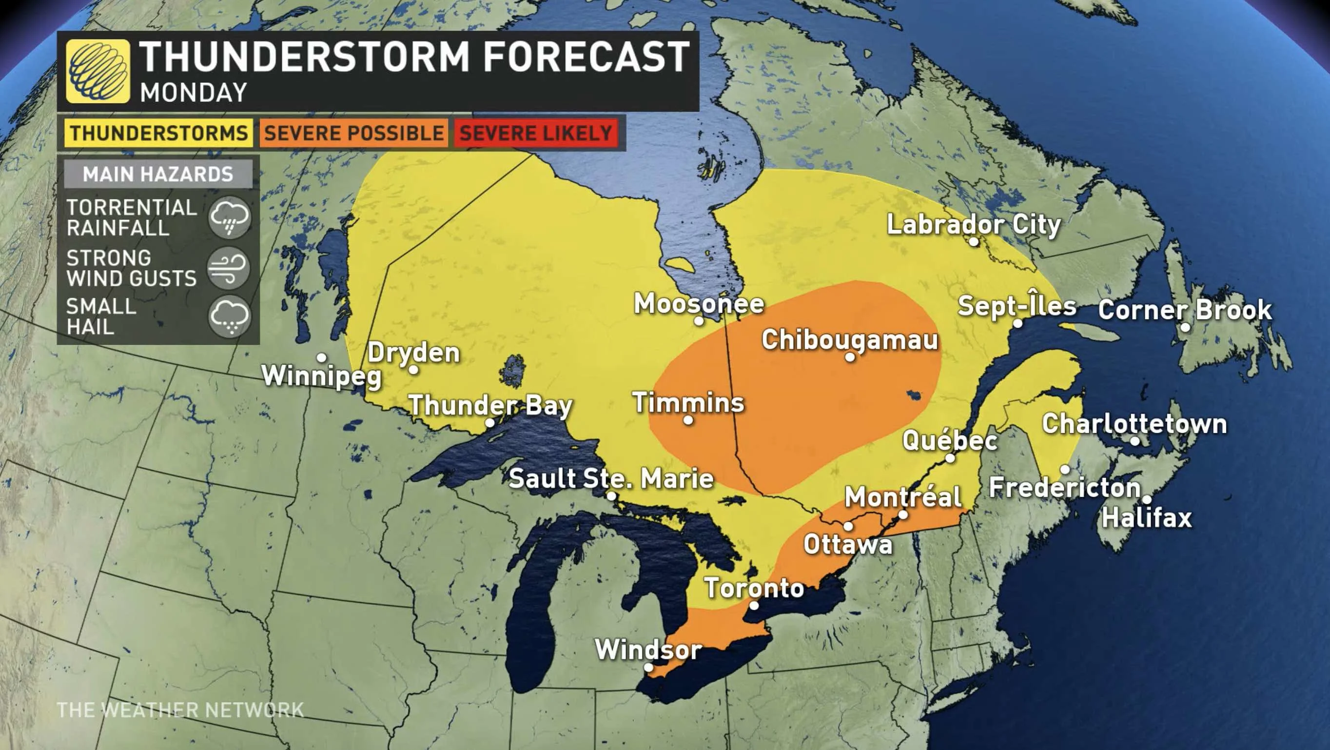
Any severe storms that do fire up will have plenty of moisture to work with, so there will be torrential rainfall, as well as strong wind gusts and small hail.
TUESDAY: SEASONAL TEMPERATURES, HUMIDITY LOWERED
The same cold front that may trigger Monday's storms will not only take the temperatures down, but also sweep that humidity out of the province.
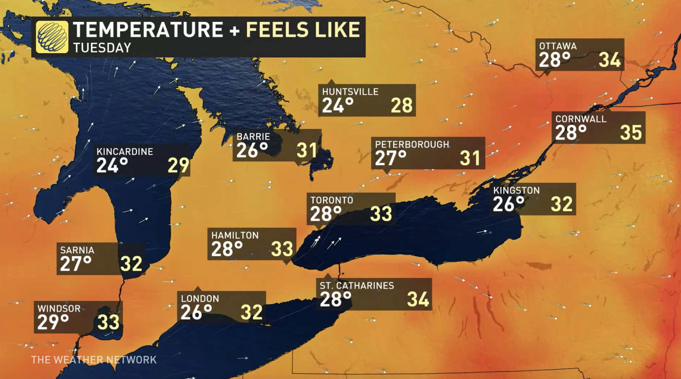
On Tuesday, temperatures return to seasonal with daytime highs sitting in the mid-to-upper 20s and more tolerable humidex values in the low 30s. This trend will continue for the rest of the week.
While the storm risk will remain north of the Nickel Belt region, there may be afternoon showers in southern Ontario.
THE SCIENCE BEHIND A HEAT DOME
Check back as we continue to monitor the forecast.


