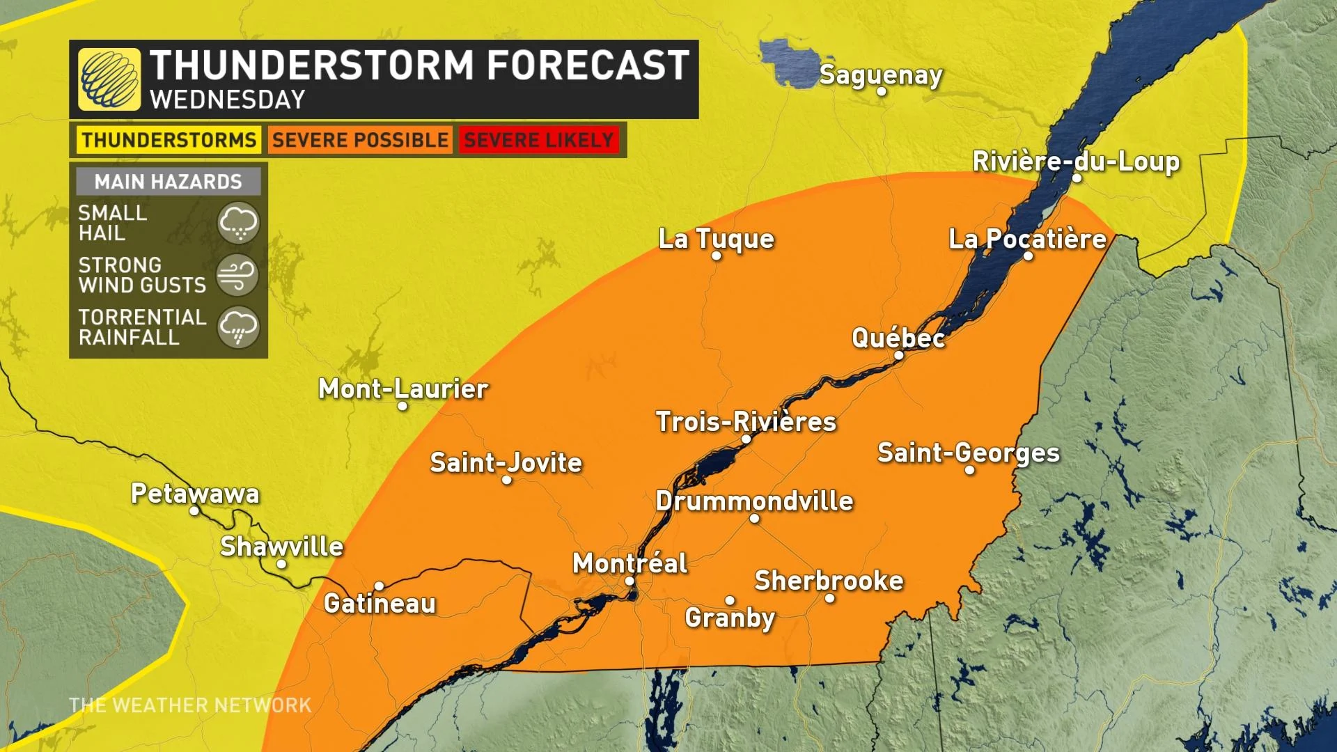
Heat and humidity to fuel severe storm threat in Quebec on Wednesday

The summer-like pattern blanketing eastern Canada isn’t going anywhere in a hurry. Warm and humid air will provide the energy necessary to fuel a risk for thunderstorms over a large swath of Quebec on Wednesday. Some of the storms in southern Quebec could turn severe, bringing the risk for torrential rainfall, strong wind gusts, and small hail. More on the severe threat and what to expect this weekend, below.
WEDNESDAY: SEVERE STORMS POSSIBLE IN SOUTHERN QUEBEC
Warm and humid with a chance for storms—it’s a pattern we’re familiar with by this point. But familiarity doesn’t make the hazards of a rowdy afternoon thunderstorm any less serious.
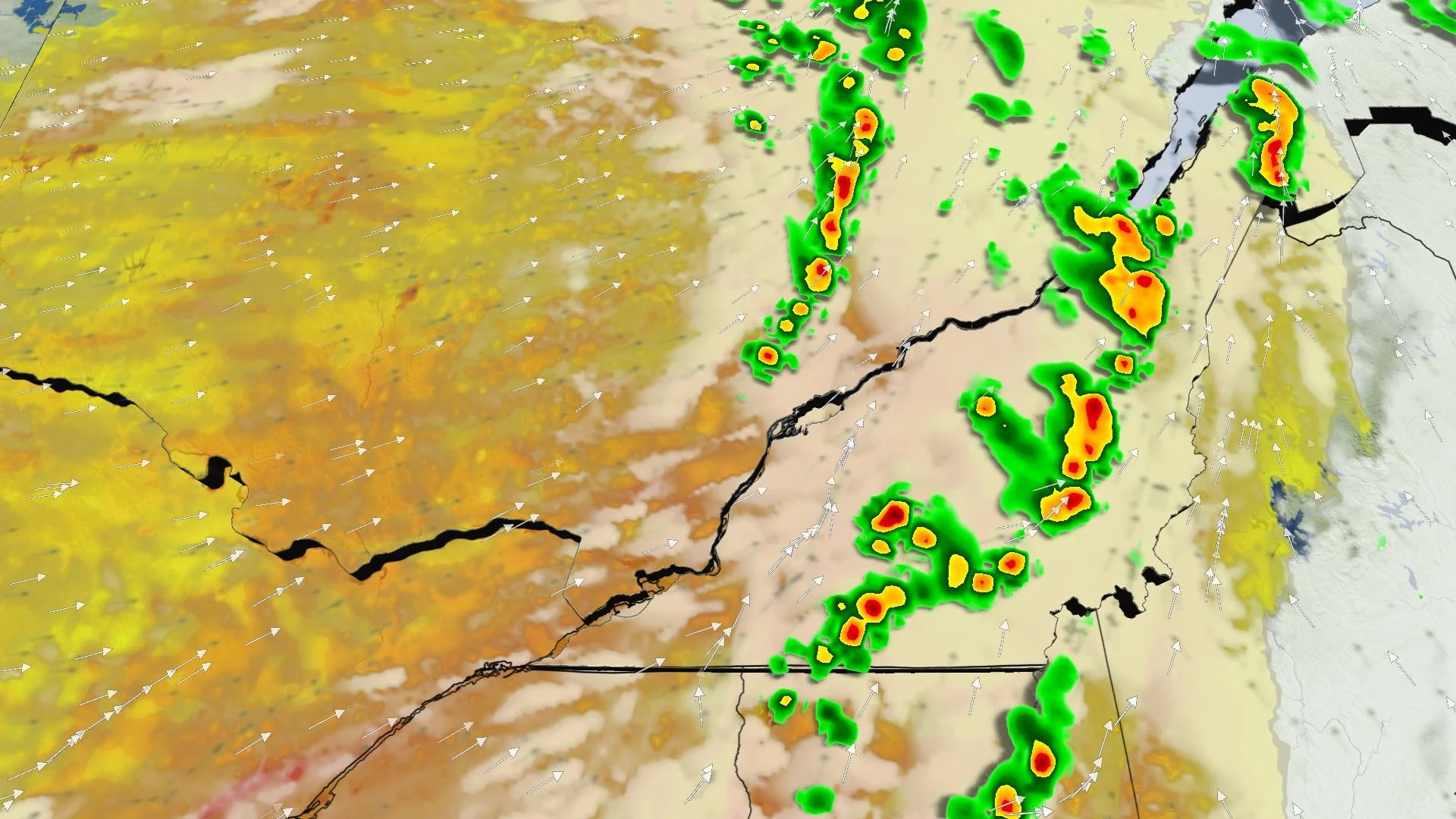
A surface trough moving over the northeastern United States will jut into southern Quebec during the day on Wednesday, providing the lift and trigger for thunderstorms to develop in the unstable air parked over the region.
Any thunderstorms that form in eastern Ontario and southern Quebec could reach severe levels, posing a risk for small hail, strong wind gusts, and torrential rainfall. This threat includes Ottawa, Gatineau, Montreal, and Quebec City.
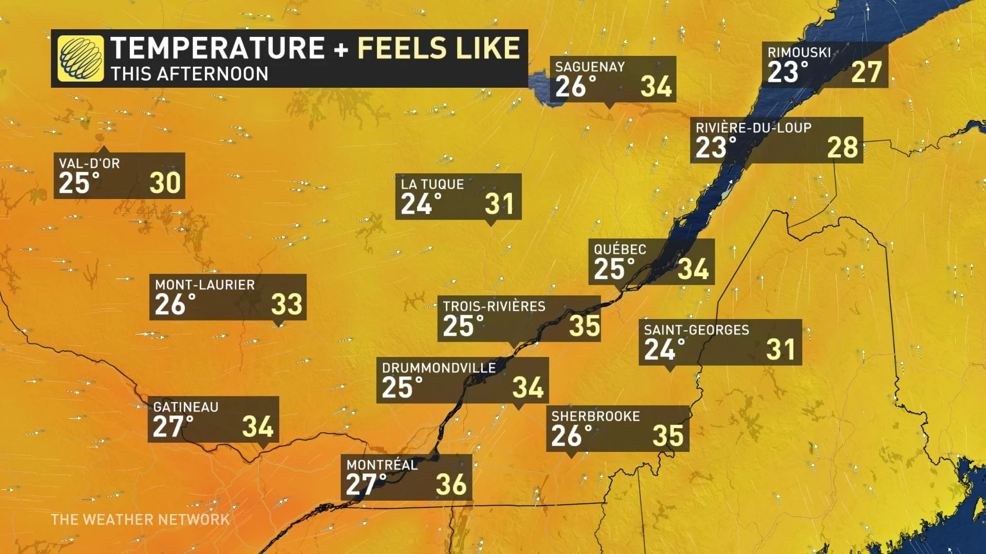
A quick look at humidex values on Wednesday takes much of the mystery out of what’s driving the threat for strong to severe thunderstorms. Southwesterly winds wrapping around a Bermuda High over the western Atlantic Ocean continue to stream warm and muggy air over eastern Canada.
Daytime highs will reach the upper 20s across southern Quebec, with humidex values potentially reaching the mid 30s during the heat of the afternoon.
THURSDAY: SEVERE THREAT DIMINISHES, BUT THUNDER STILL POSSIBLE
The surface trough responsible for bringing thunderstorms to severe limits on Wednesday will move off to the east on Thursday, removing the triggering mechanism that would help thunderstorms reach their full potential.
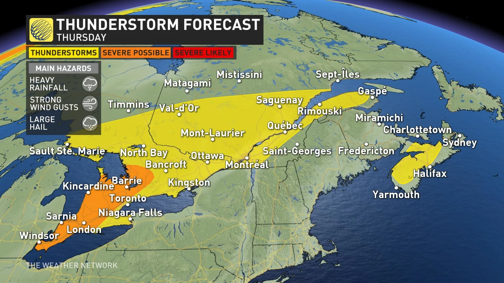
The heat and humidity could still give rise to a chance for run-of-the-mill thunderstorms across Quebec, but we shouldn’t see a widespread risk for severe weather like we saw on Wednesday.
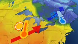
Thursday looks to be our warmest day, with daytime highs approaching 30°C in southern Quebec and humidex values creeping into the upper 30s across most of the area.
THIS WEEKEND: TEMPS FALL BACK A BIT, BUT HUMIDITY AND RAIN LINGER
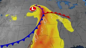
A centre of low pressure moving over the Great Lakes will bring our next chance for active weather across southern Quebec. The low will push into northern Ontario on Thursday and reach interior Quebec by Friday.
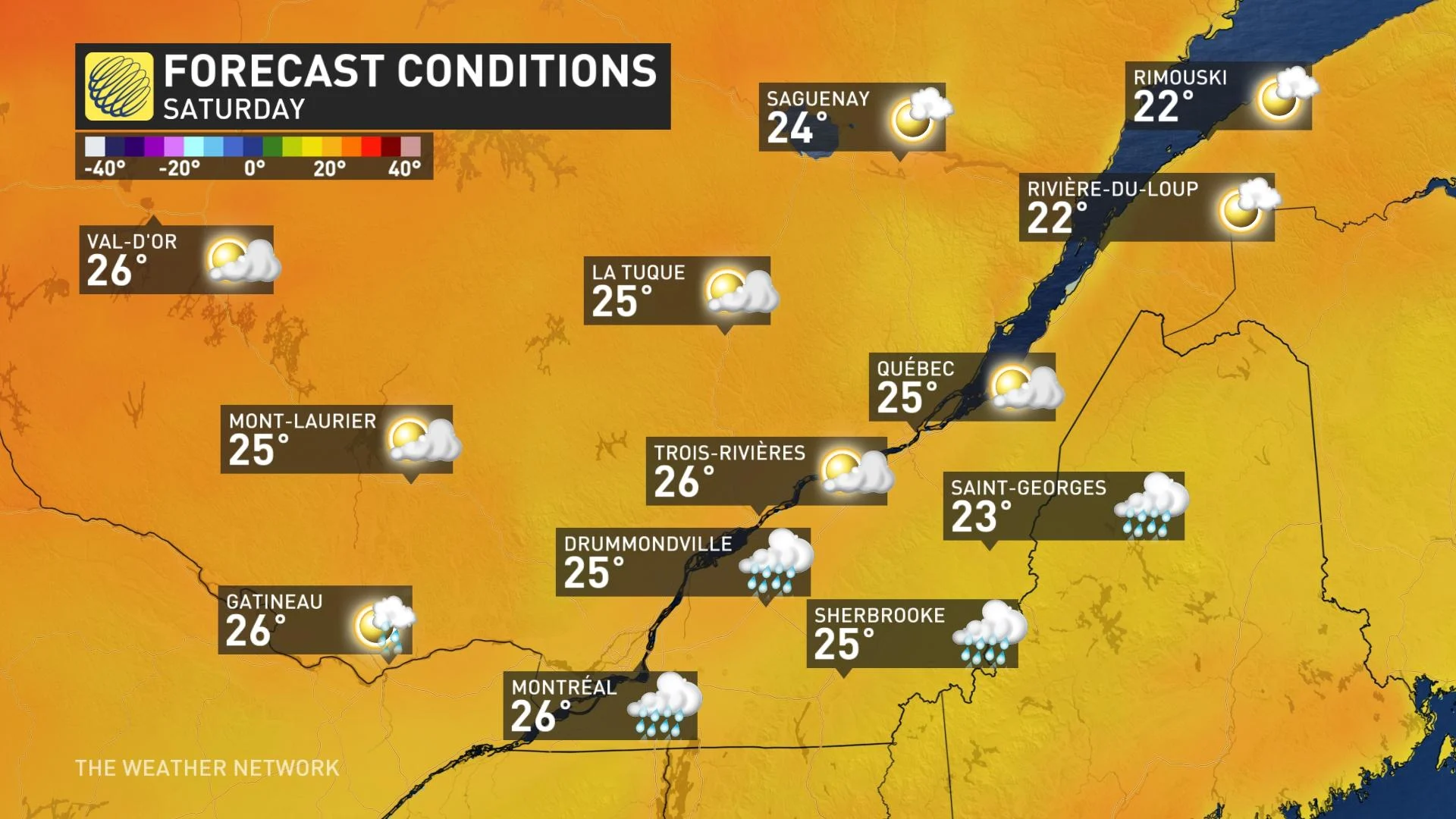
The cold front stretching off this low will slowly move into southern Ontario and southern Quebec by the end of the week, bringing a chance for showers and thunderstorms on Friday and Saturday.
Along with the chance for precipitation, the boundary will knock temperatures back toward seasonal for the weekend and into next week. However, stubborn humidity levels will still make it feel like the low- to mid-30s across the area.
Be sure to check back for the latest on the severe threat in Quebec.