
Risk for severe storms across Ontario as the south bakes under heat

The hottest week so far this summer is on tap for southern Ontario as a brutal stretch of heat and humidity builds in the region. The threat for severe storms will encompass southern and northern Ontario Tuesday.
Southern Ontario is in the middle of what could be the hottest week of the summer so far. Temperatures reaching the 30s and feels-like values approaching, at or even exceeding the 40s will be a mainstay as it progresses, particularly in the southwest and eastern areas. The heat is helping to set up the risk for severe thunderstorms in the region Tuesday, a setup that is also occurring in the northwest due to a warm front trekking through. Beyond, another chance for storms and torrential rainfall will reappear in the south late week. Details regarding the south's locked in hazardous heat and humidity, as well as where the severe thunderstorm risks are in Ontario Tuesday, can be found below.
TUESDAY: STORM POTENTIAL ACROSS SOUTHERN, NORTHERN ONTARIO
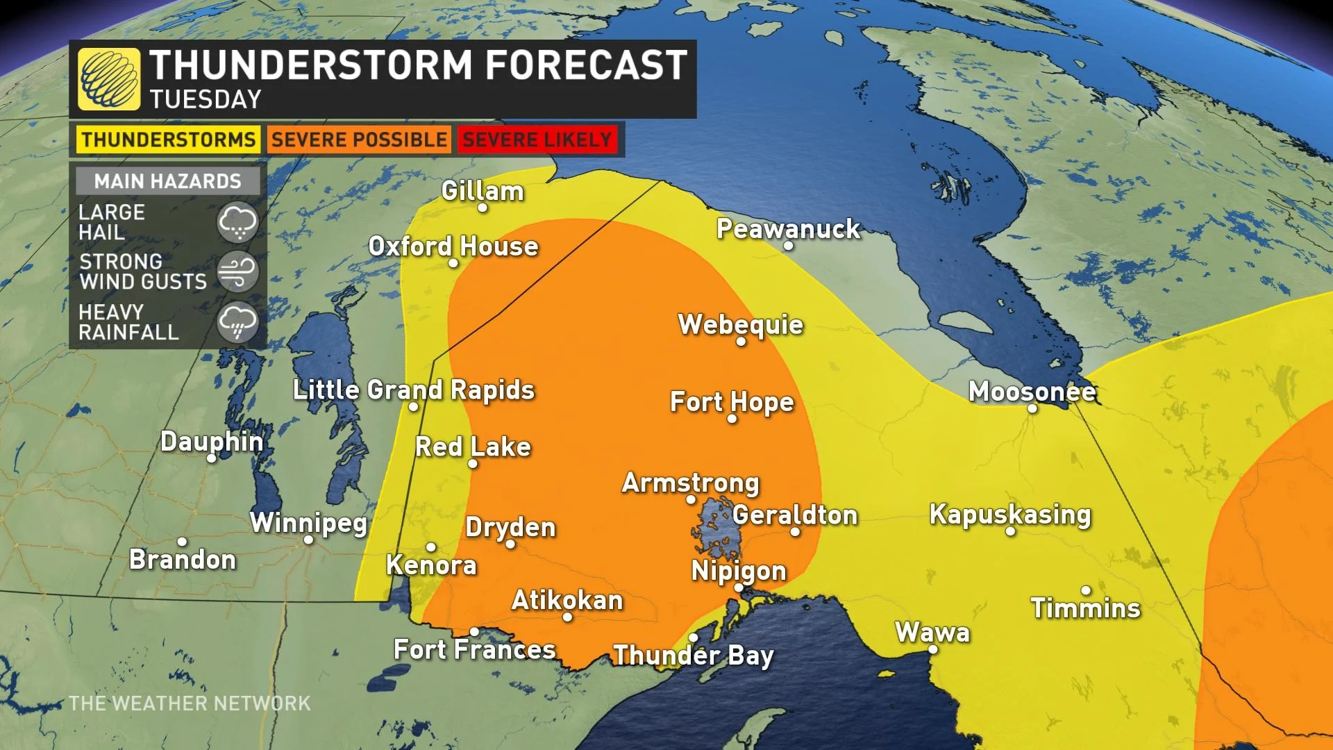
After severe storms made their way through parts of northern and southern Ontario Monday, much of the province will see the threat again Tuesday. The chance in the north comes courtesy of a warm front, while a trough and instability in the south could set them off.
In the former, the risk for severe thunderstorms will stretch from just north of the shores of Lake Superior into northeastern Manitoba, with Kenora just outside of it. The front is expected to push further into northwestern Ontario, potentially setting off severe thunderstorms in the afternoon and evening hours. The main hazards will be large hail, strong wind gusts and heavy rainfall.
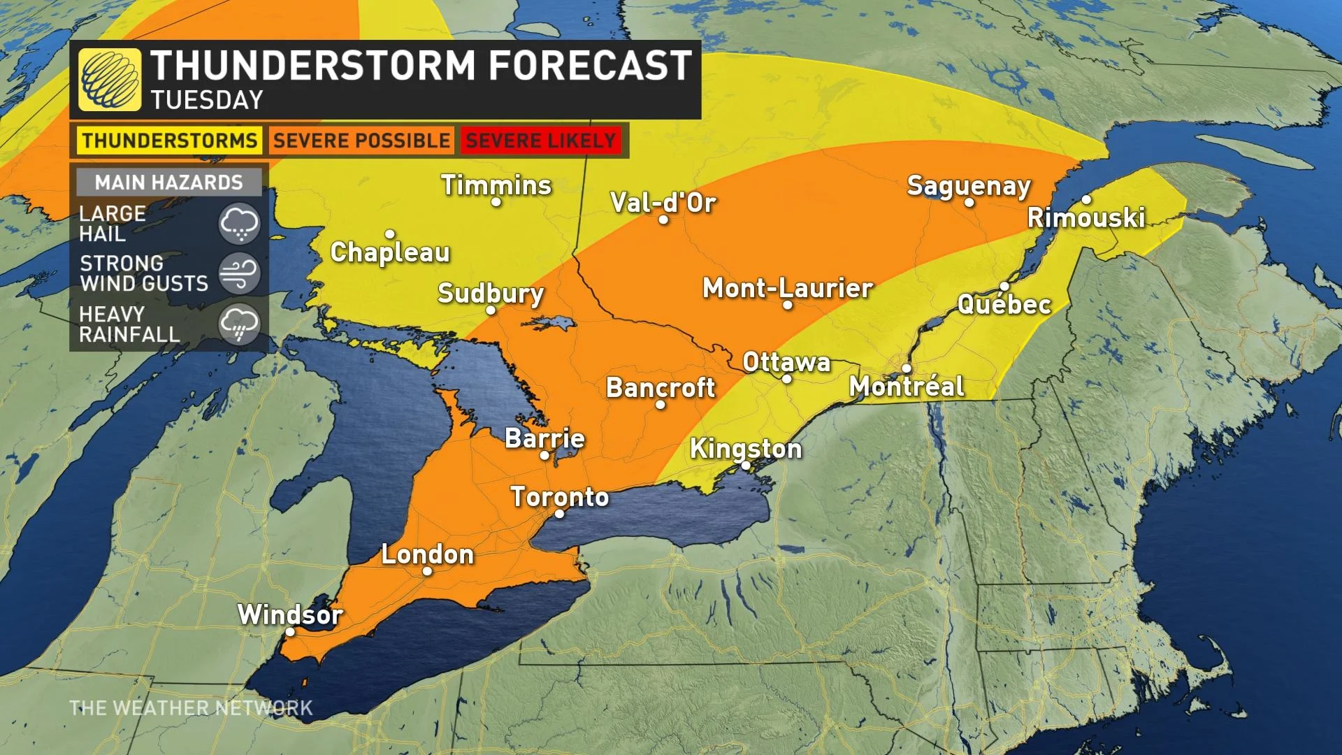
Meanwhile, in the south, a trough and instability from the heat and humidity will be the trigger mechanisms for the widespread thunderstorm chance. The severe threat will encompass a large swath extending from the southwest into cottage country and parts of eastern Ontario, spilling over into western Quebec, as well.
The timing of the potential thunderstorms will vary depending on where you are. The early-morning hours Tuesday will be prime for the western half of the south, while the threat will move into eastern part in the afternoon and evening hours. There is even a chance for supercell development in eastern areas and in parts of cottage country.
HEAT, HUMIDITY SPREADS IN THE SOUTH, ANOTHER LATE-WEEK CHANCE OF STORMS
The dangerous heat and muggy conditions won't be going anywhere Tuesday. The hottest temperatures are expected in southwestern and eastern sections, where they could hit the low 30s. They will approach the 30s elsewhere across most of the south.
Feels-like values could hit the low 40s in southwestern and eastern Ontario, but the rest of the south won’t be far off — feeling like the mid- and upper 30s.
Wednesday will see the heat and humidex values further increase across southern Ontario, with the Niagara region and Greater Toronto Area seeing 30-degree daytime highs and feels-like values exceeding 40.
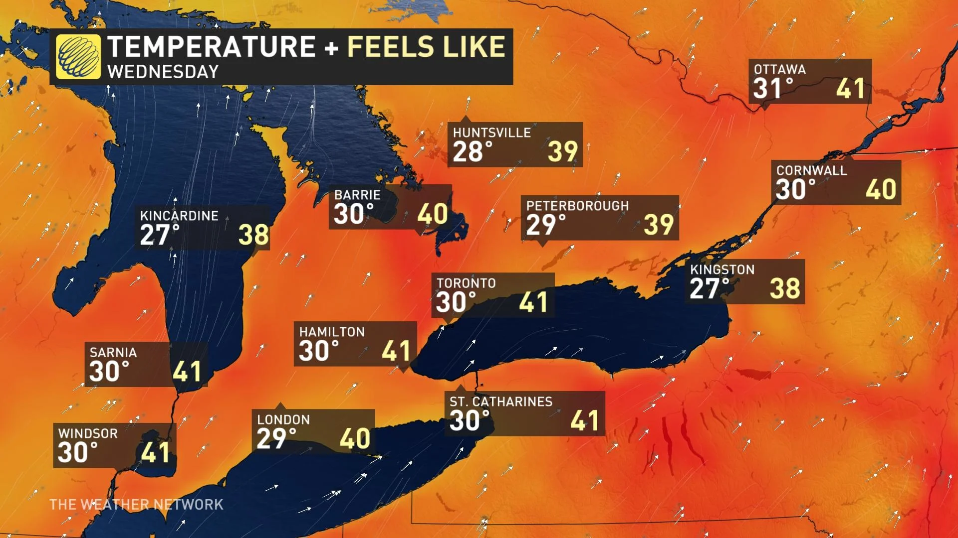
Just to put it into perspective, Toronto’s hottest day so far this year was June 6, which saw a daytime high of 33.8°C.
Beyond, a cold front is expected to move through southern Ontario late week, bringing the risk for thunderstorms and torrential downpours. However, timing of it is still uncertain -- either Thursday night or Friday morning, so there's low confidence as to whether Friday will still be muggy versus cooler temperatures and less humid.
Regardless, a pleasant weekend is expected across the region with abundant sunshine, low humidity and comfortable temperatures. Fair weather and a warming trend are forecast for early next week.
TIPS FOR KEEPING COOL IN THE HEAT
Keep the heat in mind as you plan your week. Prepare to limit outdoor activity and make arrangements to keep cool.
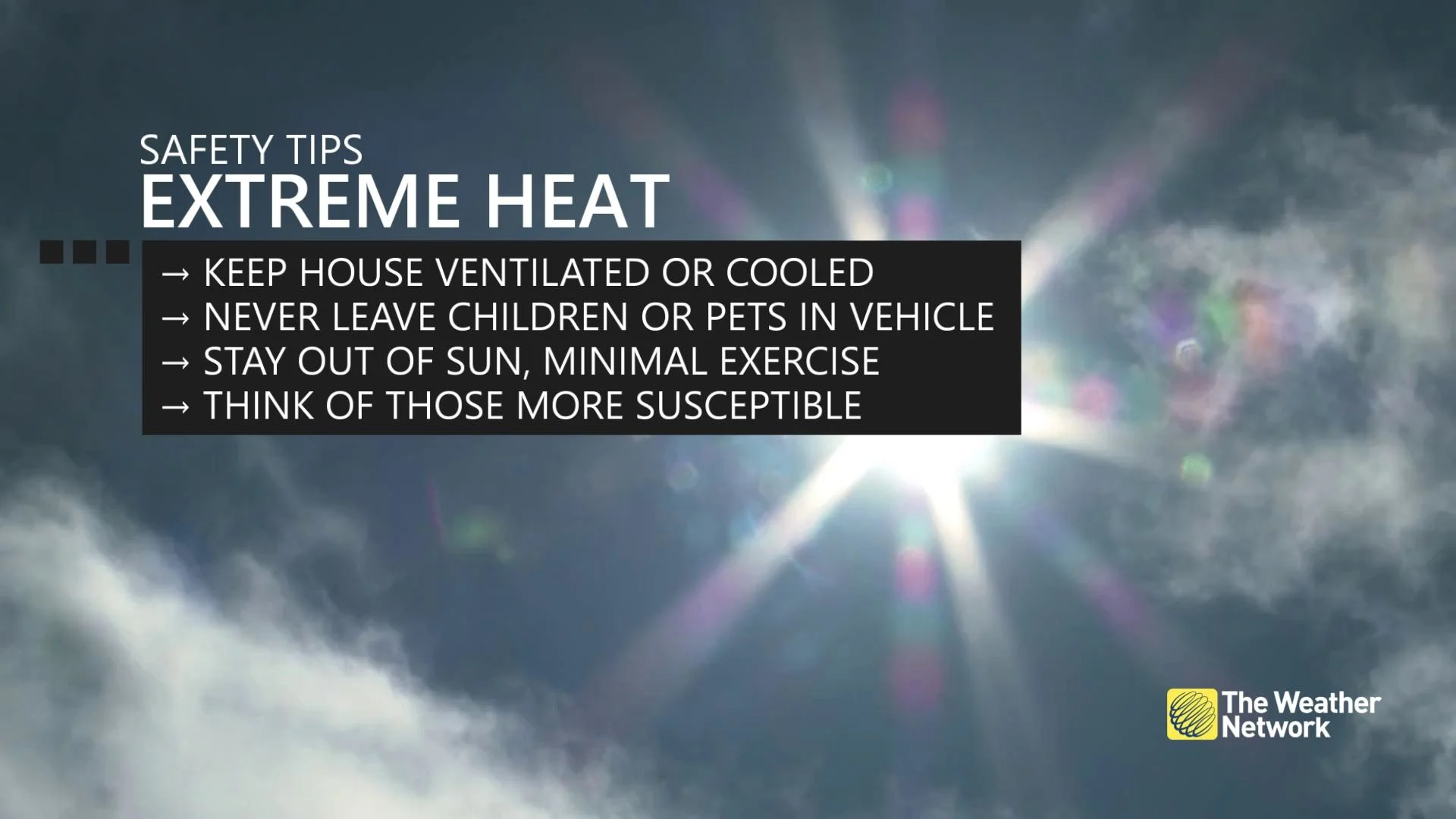
During a heat event, Environment and Climate Change Canada (ECCC) says the risks are greater for young children, pregnant women, older adults, people with chronic illnesses and people working or exercising outdoors.
Watch for the effects of heat illness: swelling, rash, cramps, fainting, heat exhaustion, heat stroke and the worsening of some health conditions
Check on older family, friends and neighbours. Make sure they are cool and drinking water
Never leave people or pets inside a parked vehicle
Also consider these tips to staying cool including eating spicy foods, taking vitamins, stay in the shade, consider hot over cold drinks, and avoid dark clothing.
WATCH BELOW: IS IT DANGEROUS TO DRINK ICE COLD WATER ON A HOT DAY? WE ASKED AN EXPERT
Check back as we continue to monitor the forecast in southern Ontario.