
Gulf of St. Lawrence could set another record for lack of ice
Ice coverage in the Gulf of St. Lawrence was measured at less than two per cent this week, putting it on course for breaking the low-ice record for the second time in three years.
In the last 10 to 15 years, normal ice coverage for this time of year is about 15 per cent, but that is a recent change. The 30-year average is closer to 25 per cent of the water being covered by sea ice in late January.
"1995 is kind of like a special year," said George Karaganis, a senior forecaster with the Canadian Ice Service.
"Everything before that, heavier ice years were more normal. After that, lighter ice years were more normal, with this year and two years ago being extreme cases of that."
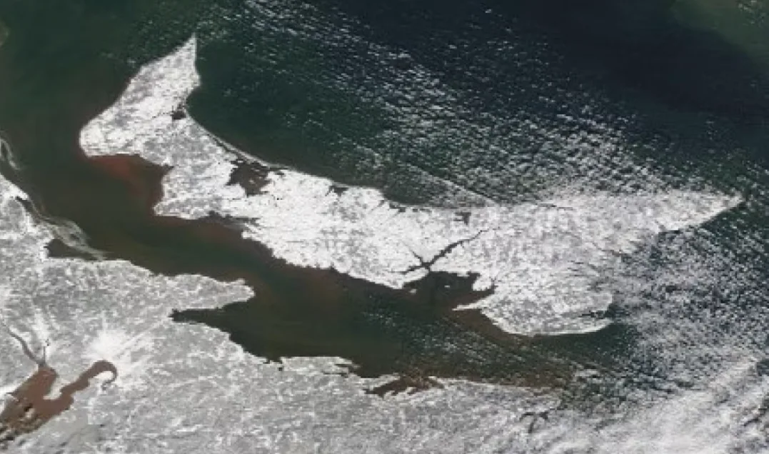
A satellite image of Prince Edward Island taken Tuesday shows a scattering of ice around the eastern end. (MODIS image/NASA)
Ice forecasts are made for people working in shipping, and a light forecast is good news for them, said Karaganis. The lighter years of recent decades have become the norm for most people currently working in shipping.
But the low ice coverage is a problem for seals, who use the ice for birthing, and for the shoreline, which is normally protected from the surf caused by winter storms when ice builds up and acts as a buffer.
The gulf set a record for low ice in 2020-21, and is on track to break that record this year.
WATCH: Stormy waves from the Atlantic Ocean
After rain and warm temperatures Thursday, temperatures are expected to fall for a few days, and Karaganis expects some ice to form.
Temperatures will still be mostly above normal, though. The average high for this time of year is -4 C, and three of the next six days are forecast to be above that. There are no nights forecast to reach the average overnight low of -13 C in the next week.
"If we look at these longer-range models, they're not all showing colder in February," said Karaganis.
"It has to stay cold, probably for most of February, to get that ice to be thicker as it normally is that time of year. We're running out of time."
The average temperature at Charlottetown Airport in December was 3.0 C above normal. To date in January, it has been 6.1 C above normal.
Thumbnail courtesy of Shane Hennessey/CBC.
This article, written by Kevin Yarr, was originally published for CBC News. Contains files from Angela Walker.


