Pleasant start to Ontario's long weekend, but strong storms ahead

Saturday will be the best day for the long weekend in southern Ontario, should you have any outdoor plans.
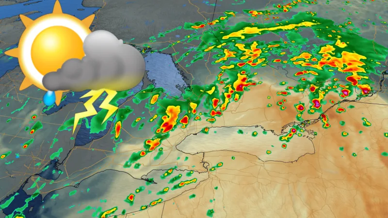
The August long weekend starts off with fair skies and rosy temperatures in southern Ontario, but storms move in overnight Saturday, becoming more widespread through Sunday, with several parts of the province at risk of severe thunderstorms. The unsettled weather will stick around on Monday, accompanied by seasonal temperatures, but hotter days are ahead. Details and timing, below.
WEATHER HIGHLIGHTS:
Mostly clear Saturday, showers move in overnight
More widespread showers and thunderstorm risk Sunday
Seasonal temperatures through Monday, heat returns next weekend
Keep an eye on weather ALERTS in your area
SATURDAY AND SUNDAY: STORMS APPROACH, SEVERE POSSIBLE
For most people, Saturday will be far and away the best day of the August long weekend, so anyone with outdoor or cottage plans should soak it up while they can.
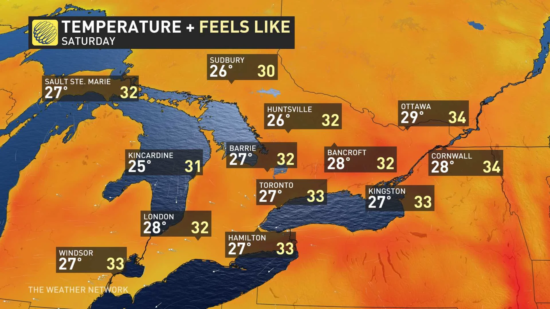
Most of the day looks to be dry, with partly cloudy skies and seasonal temperatures in the upper-20s across southern Ontario.
However, things will start changing later in the day, thanks to a low-pressure system slowly tracking northward from the U.S.
People in southwestern Ontario and possibly parts of the western GTA may get an early taste of showers later on Saturday, but the bulk of the rain and storm risk will only really move in overnight ahead of the low. But this will be a widespread system, with most places set to see at least a shower Sunday.
By the afternoon, thunderstorm risk rises with the downward passage of a cold front, triggering stronger storms as it passes.
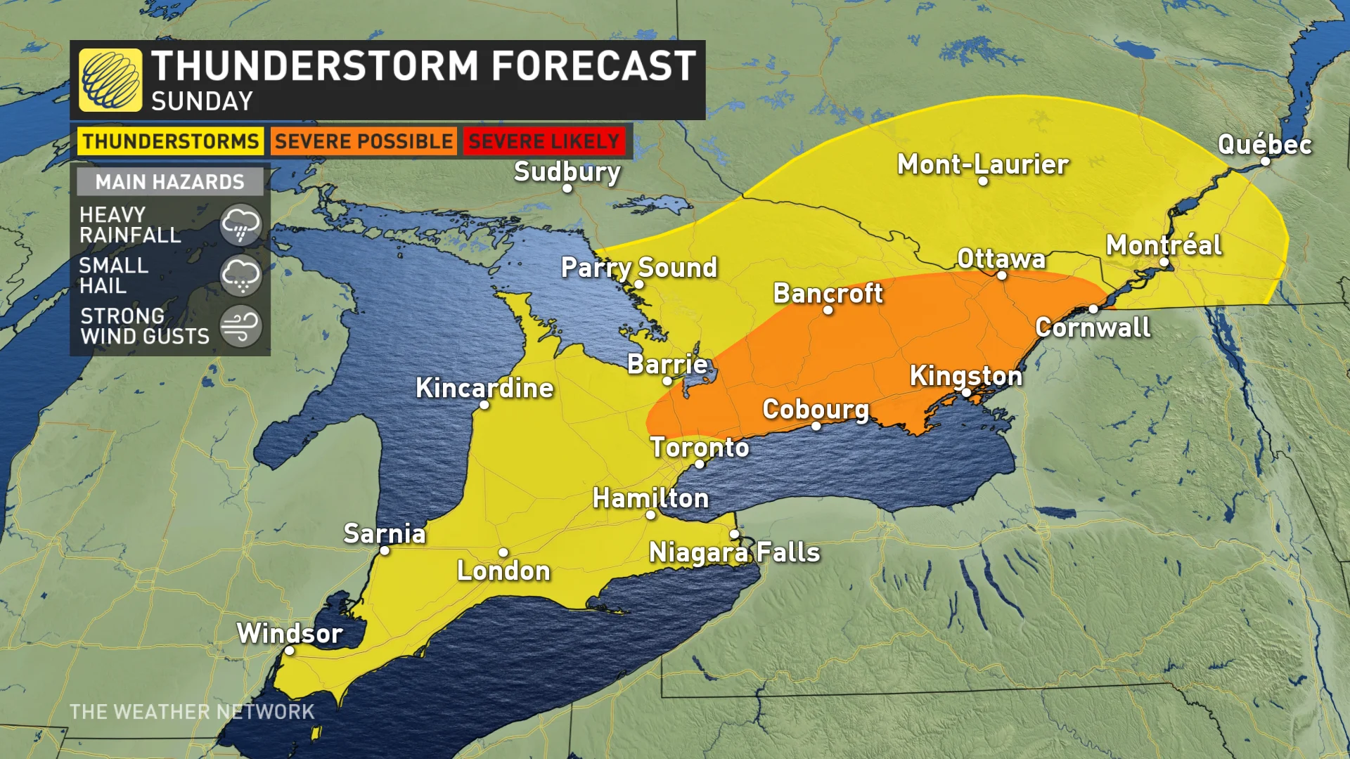
Storms that do cross the severe threshold will feature torrential downpours, strong winds, and small hail.
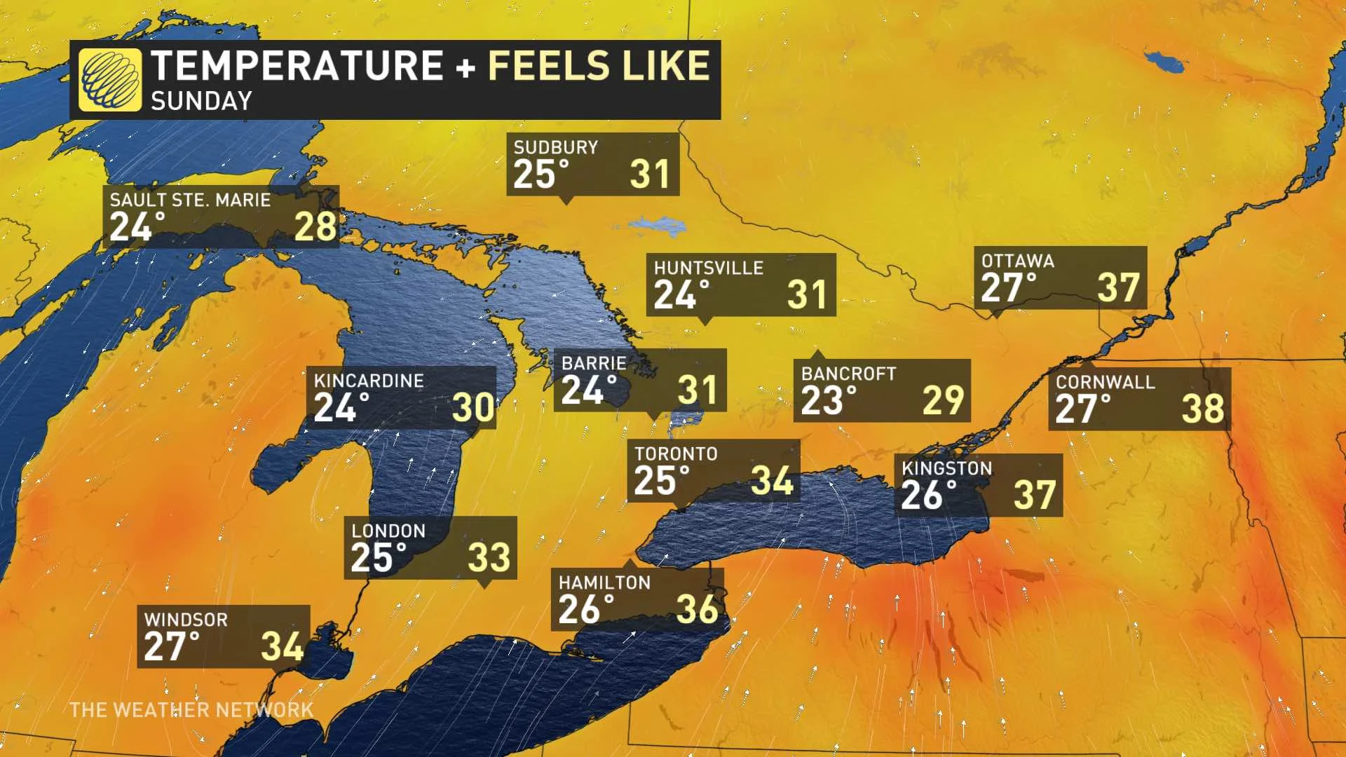
Storms should exit the province through the evening, and in any case, Sunday's daytime highs won't be much different from Saturday, though feeling slightly hotter in the east with the humidity.
BEYOND: UNSETTLED BUT SEASONAL MONDAY, HEAT RETURNS NEXT WEEKEND
Monday will have a similar unsettled pattern due to a lingering trough, which will bring scattered showers and possible thunderstorms in the afternoon hours. Seasonal temperatures will continue.
Beyond, temperatures may dip below a few degrees below seasonal by Tuesday as the front is expected to usher in slightly cooler air. Daytime highs will be in the low- to mid-20s. However, the heat will return next weekend.
Check back as we continue to monitor the forecast.