This major weekend warm-up in Ontario is no one-hit-wonder

After a week of November-like weather that featured freezing temperatures and bouts of snow, a quick flip in the pattern will bring a spectacular fall weekend across much of southern Ontario
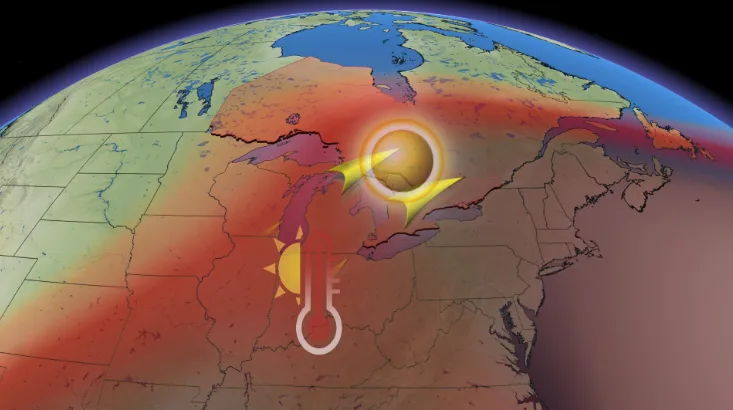
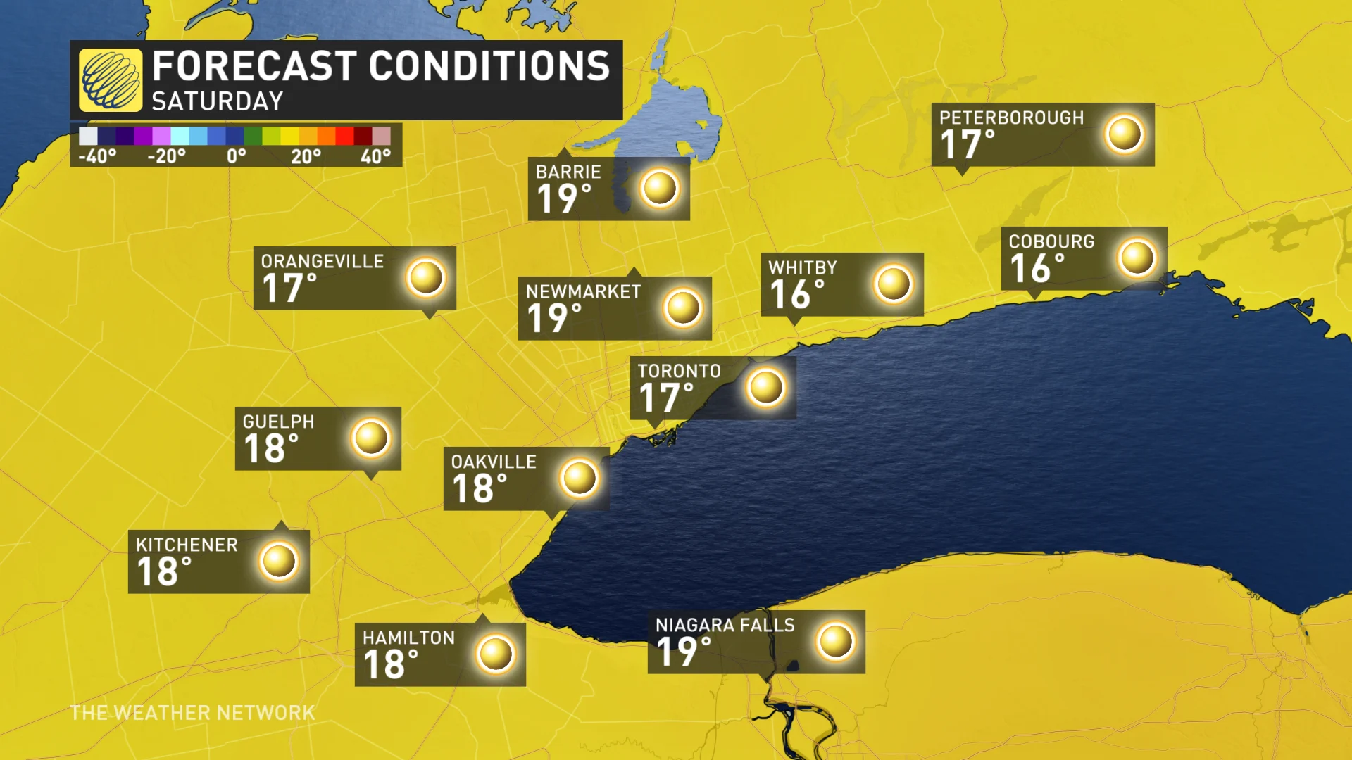
It may seem hard to believe that daytime highs will be soaring to near 20°C on Saturday, especially after a week that's brought well below seasonal temperatures and even rounds of snow to parts of southern Ontario.
DON’T MISS: First look: Pattern reversal expected as Canada falls into winter
Temperatures have been running about 5 to 8 degrees below seasonal across the region this week, with overnight lows plunging to -- or below -- the freezing mark.
This unseasonable cooldown allowed for a decent early-season snow for some communities, along with several lake-effect snow squalls blowing off of Lake Huron and Georgian Bay. That prompted the first winter weather travel advisories of the season so far and left some drivers challenged with the slick and snowy conditions.
PHOTOS: 'Snow it begins' -- but most Ontarians aren't ready
These early signs of winter may have left some wondering if this would be the freefall right into the season ahead, but as you'll see with the weekend forecast coming up, it will be looking and feeling like anything but winter by Saturday.
"We're looking at spectacular fall weather for southern Ontario this weekend, with abundant sunshine and well above seasonal temperatures," says Dr. Doug Gillham, a meteorologist at The Weather Network. "Daytime highs will reach the mid to upper teens, with a few spots even nearing 20°C on Saturday."
That's as an upper ridge builds into eastern Canada. This could be the perfect opportunity to touch up any outdoor Halloween decor, or maybe hit your favourite pumpkin patch and take in the fall foliage.
RELATED: There's a trick to carving a pumpkin in the rain
While temperatures will cool a couple of degrees with a light east wind off of Lake Ontario on Sunday, it will still be feeling rather balmy, especially in comparison to the chilly early-week lows. This weekend warm-up won't be a one-hit-wonder, either.
Warmer than normal temperatures will continue through early next week as well, but there are some complications that could impact daytime highs. Building clouds and a risk for showers will keep temperatures closer to seasonal across eastern Ontario and southern Quebec on Monday, but we're watching the potential for temperatures to reach or top 20°C once again on Tuesday.
How do YOU feel about this pattern change?
"There is a risk for passing showers with an approaching front, but areas that can see some well-timed sunshine during the middle of the day should reach 20°C," Gillham says.
Near or slightly above seasonal temperatures are expected for the second half of next week, and while changeable at times, overall a milder pattern is expected into early November.
WATCH: Slushy snowfall in southern Ontario is a grim reminder of winter
Stay tuned to The Weather Network for the latest forecast across Ontario.