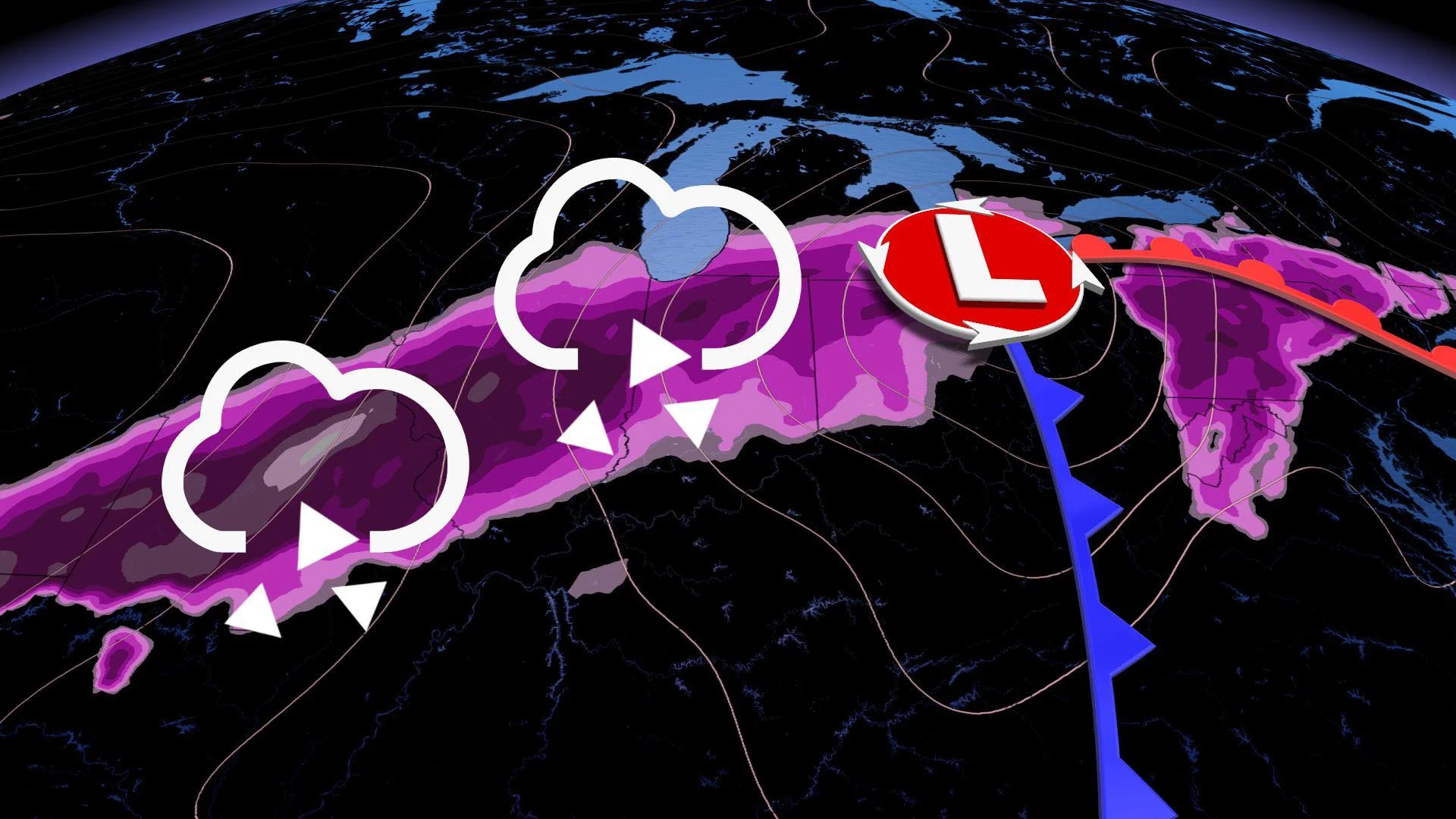
Freezing rain, ice threat spans 3,000-km stretch in Canada, U.S.

Everything is bigger in Texas, as the expression goes, and that rings true with a potent low that developed on New Year's Eve. The latest system born in the Lone Star State started materializing Thursday, brewing up a severe thunderstorm risk in the Deep South on one side of the low, while the northern half will see a freezing rain and ice threat.
SEE ALSO: Strongest low in the world heading towards Alaska
As the storm moves north, the Midwest will see a considerable risk for freezing rain and ice before it treks into the Great Lakes region for New Year's Day. The storm threatens to bring freezing rain and ice from parts of the Deep South to Ontario -- encompassing a 3,000-kilometre stretch.
FRIDAY: NEW YEAR'S DAY SETUP IN ONTARIO
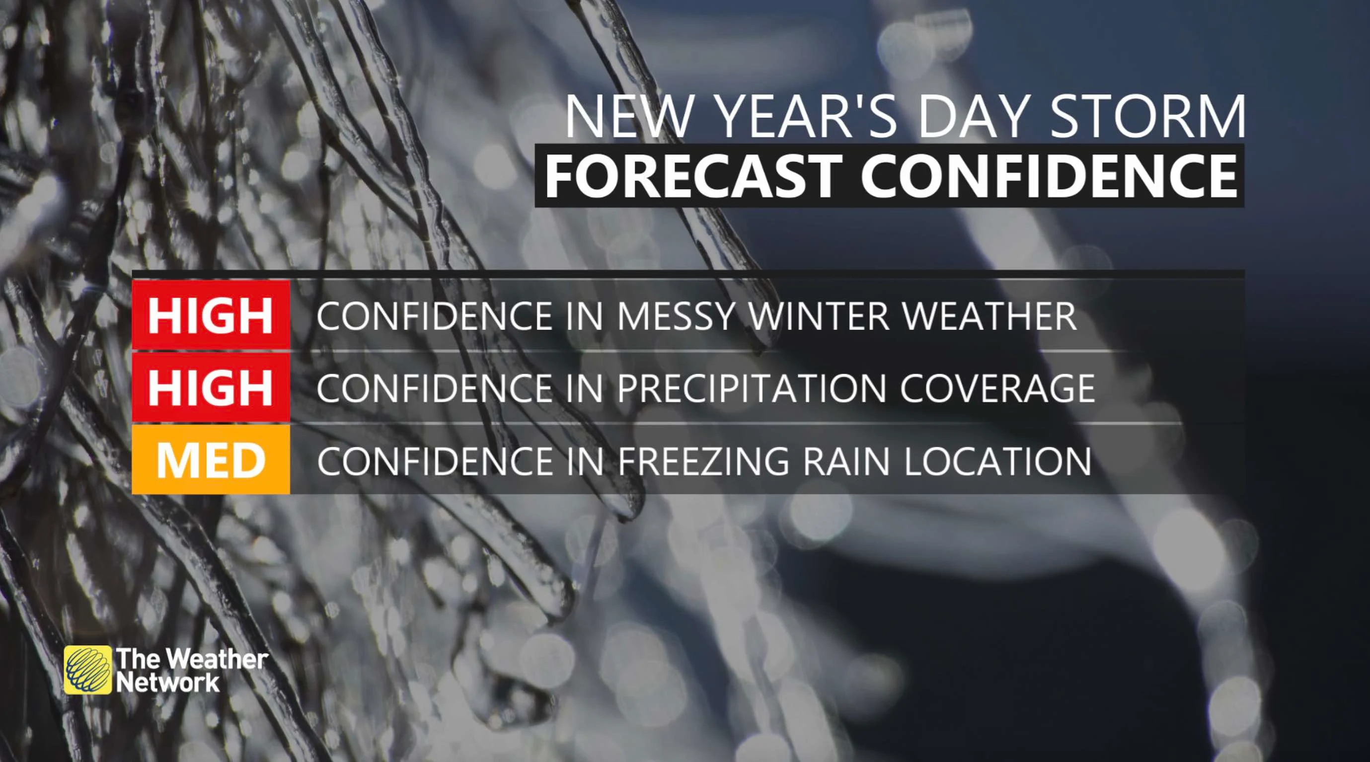
The Texas low will push into southern Ontario Friday afternoon and evening, bringing a risk of freezing rain in parts of the southwest. With Arctic air to the north and temperatures plummeting, there will be the freezing rain and possible ice accretion.

While the extreme southwest will see just rain, areas along the 401 corridor from London to Kitchener and Waterloo, even stretching to Niagara and western Hamilton, will see freezing rain and/or ice pellets in the evening and overnight period. Several hours of freezing rain with isolated ice accretion amounts of 5-10 mm are possible in the London to Kitchener corridor.
Freezing rain may be mixed initially with rain or snow. The freezing rain should transition to rain or snow later in the overnight period. Snow will reach eastern Ontario during this time.
Meanwhile, the system will also bring a swath of 5-10 cm of snow north of the GTA -- through the Dundalk Highlands and cottage country. The GTA and areas along the Erie and Ontario lakeshores should see less than 5 cm.
As mentioned, the storm's final expected impacts are still taking shape, so check for updates as this system approaches.


