Tropical Storm Dorian roars to life, takes aim at Caribbean

The Atlantic basin may finally be slipping into gear when it comes to hurricane season. While the U.S. National Hurricane Center (NHC) continues to closely monitor a disturbance over South Florida, a new tropical storm has formed further to the south, with its sights on the Caribbean.
DORIAN FORMS, EYES PUERTO RICO AND THE DOMINICAN REPUBLIC
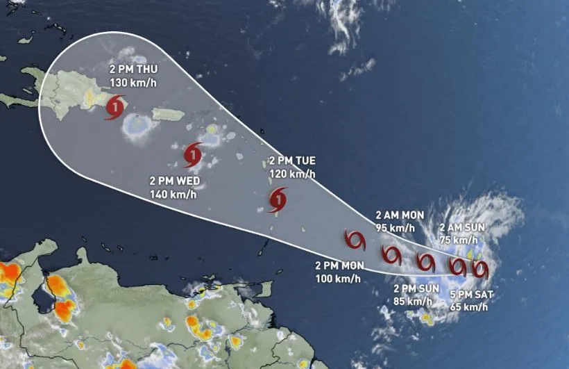
Tropical Depression Five formed east-southeast of the Lesser Antilles Saturday morning, and was officially declared Tropical Storm Dorian by the early evening, the fourth named storm of the Atlantic hurricane season.
The storm's maximum sustained winds of 65 km/h as of 5 p.m. were just over the 63 km/h threshold to qualify as a tropical storm, but it is expected to strengthen in the coming days.
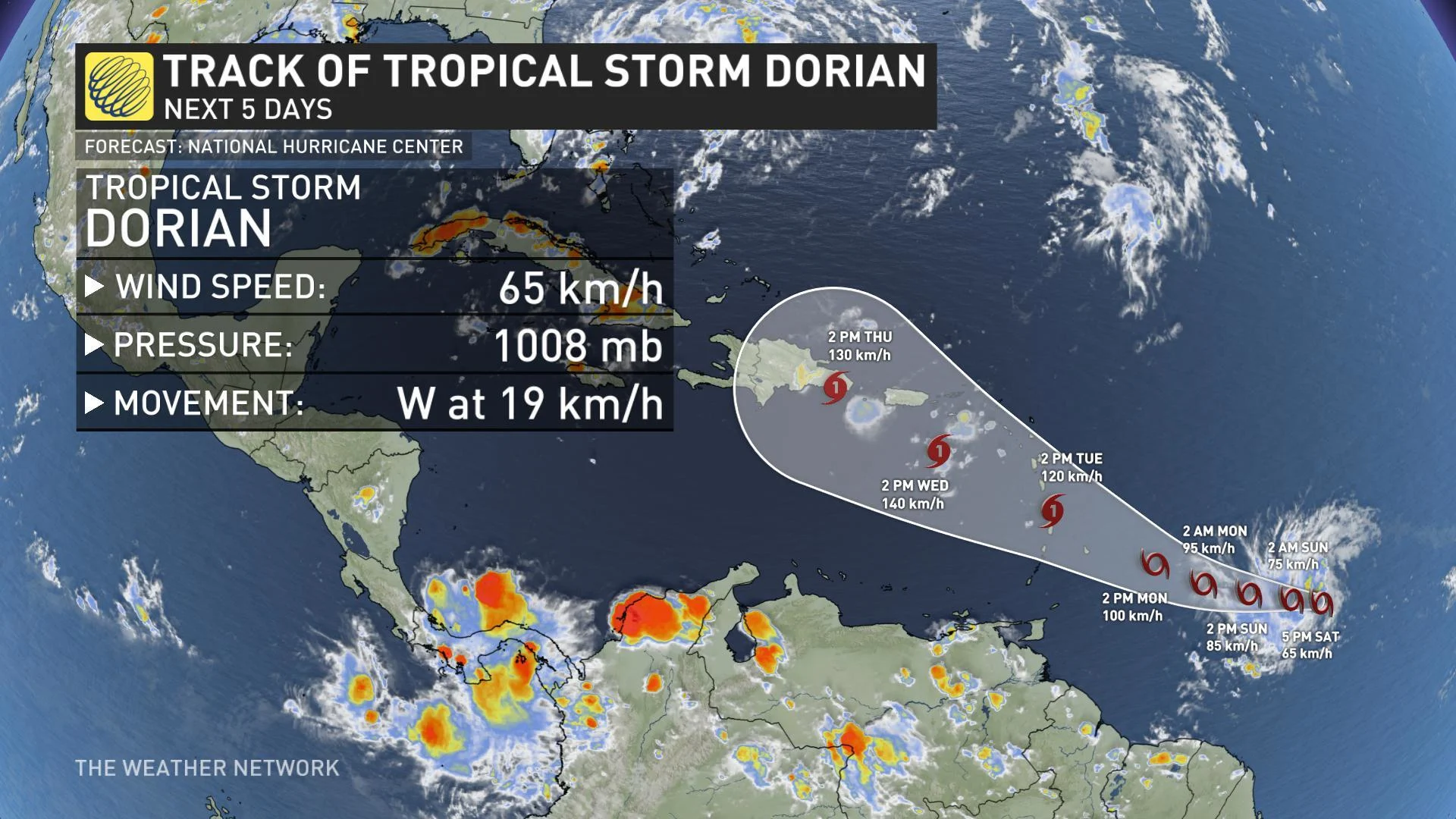
With warm sea surface temperatures expected to provide ample fuel for the system, current projections have Dorian reaching hurricane strength potentially by Tuesday. This is a storm that will bear watching by anyone with interests in the Lesser Antilles or eastern Caribbean.
A SNEAKY EAST COAST SYSTEM?
Significantly farther north, a disorganized area of low pressure and thunderstorms has also caught the attention of hurricane forecasters.
"A broad and elongated area of low pressure extending from the southern Florida peninsula northeastward into the Atlantic is producing a large area of disorganized showers and thunderstorms, primarily over the Atlantic north of the Bahamas and east of the central Florida peninsula," the U.S. National Hurricane Center said in its 5 p.m. update Saturday.
According to the update, a tropical or subtropical depression is likely to form early next week once the low moves offshore of the southeastern United States coast.
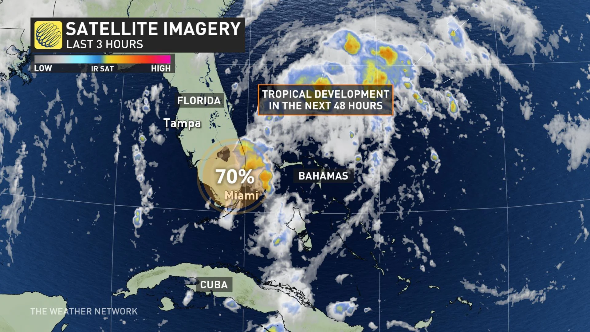
Even if the storm doesn't reach official tropical cyclone status, locally heavy rain is expected over the northwestern Bahamas and southern and central Florida through the weekend.
Currently, the system is expected to track well offshore up the Eastern Seaboard, though some coastal spots still stand to see some hefty rainfall totals. We are continuing to monitor the possibility of a rainfall threat to Atlantic Canada as well.
"There's low confidence in the track of the storm as it heads out to sea, but it is worth keeping an eye on this storm as it's possible that it will track far enough north to have an impact on Atlantic Canada," says Weather Network meteorologist Dr. Doug Gillham.
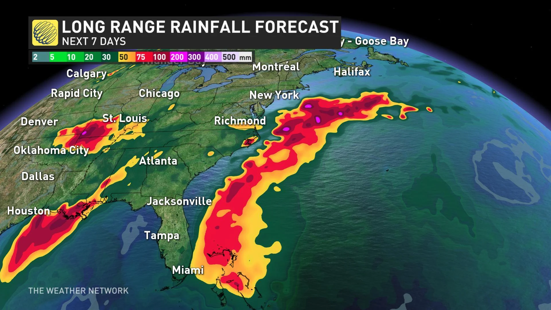
Waters off the coast of the U.S., especially off the coast of Massachusetts, are much warmer than average, which means that it could enhance the storm development over the next few days. If the storm assumes tropical storm status, it will be given the name Erin.
The tropics have been relatively quiet for June, July and so far most of August. The climatological peak of the Atlantic hurricane season falls on about September 10, so the span from late August to early October tends to be the most active time of the year. The season runs from June 1 to November 30. Last year, Hurricane Florence (Category 1 at landfall) and Hurricane Michael (Category 5 at landfall) both occurred in the second half of the season.