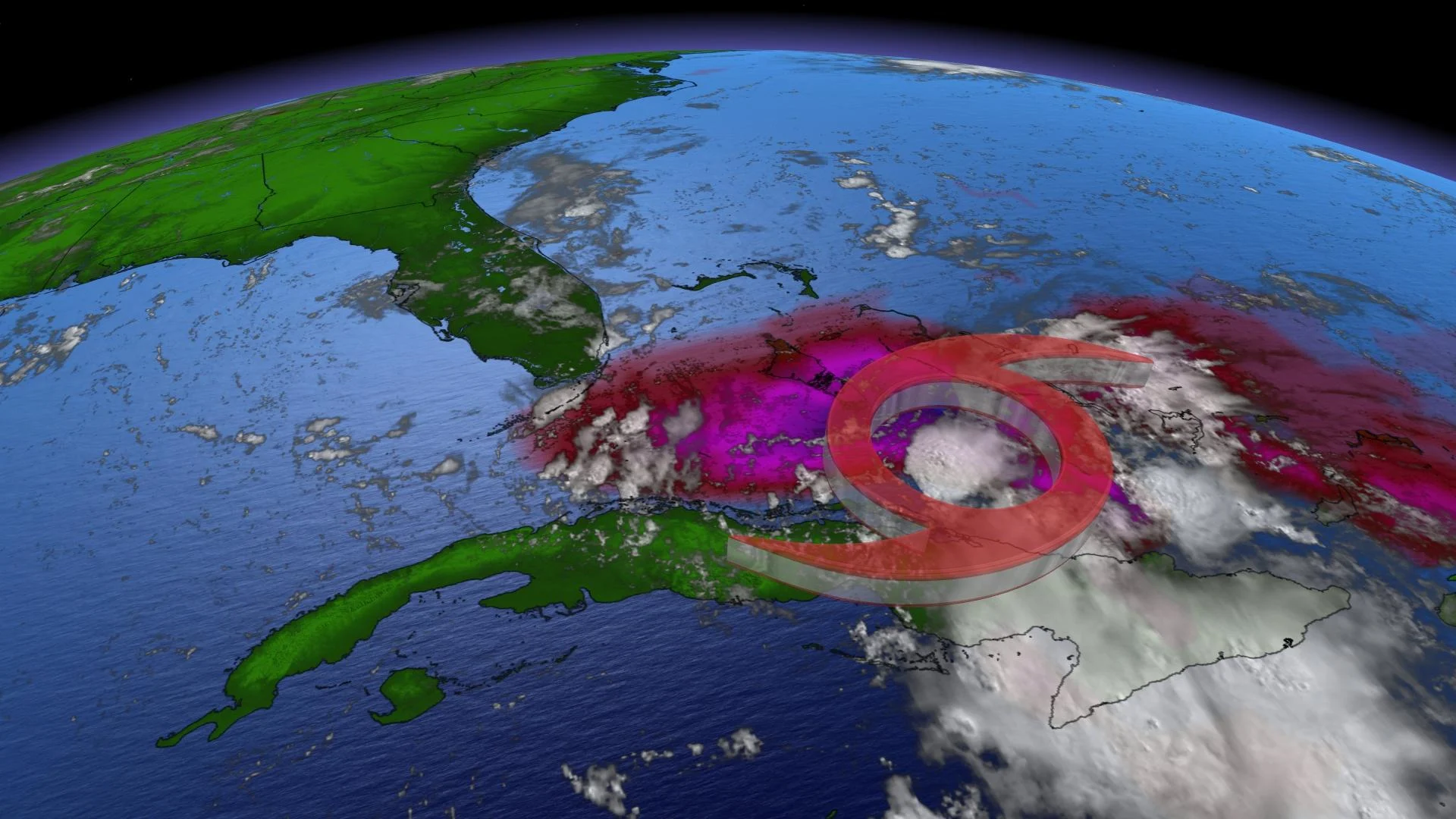
Fred could impact Florida as a tropical storm, complicated Canadian connection

After a few days at tropical depression-strength, the storm is set to re-strengthen to a tropical storm as it nears the Florida coast.
Still a tropical depression, Fred spent much of Friday on the move along or just north of eastern and central Cuba, with its forecast track bringing it near the Florida Keys on Saturday and along the west coast of Florida by Sunday.
The storm's proximity to the Cuban coast is one of the reasons Fred remained a tropical depression for the past couple of days: the coast limits its exposure to the warm ocean water it needs to gather strength. The storm is expected to regain tropical storm status as it starts to pull away from Cuba later Friday or early Saturday.
As of Friday evening, Fred's maximum sustained winds were at 55 km/h, as the system continued to move westwards at 19 km/h.

The storm's rainfall isn't expected to be extreme, but it will still be significant. For portions of the Bahamas, 25-75 mm is likely, with local peaks of 125 mm. In Cuba, more like 75-125 mm of rain is possible, with isolated maximum totals of 200 mm.
Beyond, forecasters expect a deluge for parts of Florida through the early part of next week. Some 75-150 mm is expected across the Florida Keys, along with southern and central parts of the peninsula, with isolated totals in excess of 200 mm.
"Heavy rainfall could lead to areal, urban, and small stream flooding, and potentially worsen ongoing minor to isolated moderate river flooding over northern Florida," the U.S. National Hurricane Center warns.
WATCH: FRED BRINGS HEAVY RAIN, FLOODING TO THE DOMINICAN REPUBLIC
TROPICAL MOISTURE FROM FRED COULD MAKE ITS WAY INTO PARTS OF EASTERN CANADA
Remnant tropical moisture from Fred may contribute to some increased rain and thunderstorm chances in Central Canada mid- and late next week.
"Tropical moisture from the remnants of Fred will complicate the forecast," says Dr. Doug Gillham, a meteorologist at The Weather Network. "As moisture from the Gulf of Mexico surges into the region we will once again have a threat for scattered showers and thunderstorms and very muggy conditions. Warm and very humid weather will continue into the weekend, but the timing for the arrival of the next cold front -- with rain, thunderstorms and eventually relief from the muggy weather -- is highly uncertain."
Stay tuned to The Weather Network for the latest updates on Tropical Depression Fred.