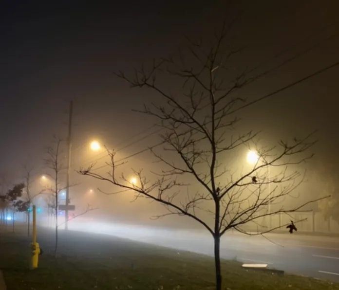
Slug of thick fog completely blankets southern Ontario

A wall of dense fog built across much of southern Ontario through the overnight hours Wednesday into Thursday, creating periods of near-zero visibility and prompting widespread advisories.
A slug of thick fog will continue building across much of southern Ontario through Thursday morning, leading to dangerous travel conditions due to reduced visibilities.
CHECK IT OUT: Canada's November Forecast: Winter weather moves in
Folks across the western shores of Lake Ontario watched as a thick fog bank rolled onto the lakeshore during the late afternoon hours on Wednesday. Warm, moist air blowing over the cooler waters below created ideal conditions for a shallow but thick layer of fog to build at the surface.
This lake-induced fog slowly crept inland through the evening hours, reducing visibility across densely populated portions of the Greater Toronto Area.
The fog continued to create near-zero visibility through the morning hours on Thursday, making travel dangerous or downright impossible in spots. Widespread fog advisories were issued across the region.
DON’T MISS: It’s not your imagination—here’s why fall is the foggiest season
"Visibility may be significantly and suddenly reduced to near zero. Travel is expected to be hazardous due to reduced visibility," said Environment and Climate Change Canada (ECCC) in its fog advisory. "If visibility is reduced while driving, slow down, watch for tail lights ahead and be prepared to stop."
Fog will begin to lift later Thursday morning, clearing out completely as temperatures rise across the region.
WATCH: How to keep safe in the darker months while walking and driving
Stay tuned to The Weather Network for the latest on conditions across southern Ontario.
Thumbnail image courtesy: Chirag - Markham, Ont.