Heavy rain inundates parts of southern Ontario with flooding, ice jams

Flooding rains made a mess of the morning commute across southern Ontario, with the Toronto and Region Conservation Authority issuing a Flood Warning that will last into Friday.
With all eyes on the heavy snowfall set to return to southern Ontario later Thursday, the first part of the system caused plenty of issues itself.
FORECAST: Quick snap back into winter as heavy snow returns to Ontario late Thursday
Wednesday's milder temperatures allowed for the first wave of moisture to begin as rain, with most areas waking up to heavy and intense downpours first thing Thursday morning.
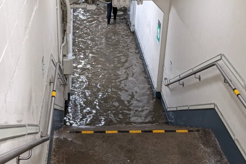
Localized flooding has been reported, with water pooling on roads making a mess of morning commute times. According to officials with the Ministry of Transportation (MTO), the flooding rains have obscured giant potholes, leading to multiple flat tires for drivers along the QEW highway. Flood waters inundated the Long Branch GO station as well, impacting train commuters there first thing Thursday morning.
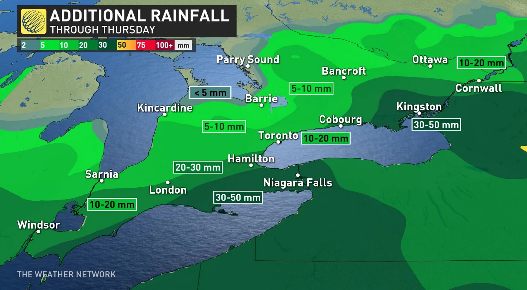
While the rain will eventually transition over to snow as Arctic air spreads back in later Thursday, an additional 10-20+ mm of rain is likely to fall across parts of the region first.
WATCH: LARGE CHUNKS OF ICE JAM THE HUMBER RIVER IN TORONTO
FLOOD WARNINGS IN EFFECT
Due to the heavy rainfall already received, the Toronto and Region Conservation Authority (TRCA) issued a Flood Warning Thursday morning, which will remain in effect until February 18. The Niagara Peninsula Conservation Authority updated their Flood Outlook to a Flood Warning as well, set to remain in effect until Sunday.
"Current watershed conditions are saturated and water levels are elevated at this time and will continue to rise," the TRCA warns. "River water levels may stay elevated through Friday afternoon."
The water levels in some of TRCA’s watercourses are rising steadily and have yet to peak in all of TRCA’s watersheds, specifically in the Humber River and Don River. With any additional rainfall, these water levels may continue to rise.
A large ice jam developed on the Humber River at the Old Mill in Toronto early Thursday afternoon. More ice jams are possible on waterways throughout the GTA.
RELATED: Why Toronto's Don Valley Parkway floods so often
"Additionally, all rivers and streams within the GTA should be considered dangerous as the weather conditions will result in higher water levels, fast flowing water and slippery or unstable banks," the TRCA adds.
Here's a closer look at some of the flooding issues with round one of this potent weather system:
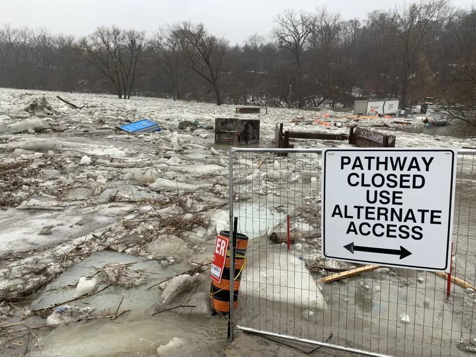
Ice jam on Humber River. Feb. 17, 2022 (Mark Robinson/The Weather Network)
Thumbnail image courtesy: @LillyAnne - Twitter.